How would I go about locating a specific tract of land in the Chireno Grant in Nacogdoches County, Texas? I have the boundaries from a 1969 Warranty Deed but there is no way for me to locate the actual acreage given the information that I have. I’m attempting to determine the drilling activity around our property before agreeing to sign a lease agreement. Yes, I am still new to all of this but I’m learning. Thanks.
Take the deed to the County Appraisal District office if you live near there and they can help you locate it.
Unfortunately, I don’t live near there but I’ll sure make a phone call to them. Thank you.
1 Like
If you list the Block, Abstract name and number and the section number, we can give you a general map of the Grant. Then you can at least see wells in the grant. From there, you may be able to figure out the description or get help from the appraisers office to get the plat.
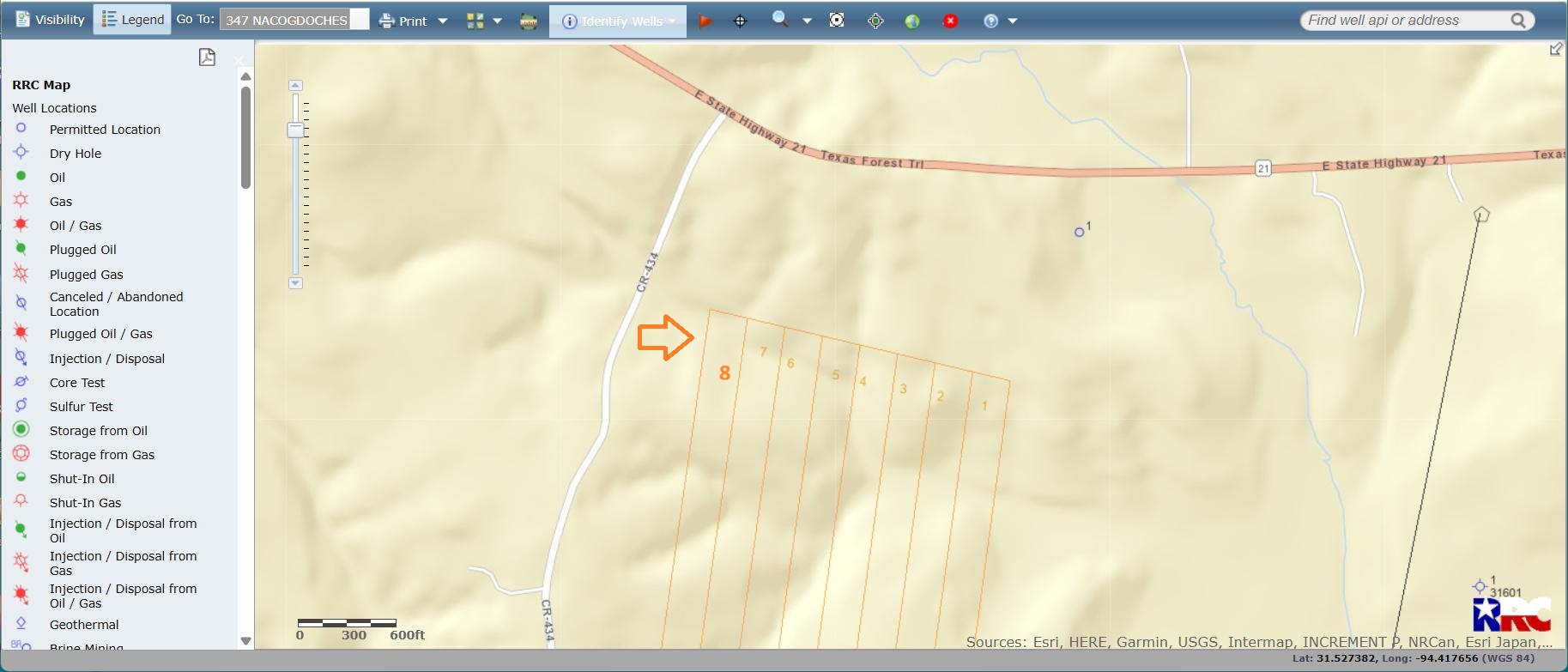
@Biz, looks like your block is shown as part of the Original Texas Survey on the RRC GIS map.
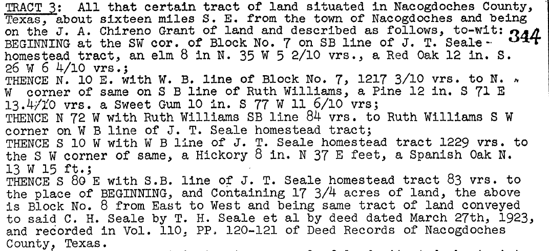
The Block No. 8 referenced in your description is about 5 miles west of Chireno, Texas, about 0.2 miles south of the intersection of State Hwy 21 and CR 434. Screens shown below for A-17 of Nacogdoches County.
1 Like
Thank you so much Pete.
You seem to be extremely well informed and knowledgeable of all this. Can you recommend an attorney who could help us? Just FYI, our acreage is in Leon County, Texas, the John Carson Survey. Thank you.
1 Like
Hi, seems we are family as me and my uncles have Tract 8. Me and my son are also new to the mineral rights so he was looking at forums and found you. I have a lot of information about it now I would love to share.
There are several Texas attorneys listed in the Directories tab above.
We might just be. What is your family name?
Seale. I have a cousin in Texas who worked with the attorney.
1 Like
Are you in Arizona?
Yes.
This topic was automatically closed after 90 days. New replies are no longer allowed.