I have mineral rights in the Simon Sanchez survey, A33, block 12. I know the drilling permit was pulled last October, and I believe it’s Comstock. Does anyone know how to find the potential physical location of the well? The landman told me they may not drill on the property where my rights are. I appreciate any help.
1 Like
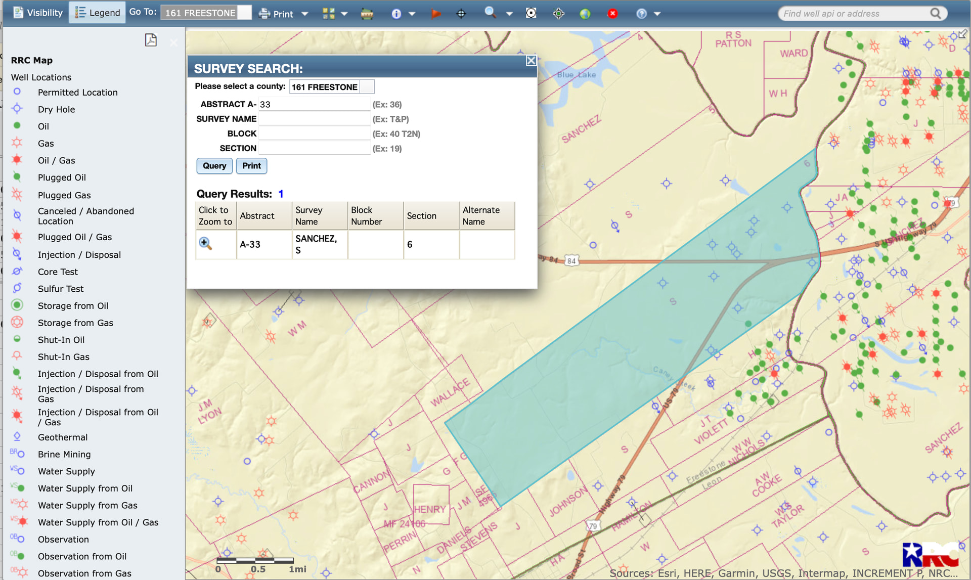
Use this address to go to the Texas RRC website: RRC Online Research Queries. Then choose Drilling Permit (W-1) Query. Choose Freestone County and fill in what you know—sometimes less info gets you where you need to be, even if you have to check out a greater number of permits. I think Comstock is active in that area these days, so there will likely be quite a few to review. Using the legal description may help, but some of those surveys are quite large. Good luck.
There are lots of permits, so narrow your query to 1/1/2025 to see all of them from 2025. Comstock, Hilcorp, etc have a few.
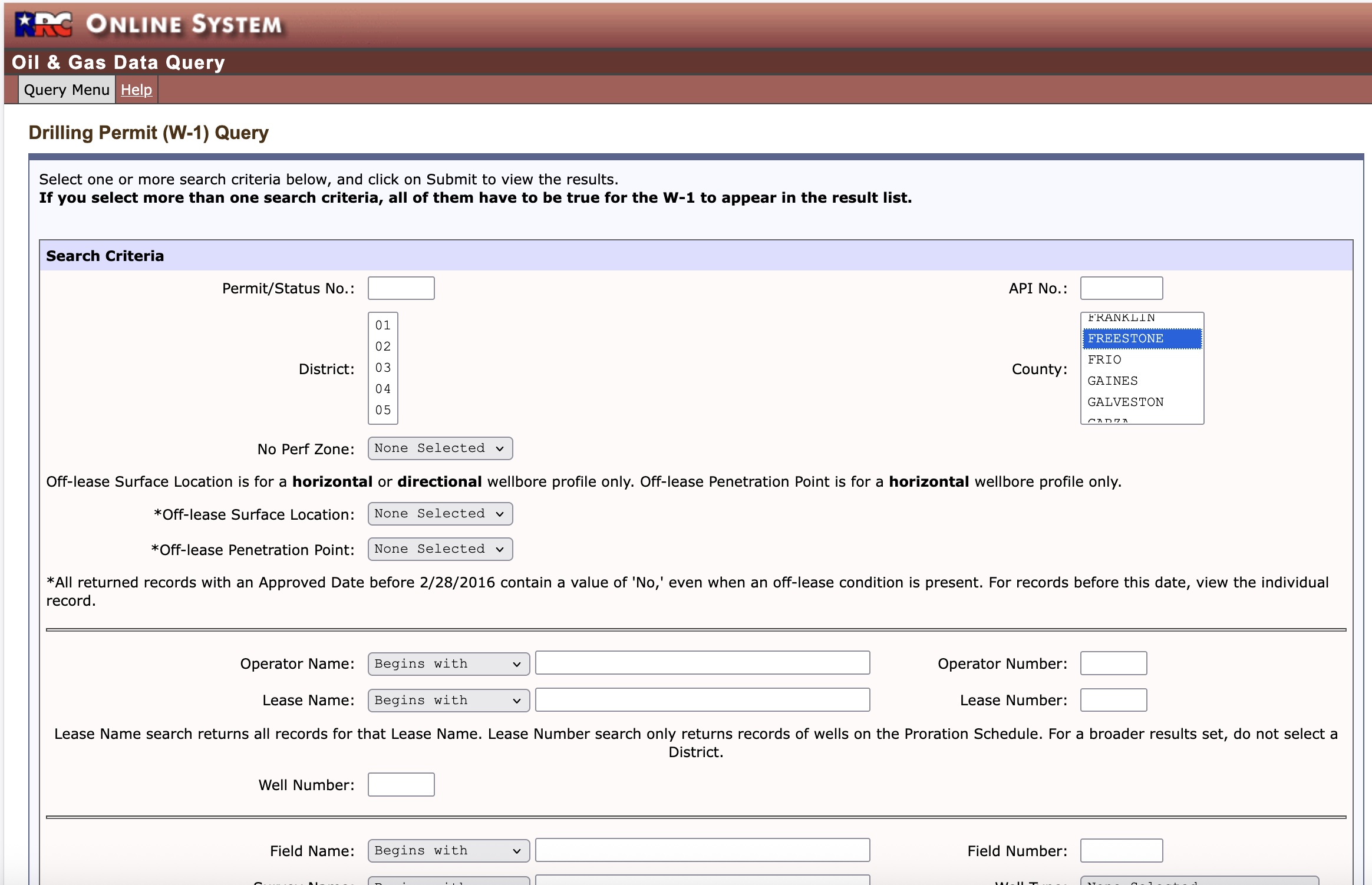
You can go inside the W-1 and find the plats to see where they are going to be drilled.
Thanks. The Texas RRC website is a little wonky to me, but I am technology challenged. I will figure it out. I found some permits, but I can’t tell if they are associated with the property where I have mineral rights.
The W-1 list has the survey names. The well surface location may not be in your survey, so use the big map to look for your abstract and the ones that touch. Then use the W-1 plats to check for the shape and direction of the well bore. That will narrow down the surface location and the well path.
This topic was automatically closed after 90 days. New replies are no longer allowed.