Hi
I was hoping to get some help finding out if any activity is occurring on properties I have inherited mineral interest on. These are the descriptions in the will:
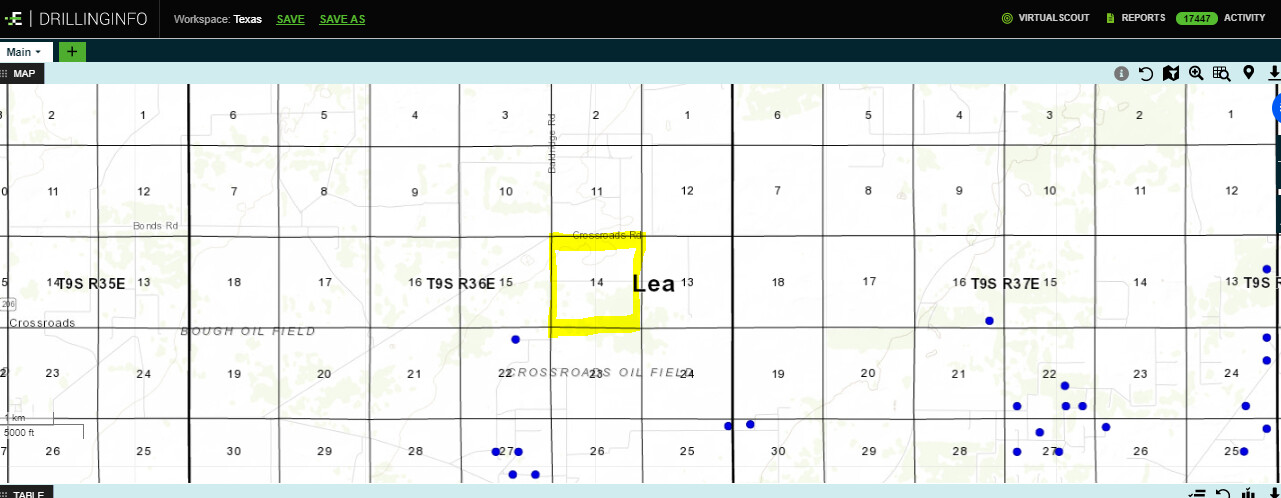
NW/4 of Section 14, Township 9 South, Range 36 East NMPM Lea County
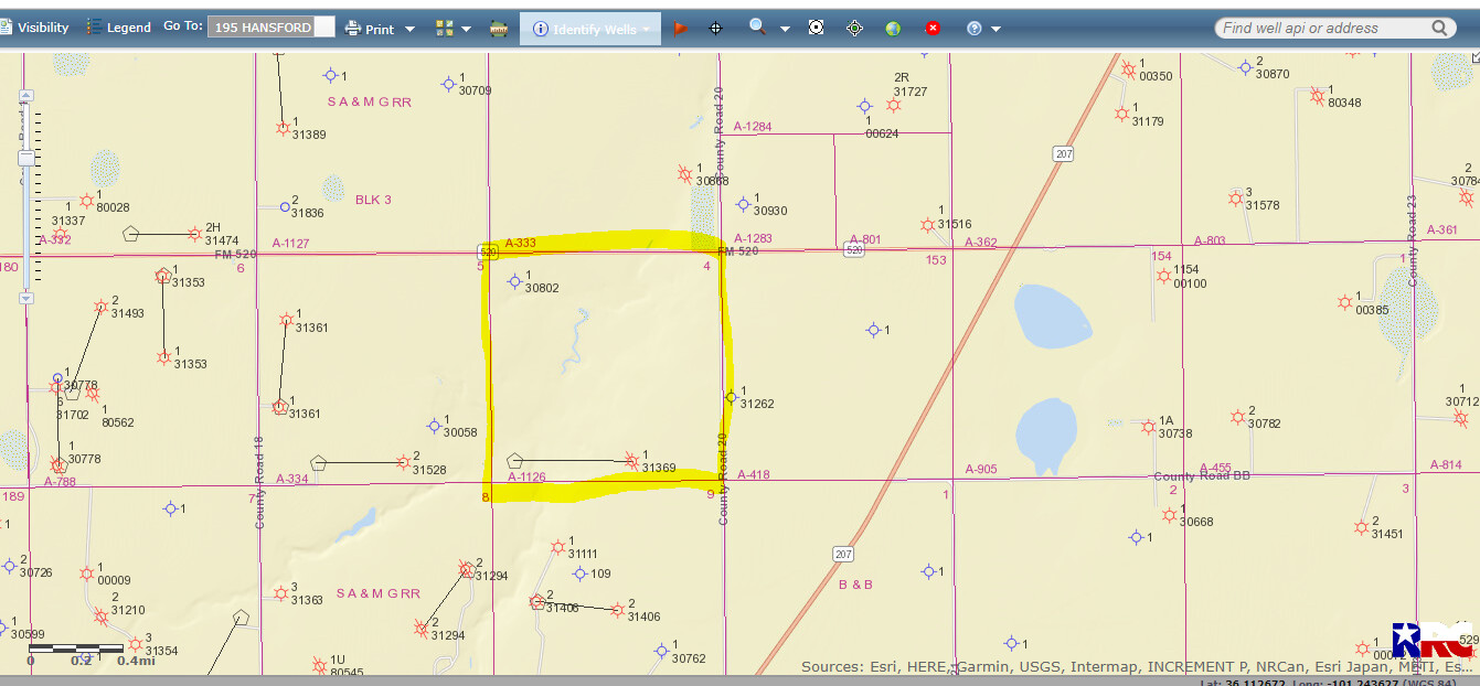
This second one is in Texas: Section 4, Block 3, SA & MG RR Co. Survey, Hansford County, Texas (Kiff 4 #1)
Regarding Hansford County, TX (this portion of the topic should be moved to that part of the forum), the Kiff 4 #1 last produced in 1999 and has been plugged and abandoned. Here’s an image of the section and its surroundings:
Thank you for taking the time to look for me on both properties and attach maps. Are these maps you included from sites that are publicly available, or by subscription only?