(Specifically, the Texas Railroad Commission Public GIS Viewer; but this might apply to any)
The Texas Railroad Commission Public GIS Viewer lets you print either a PDF or PNG of whatever you are viewing in the window. That means you don’t see items such as survey names, abstracts, or well locations until you are zoomed in to a small portion of a county. I want to print an entire county as a PDF, but with those details. I know the file will be huge in that I would have to zoom in to see the details. Also, I know that if I want to print that file to one sheet of paper, I would have to go to a print shop with a large format printer in order for words and marks to be large enough to see.
@nielloeb, it is possible if you have the GIS data and a GIS program.
I don’t see a way to do this directly from the RRC Public Viewer.
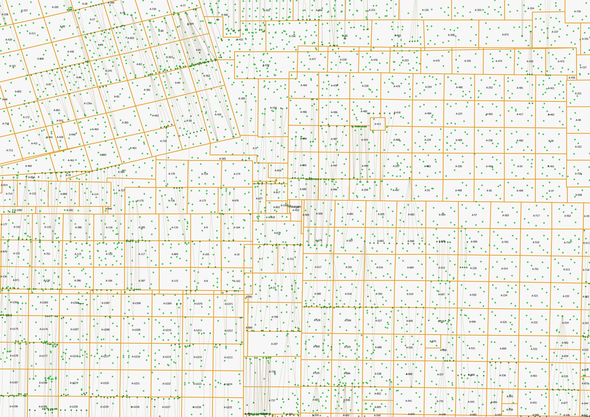
Which County were you interested in? Attached a sample of a larger region of Reagan County that is sized for 36" x 24", but the data is available for the other Texas counties.
Thanks. Your example shows my problem. If this were the area I wanted to see on one page/image by zooming out to show all the surveys I want to see, the survey borders and numbers would no longer show up.
@nielloeb, right, so larger paper would be needed to print entire county legibly.
Maybe a different way to get the information you want, since huge paper size is somewhat impractical?
I’m sure this works using other GIS programs. Texas allows only their online one, which has only options to print what you see on the screen as a PDF or PNG. And their County view shows no details.