East Half (E½) of Tract 56, Section Four (4), Block Two (2), of Fort Stockton Irrigated Lands Subdivision, Pecos County, Texas.
Here’s a link to the property on an interactive map. This should get you started: Pecos CAD Web App
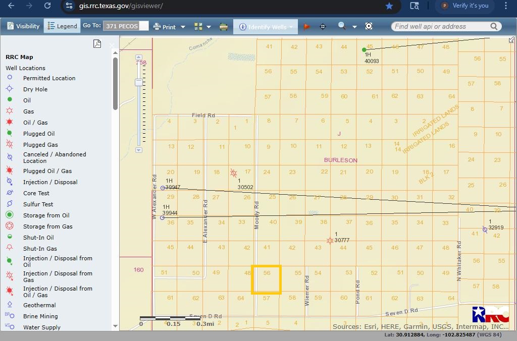
@msgriggs123, your parcel appears to be the same as Pecos County surface parcel #3260. Description is FSIL (Fort Stockton Irrigated Lands) Block 2 Section 4 E/2 56. Abstract is A-4. Located near Moody and Seven D Road. Picture from RRC map attached below. Parcel can be found in CAD map referenced in previous post.
Thanks, is there a way to see past or any current leases?
@msgriggs123, you can check the Pecos County records for previous leases. Easiest to check under ancestor or previous owner’s name.
If you are a member of NARO, there is a free webinar that teaches you how to search sources like TexasFile and Courthouse Direct.
This topic was automatically closed after 90 days. New replies are no longer allowed.