We own acreage with a couple of wells in Block 2, Sections 20 and 21, H&GN Survey in Reeves County. I’ve been told that we are in a 600+ acre unit and I would like to find out if there are other producing wells in the unit. It may be called the North Mitre Unit and I should know more but I don’t. Any help is appreciated.
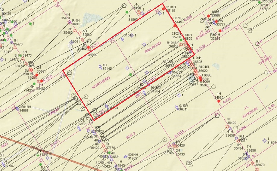
Below is the current Railroad Commission map of the area you are interested in. Sections 20 and 21 are outlined in red.
It looks like about 2016 Resolute drilled a bunch of wells extending through those two sections. At least two wells in what Resolute called the South Mitre 2 Unit are still reporting production, but it looks like most of the others are shut-in, or possibly were never completed.
The online research section of RRC’s website has details on each of those wells. Here’s a link to the map section which is a good place to start. https://www.rrc.texas.gov/resource-center/research/gis-viewer/
That page includes a link to a video that shows how to navigate their map
1 Like
This topic was automatically closed after 90 days. New replies are no longer allowed.