Before my eyes go totally out of focus looking at the GLO Viewer and RRC map on a small laptop screen, can anyone show me where to find Block 1 Section 9 Ft Stockton Irrigated Land Company Subdivision. I thought I had it located SW of Ft Stockton on the Marathon Highway but now can’t find it. I have a low production gas well described as Ft Stockton GU 6-2 there.
Daniel it’s easier for me to find property on the GLO map if I have the Abstract number. The Abstract number you are needing is A-2023. And all I see in Section 9 is a dry hole that was drilled years ago…no production in the area.
GIS map of Pecos County Section 9/Block 1/A-2023:
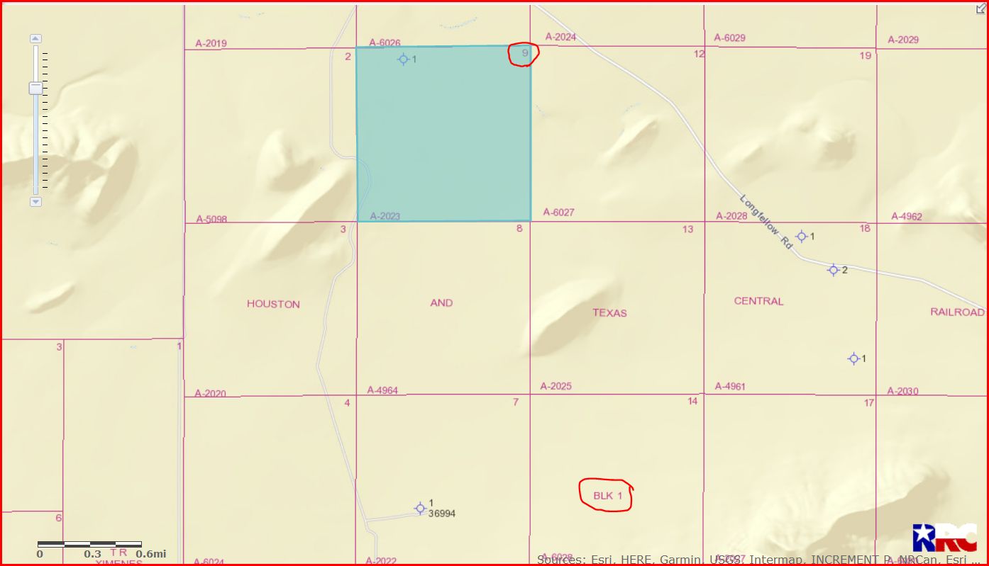
DOUBLE LEFT CLICK ON MAP TO ENLARGE
Clint Liles
Thanks. I will have to contact Chevron as a copy of the lease they sent, which dates to June 1994, indicates sections 7-8-9 of Block 1 are in a pooled unit of 699.7 acres and the property name is “Ft Stockton GU 6-2.” The well is old and production is close to zero. I received a royalty check for about $75 for slightly over 4 years of production. The issue is…I can’t find the location of the well. Not that it really matters, just curious. Thanks for pointing me in the right direction!
Daniel the operator of the well is Chevron Midcontinent/API 371-36603/Lease #168624. Link to production data on Ft. Stockton GU6 well #2:
Link to approved recompletion permit:
GIS map of Pecos County Block 1 Section 9/circled in red is well 36603:
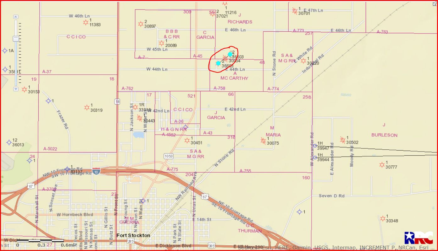
DOUBLE LEFT CLICK ON MAP TO ENLARGE
Clint Liles
Great information…thanks! I will keep it bookmarked for future reference. The offers to purchase, so far nothing but bogus fishing expeditions, are starting to arrive again. I am now much more knowledgeable about my Pecos County property and can continue ignoring their calls and letters.