My wife has mineral interests that were leased to Geosouthern off of Boundary School Road outside of Burton. In one of the previous forums I saw that Geosouthern has a pad nearby and was checking to see if anyone knows if they are heading in that direction.
Wes, Geosouthern has permits to drill three wells from a pad right off Boundary School Road that they are about to finish the dirt work on. They completed a well several weeks ago from a site not far north of Boundary School Road a little east of Fuchs Road and they have at least 2 more permitted there. But it looks like the next one they may drill will be from a pad they’ve built just east of Highway 290 on the north side of FM 2502.
Here’s the RRC map of that area
Dusty,
Thanks for the information. From the map that would put the lease very close to the new pad.
WP
WP, sounds like you are in a good area.
Geosouthern platted 800-acre units for each of the three wells they’ve gotten permits to drill from that pad next to Boundary School Road. If you can pin down your location we should be able to tell if it’s in one of their proposed units.
If you want to do it offline you can send me a friend request.
Hi Dusty,
Recent update that the well is the Mitchell 1 unit. Drilling permit was issued in July, but not sure on the status.
WP
Wes, I thought the one rig Geosouthern has been using in WC was still drilling those 4 wells they had permitted to drill from that big pad just north of 2502, but RRC is showing they spudded the Mitchell on 8/28.
That should mean they are about done drilling and getting ready to frack. I’ll drive by that way and check it out next weekend.
Thanks. I thought I was still seeing that one from 290.
Do you know if GeoSouthern has another rig set up on the pad east of 287 on Boundary School Road?
Thanks for checking!
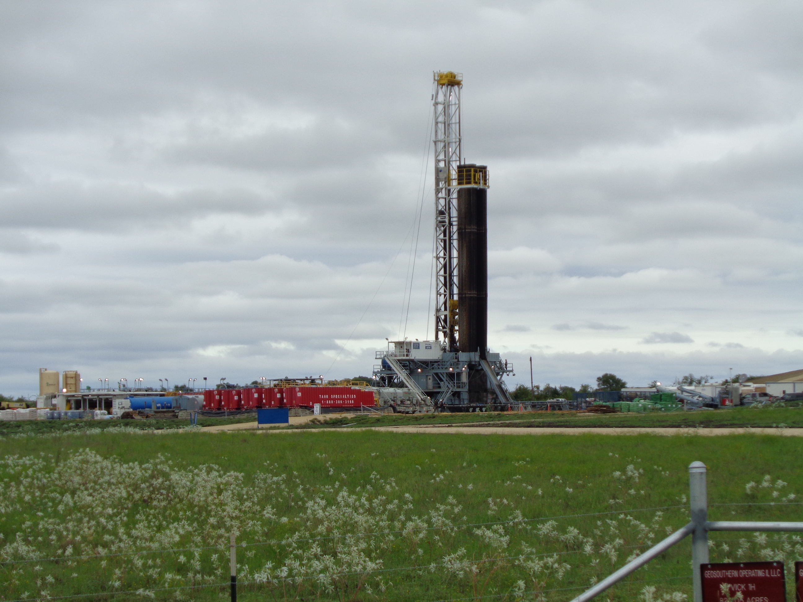
Lot of pipe in the rack on that rig! Here’s Boundary School. Pics taken 9/22!
Thanks for the picture. After looking at what GS has reported on all their recent permits up there and remembering what they’ve done in other areas, I think the answer is they have first brought in a small portable rig that they use to spud and install the surface casing on all these wells…which is why RRC is showing the Mitchell was spudded on August 28th, but they haven’t brought in the big rig in to do the deep drilling. Probably not until they finish what they are now drilling off 2502.
That’s how they could report to RRC that they spudded the Fuchs on 8/25/18, just 3 days before the Mitchell. Don’t see the Fuchs name on any of those signs in the picture but the maps show it was permitted to be drilled from that same pad. No spud date has been reported yet for the Dallmeyer or the Garlin that are on the signs. GS also has a big pad built the other side of Burton off FM 1697 where they show they spudded the Boeker on 4/6/18 and the Union Hill on 4/10/18 but the big rig has never been set up there.
How can I find out anything about this permit in Washington County, Burton, TX? 42-477-31068 BOEKER UNIT 1H GEOSOUTHERN OPERATING II, LLC 2018-03-01 2018-03-05
Not sure what information you are looking for. If I got this to work right below should be the unit plat and a long link that should take you to the permit. If you are needing to see the ownership of the tracts that are in the unit click on the six pages of P-12’s that are attached at the bottom of the permit.
Geosouthern reported to RRC that they spudded the Boeker on 4/6/18 and installed surface casing the next day (using a small portable rig) but since then the pad has been empty, apparently waiting on the full depth drilling rig GS is currently using to drill a bunch of wells on the east side of 290.
If you are needing to see the ownership of the tracts that are in the unit click on the six pages of P-12’s that are attached at the bottom of the permit.
Thank you - helpful information re ownership.
In August Geosouthern filed “Well Record Only” completion reports for each of the three Wickel wells, so there were no test results but initial production reports they filed for July and August show gas volumes from each well averaging about 5 MMCF/D. Not bad, but less than half the numbers GS reported from earlier Washington County wells like the Fowler and Lehrmann. The strongest Wickel well only averaged 36 BPD of condensate.
Each of those first month production reports noted “equipment being installed” so it’s possible Geosouthern has them choked back. They seem to be going strong on drilling the next 4 wells they permitted not far north of the Wickel wells on the opposite side of FM 2502.
1 Like
The following is a sponsored (paid) promotional notice:
If you own minerals in Texas and live in the Dallas area, please consider attending the NARO – Texas Town Hall Meeting in Dallas at the SMU Cox School of Business, Maguire Energy Institute, on November 14, 2018 from 6-8 p.m. We will cover four timely topics, and the cost is only to cover the food provided (plus a cash bar) at $20/person. The Mineral Rights Forum is also a sponsor of this event and it is open to non-NARO members, but attendance is limited to about 80 people, so please sign up today! A link to the signup and information page is NARO - National Association of Royalty Owners - NARO Texas Townhall Meeting
Hope to see you in Dallas!
Geosouthern applied for permits today for two wells called the Burns Creek 1H and 2H. The 521-acre unit where they plan to drill them extends north from FM 390 and east from 1948, and is between the unit GS formed for their Fowler well and the Broiller and Morgan units formed by Wildhorse.
The permits show the two wells will be drilled from the same pad, each with a 9,000’ lateral. The horizontals will run parallel and will only be about 900’ apart. As far as I know, that will be the closest spacing GS or Wildhorse have used on any wells they’ve drilled in Washington County. On the other side of 290, Geosouthern continues drilling multiple wells from single pads, but in those cases, each well was in its own large unit. These newest permits look more like developmental, infill drilling.
Dusty, Has Magnolia Oil and Gas Corp. filed for any new drilling permits in Washington County since they took over the Enervest leases?
Magnolia filed a couple recently in Fayette County to add wells in old Enervest units but nothing yet in Washington County.
Thank you very much, Dusty.