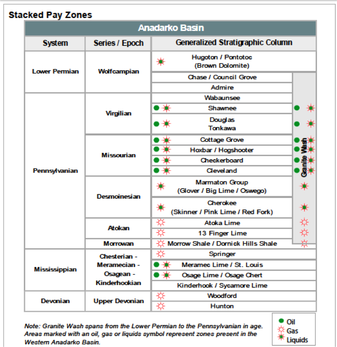
Howdy. Looking to find the best / most accurate readily available to the public depiction of the various formations in this section (to the extent that matters). A question regarding a depth clause has come about and I need to research the ‘layers’ a bit to identify whether or not an issue exists. Clause states ‘deepest penetrated’ formation vs ‘deepest producing’.
If your clause reads 100' past the base of the 'deepest penetrated" formation and they went into the Hunton but are only producing in the Woodford, then you are held all the way through the Hunton and 100' more into the Slyvan or Viola depending upon the area.
Thank you for the feedback. This is my understanding of the clause as well. Appreciate the attachments and any other thoughts / details / resources to locate info you may have. Looking to see depths associated with each formation (to identify the 100’ past the base) and all formations… Sylvan, Viola, beyond. Also, is there a verification process or required ‘proof’ relative to a company’s claim on depth?
Growing my education here as much and as quickly as possible. Forgive my ignorance.
The completion report for the well should have the depths of the tops and bases of the horizons. If not, then the closest vertical well is used as a guide. The standard depth clause that most folks get does not have "Hard" proof, but general guidelines. As a geologist, I prefer a more fact based clause.