Trying to just get general oil productivity.
“General oil productivity” has a very broad meaning and Payne County is a pretty big area. Are you looking for production numbers for a particular well? Or wells in or near a particular section. Section Township Range would be needed. Like 35-13N-4E. Trying to anticipate a new well production?
You’ll need way more info to get an answer.
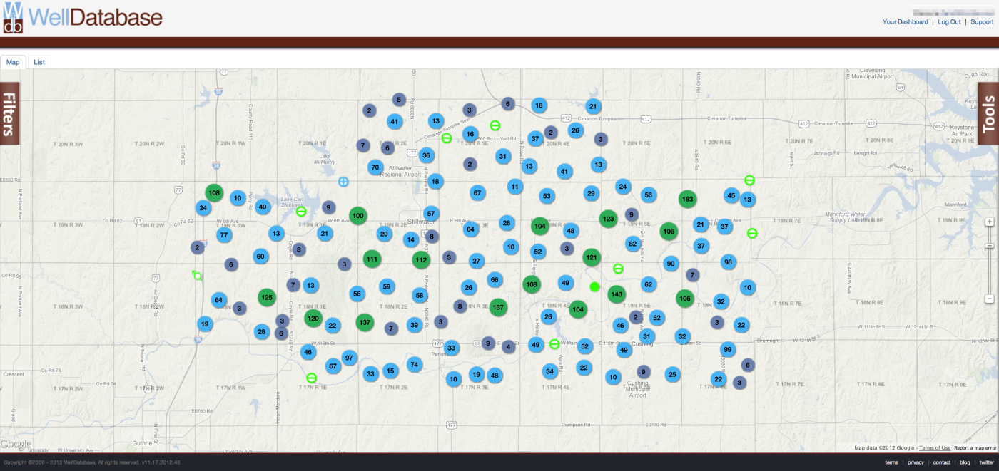
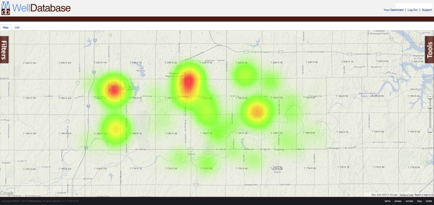
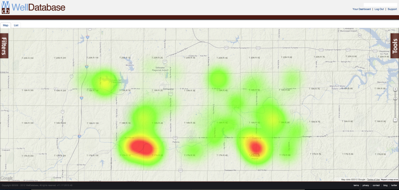
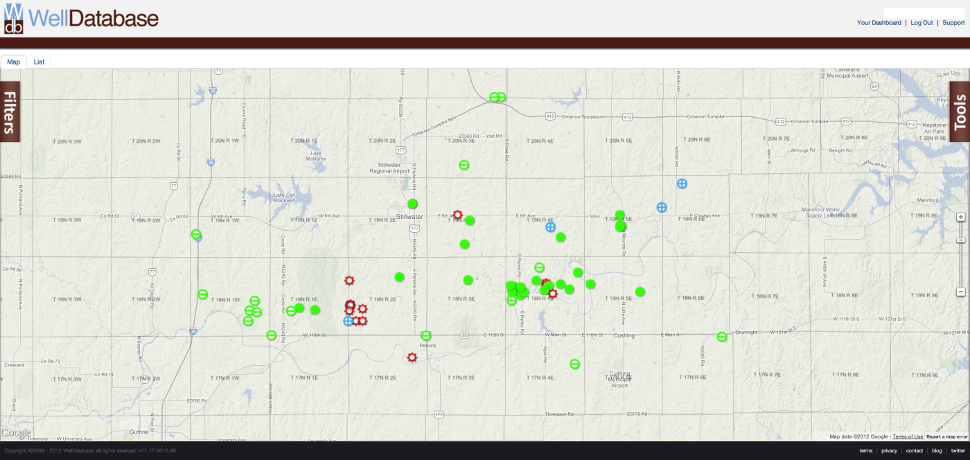
Here are some maps for simple, general information. (Interact with the map here - https://app.welldatabase.com/browse/well/public/pcsGS
Wells all time
Oil production heat map (all time)
Gas production heat map (all time)
Wells spudded in the last 5 years (1/1/2007 - present)
We have sections: 26 18N 3E 25 18N 3E 30 18N 4E 31 18N 4E 27 18N 4E Also the wells that are pumping as we know of are: section 25 Metcalf 25-1WH Section 30 and 31 RJ 30- Section 25 to 36 Metcalf 25-1WX
Any production numbers? Or any info at all? Thanks!
We have sections: 26 18N 3E 25 18N 3E 30 18N 4E 31 18N 4E 27 18N 4E Also the wells that are pumping as we know of are: Section 25 Metcalf 25-1WH Section 30 and 31 RJ 30- Section 25 to 36 Metcalf 25-1WX
Any production numbers? Or any info at all? Thanks!
I don’t see where they have reported production for any of the new wells CALYX has been permitted for this year in those sections.
The only completion reports I see are for disposal wells. Here are the permits I see with API and Spud date.
METCALF 25-1MH 25-18N-3E API 3511923929 Mississippian Spud 05/02/2012 METCALF 24-1MH 24-18N-3E API 3511923930 Mississippian Spud 03/16/2012 R&J 30-1WH 31-18N-4E API 3511923955 Woodford Spud 07/17/2012 METCALF 25-2WX 36-18N-3E API 3511923984 Woodford Spud 10/25/2012 MURLIN 1-27H 27-18N-3E API 3511923969 Woodford Spud 09/27/2012
Here are some maps for simple, general information. (Interact with the map here - https://app.welldatabase.com/browse/well/public/pcsGS
What do the green solid/not solid circles signify? I’m curious because we leased minerals 2 years ago & now are being asked for a thumping permit. There is a well being drilled within a couple of miles. 17-20N-3E
Here is the legend for the WellDatabase.com map
| Oil Well | |
| Gas Well | |
| Oil And Gas Well | |
| Gas Storage | |
| Injection Well | |
| Disposal Well | |
| Test Well | |
| Water Well | |
| Sulfur Well | |
| Unknown Well Type |
My family actually went to the sections and saw the well heads ourselves. So the permits are accurate to my little knowledge. If you are referring to the large tanks on the property, hopefully mid January we shall hear something. Thanks a bunch!
Rick Howell said:
I don’t see where they have reported production for any the New wells CALYX has been permitted for this year in those sections.
The only completion reports I see are for disposal wells. Here are the permits I see with API and Spud date.
METCALF 25-1MH 25-18N-3E API 3511923929 Mississippian Spud 05/02/2012 METCALF 24-1MH 24-18N-3E API 3511923930 Mississippian Spud 03/16/2012 R&J 30-1WH 31-18N-4E API 3511923955 Woodford Spud 07/17/2012 METCALF 25-2WX 36-18N-3E API 3511923984 Woodford Spud 10/25/2012 MURLIN 1-27H 27-18N-3E API 3511923969 Woodford Spud 09/27/2012
They filed a completion on 3511923930 since I posted that. Link below.
Payne County is mostly on the shallow shelf area of the Anadarko, therefore the ultra deep drilling isn’t typical but shallow production is very old. These sands produced for decades and new techniques have improved production. The play on the Miss. rocks may also develop regionally. The old deep Arbuckle wells are great but you’d go broke trying to drill 'em or as an old geologist told me once, “You gonna turn over a lot of cow patties before you smell a sweet one.”
So it usually takes several months before you can find out what a new well is producing? The well going in Section 24, Township 20 North, Range 2 East has had lots of activity this past week. New electric lines have been strung & 3 small pads with breaker boxes have appeared on the west side of the tanks. Just observing, it seems like they’ve set pipe at least 4 times so I’d guess each time is for a new lateral? Still haven’t seen a name on anything to indicate who is the operator. Another rig just set up last weekend on Section 19, Township 20 North, Range 3 East. This one appears to be Red Fork. It’s amazing how many rigs are up & running within 25 miles of Stw.
seems like they’ve set pipe at least 4 times so I’d guess each time is for a new lateral?
That could mean surface, intermediate, long string and completion tubing… Or it could be an injection well? They are doing a weird completion on some Red Fork wells where they move and reinject a lot of water and after several weeks or even months, the Red Fork starts producing oil with the water. Strange stuff that Red Fork.
Section 30 and 31 18N 4E Payne County OK