I am trying to locate a well on which I received a tax bill but have never received a royalty payment.
Can someone show me how to find a well’s location on the RRC Viewer?
the well name areas follows:
“Henderson-Schovajsa B W#21H”
“Henderson-Schovajsa W#3H”
“Buhler-Schovajsa W#1H”
the operator appears to be Forestwool Energy LLC and I dropped them an email this morning but have not yet heard back.
If I recall correctly, I was issued tax bills last year that the operator subsequently said I did not have an interest in the wells. This too was in Victoria.
From the pull-down menu at the upper right side, pick Victoria County, then fill in one of the lease names and at the bottom of the page fill in a submitted date range like From 1/1/2017 To 10/24/2019. Hit search and it should pull up the permit for the lease name you entered. Click the lease name to open the permit and then click the MAP symbol and it will open RRC’s map showing the location.
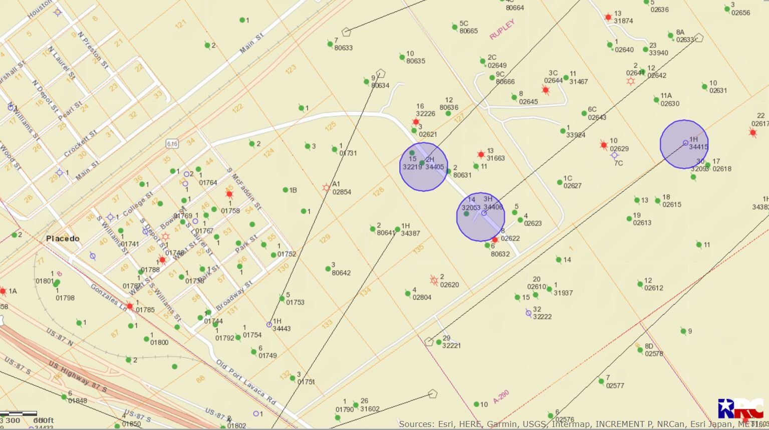
In case you have trouble finding them, those three wells are described as being 7/10 of a mile northeast of Placedo. Here’s the map with the endpoint of those three laterals highlighted in blue.