Is there a place to find the fault lines in Garvin County in Oklahoma? Or is this information privy and only obtained through a Geologist?
Each individual operating company will have their own proprietary maps regarding the fault lines. They map them using the well logs, seismic data, etc. There are some generic maps available through the OK Geological Survey. When the earthquakes were happening with some frequency a few years ago, industry and academia came together to share their information. Even now, some of those maps would be somewhat out of date as new faults are discovered. And the earth continues to move.
Another place to look is through the University data bases of Masters and PhD thesis work. I have found some useful ones there.
The best way to see faults in/near your sections is to go through the OCC cases that pertain to those sections. The exhibits in the cases often have maps with the faults that are relevant to those reservoirs under review and are usually the most up to date maps. Be aware that faults do change angles, go through some zones and not others, are different sizes, etc. They are not usually vertical that go all the way up and down through thousands of feet, so you have to know how to read the fault maps as to which side is down and which side is up. Oklahoma has a long history of complex faulting.
Your question said Garvin, but you posted in Grady. Maps would be different for each of those counties
Wow! Such great helpful information. I’ve been doing some research on the fault lines, and YES, very complex and hard to read some of the generic maps!
Oops sorry, should have been Garvin County.
Thank you so very much for the information on the fault lines!!
A good source is the Oklahoma Geological Survey. The bulletin from them on the geology of Garvin County would tell you where they are at and more information.
1 Like
This is a really old article and shows the biggest faults known at the time. 1927! That was good old fashioned field work and well done.
We are nearly 100 years later with much better technology now. Here is the link to the work that was done in 2015-2016. Oklahoma Fault Database. There are several sets of maps. What was known before industry contributed and what additions were made after. These are still at a very large scale. Looking at the case files gets one much closer to what is relevant to different sections. I often look at the case files in the sections contiguous to mine. Sometimes you will find a better map from a different operator.
1 Like
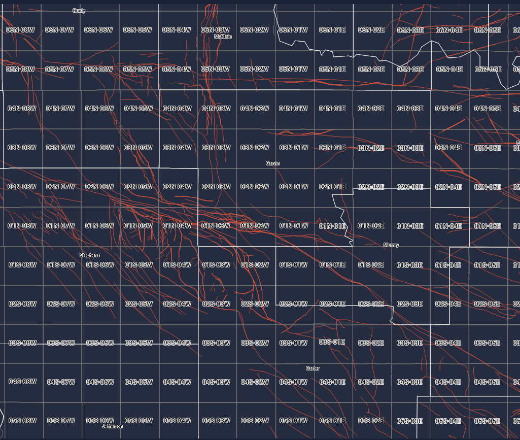
Toni - Here is a map of basement faults into the Woodford provided by the US Geological Survey. Hope it helps!
Thank you so much!! I really appreciate your help!
1 Like
This topic was automatically closed after 90 days. New replies are no longer allowed.