Why does the exploration stop so abruptly in Southeast Henderson County, Texas? I own mineral rights at the red dot/X.
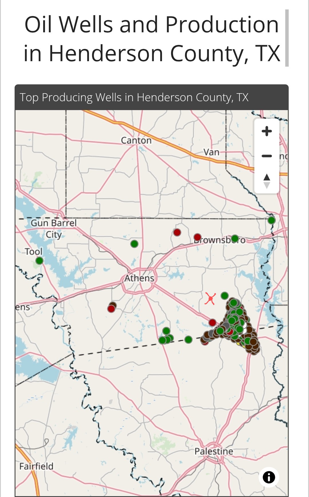
That large producing area is Fairway Field - a large reef complex with long time production. Conventional reservoir with hard boundaries as to productivity.
I am betting that there may be some dry holes drilled in the area of your minerals trying to extend this production.
3 Likes
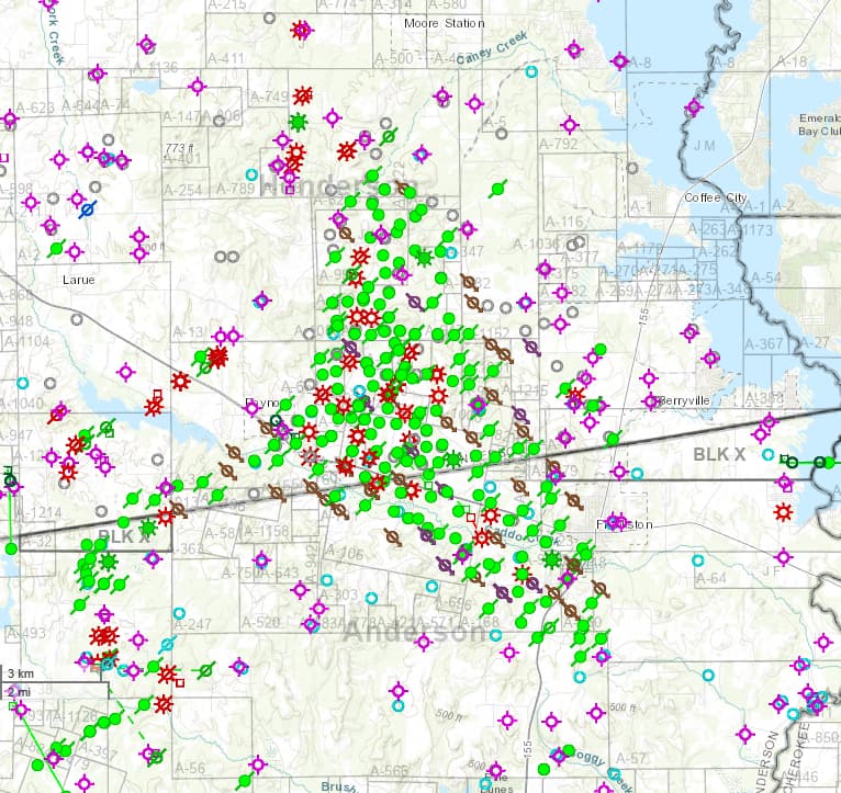
PS comment - map from ENVERUS showing this Southeast Henderson County area. Note the dry hole symbols in the area of your minerals.
A couple of scattered producers in that area too (gas symbols) - very marginal producers.
1 Like
Thanks a WHOLE LOT for the reply and the helpful information. To sound even more ignorant, can you id the symbols? I don’t know what is what.
I have a bigger interest in Roger Mills County, Oklahoma I’d like to pick your brain on if I could.
Once again, thanks a lot!
Code for well spots:
Purple circles with the lines @ Noon, 3, 6 & 9 are dry holes.
Red symbols are gas wells.
Green symbols are oil wells / green symbols with diagonal line thru them are abandoned oil wells.
Open browning circles with line thru them are permitted locations that were never drilled.
Open blue circles are OLD wells with no info available.
Note that one needs to dig into the details for each well spot as to depth and well results.
1 Like
Re - Roger Mills County
I can look up some things on this area if you want to send me some details on location.
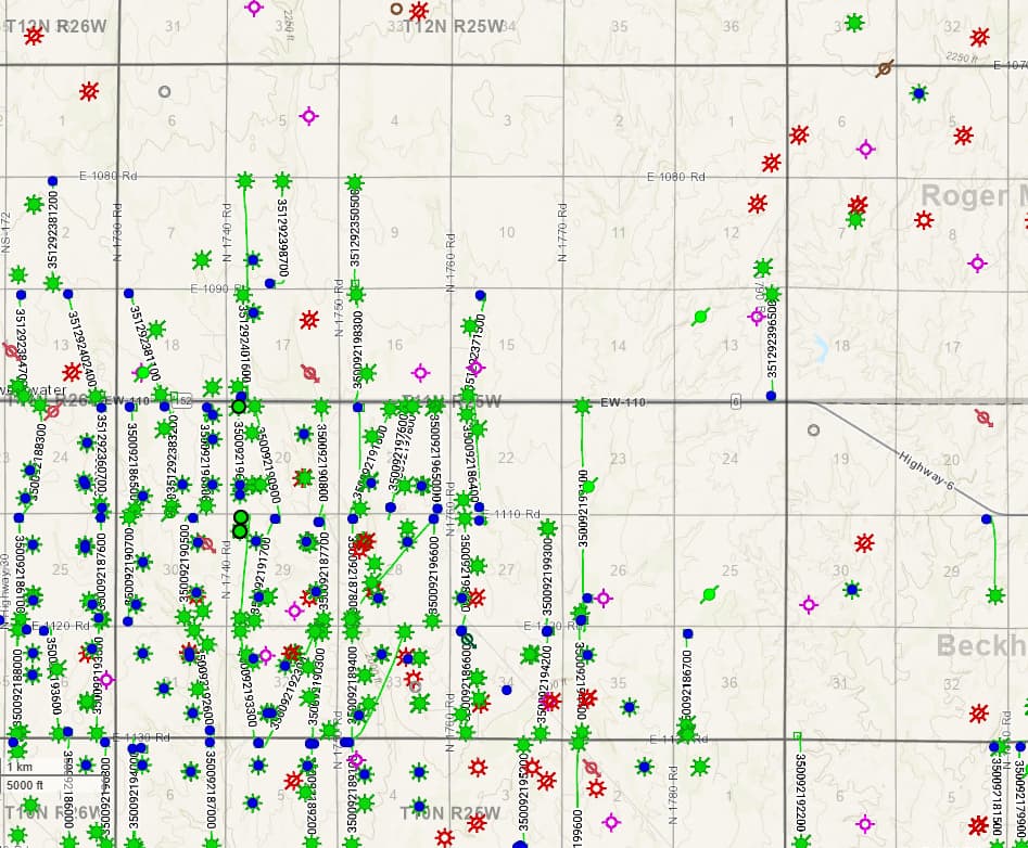
Section 11, Township 11N, Range 25W
Roger Mills County, Oklahoma
Thanks - top map is centered on Township 11N-Range 25W.
Map shows green (oil prone) and gas wells with blue dots on wells that are still active.
No blue dots = wells are abandoned / not producing anymore.
Your Section 11 shows no wells in it.
Note the “sticks” - North-South oriented wells (horizontal wellbores) just to the Southwest of Section 11. Plus a few to the east of your area.
These are horizontal wells being drilled by Diversified Energy and Mach Energy - Target zone appears to be the Missourian Granite Wash section (a sandstone reservoir). These wells are a mix of gas and oil in varying quantities.
Unless there is a very major geologic difference in the subsurface, this trend for the horizontal wells looks like it should continue through your Section 11 area.
1 Like
Do we simply wait to be notified they’re drilling under us?
You may or may not be notified by operator when they are prepping to drill a new well - but they will definitely be in touch with you once any well is completed and Division Orders are prepped for review and approval.
One can always check with the Texas Railroad Commission site as to new permits for your area.
This topic was automatically closed after 90 days. New replies are no longer allowed.