Hello -
Mineral rights are all new to me, especially being in Minnesota! I’ve just received a summons from an oil and gas broking company that has filed a civil suit to try to quiet the title on some of the mineral rights my family has inherited. I have no information from my family on these rights other than what is in the paperwork.
I’ve been looking on the BLM site, trying to understand which sections we have claim to and what, if anything, may come of these mineral rights potentially in the future. Any insight this group can provide would be greatly appreciated!
Township 25 South, Range 31 East, NMPM
Section 21: S1/2 (1/3 of 1% ORI)
Section 27: W1/2NW1/4 (1-1/3% ORI)
Section 28: N1/2NE1/4, SW1/4NE1/4, NW1/4, SE1/4NE1/4 (1/3 of 1% ORI)
Section 29: NE1/4 (1/3 of 1% ORI)
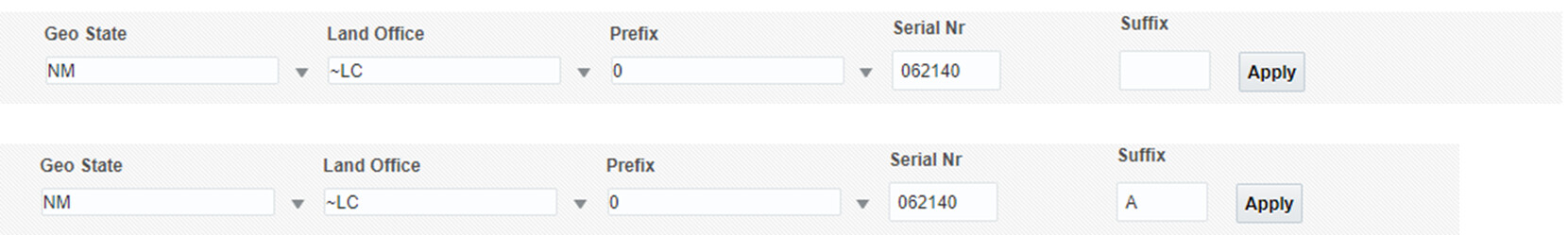
Also, does anyone know where I can pull US Oil & Gas lease information if I have the LC#?
You can go to this page and type in info to see LC-0062140 and 0062140A. At least what they have, which isn’t going to be a copy of the lease but is at least a history of the lease. Inputs below.
Thank you for the link and instructions. Were you able to find those numbers based on my name alone?
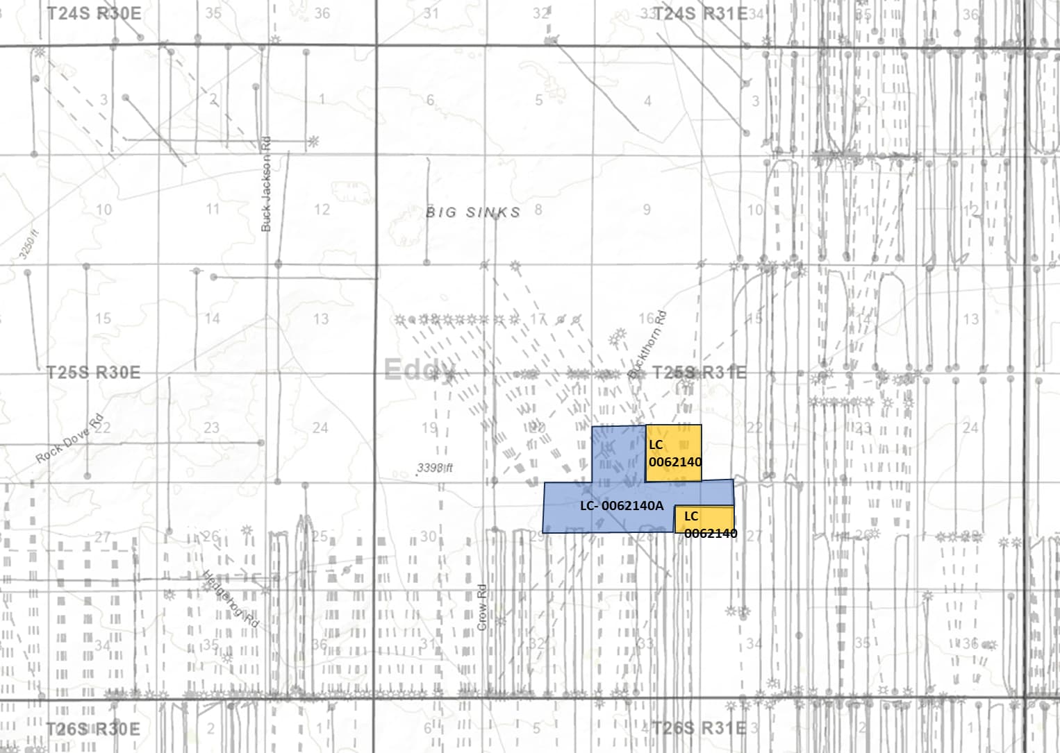
Also, in reading other posts you’ve replied to in this forum, would you be able to provide a map of the sections I mentioned and if there are any wells in these areas? The layering on the BLM interactive map is foreign to me, as is all of this!