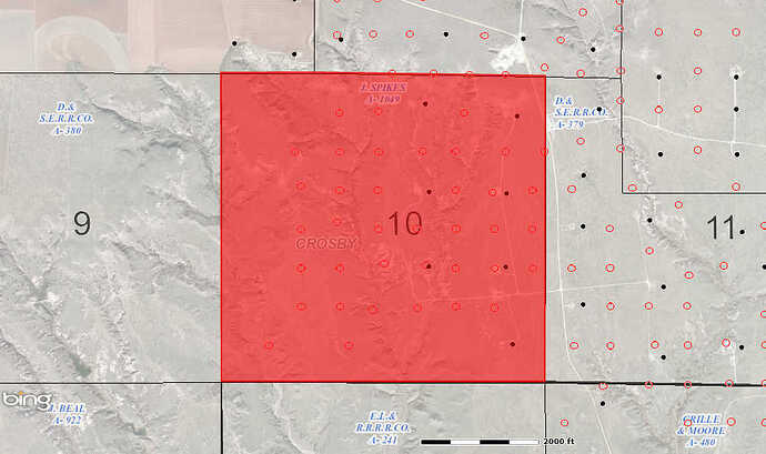
Can anyone tell me what’s up with all the Clark Wood Ranch applications for permit to drill?
Bill,
Check out this GIS Map of Crosby County A-1049 WOW.
Clint Liles
Bill Bacon said:
Can anyone tell me what's up with all the Clark Wood Ranch applications for permit to drill?
Clint, How current is this map? Am I to assume the clear circles are proposed locations?
Bill,
I just pulled this map up a few minutes ago. I'm like you, I assume these round blue circles are proposed well locations.
Clint Liles
Bill,
Here is another look using the Texas General Land Office GIS WEB:
http://http://gisweb.glo.texas.gov/glomap/
Clint Liles

