Drilling by Township.
Welcome to forum. Did you have a particular question? I moved your post over to Pecos County. You would have to give a location and a question to perhaps get an answer.
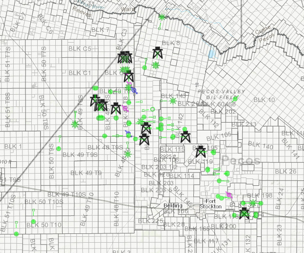
FWIW, here are wells drilled in the past 6 months (green) and current rig locations. Pretty much all Diamondback and Exxon.
NMoilboy, where do you access these maps? And thanks for posting, as we have a few acres around the more active areas on this map.
Source of map? Our land is a little farther East - Southeast.
Hey Joe, that map is from DrillingInfo/Enverus, a subscription service.
Is it correct to conclude from the map, that three wells were drilled in Section 1, Block 48, Township 8 in Pecos County, Texas? What is the significance of the green dot versus the green asterisk? Where can well production information be found? Thanks for your post!
Honestly I’m not sure what the difference is between the asterisk and the dot.
There were two wells drilled in the Unit that makes up Section 1 and 12 of 48 8. There is an additional well permitted there that I don’t believe has spud. You can find production info on wells at the RRC website. These wells are the PRI operated Wahoo State wells.
I’m in a crunch now but can look all this up later.
Thanks for the info.
This topic was automatically closed after 60 days. New replies are no longer allowed.