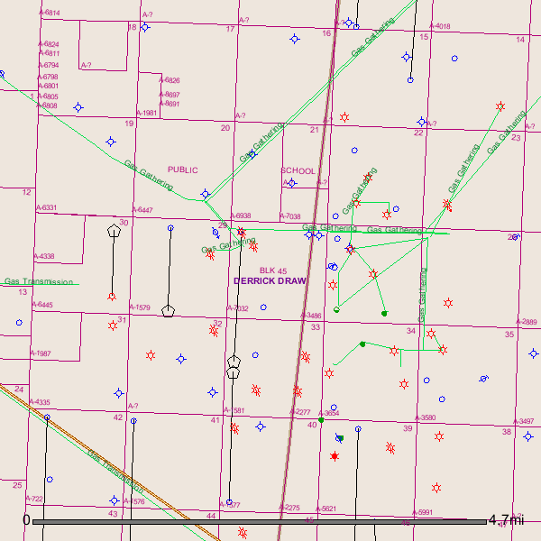
I own in Sections 28, 29, 33, 41 and 44 of Block 45 in Culberson County. This mineral interest is partly in Reeves County. Conoco leased it and plans to drill next year. Does anyone know the availability of oil and gas pipelines in this area?
Thank you, Foster
Foster,
After checking the GIS Map I find 4 different pipeline ‘Gathering Companies’ in the area:
Regency Field Services/natural gas pipeline
Enerquest Operating LLC/Screwbean gas gathering system
RGU West LLC/natural gas gathering system
Remuda Operating Co./natural gas gathering system
Since I don’t see any oil wells in the area I detect no oil pipelines.
GIS Map of Culberson County Block 45/Sections 28, 29, 33, 41, and 44 and pipelines:
Clint Liles
Clint,
Thank you for this valuable information regarding oil/gas pipelines. Correction my lease is for Section 40 not Section 44. FYI … Conoco will begin drilling 4 horizontal wells starting in early 2015. [3] 7500’ lateral and [1] 5000’ lateral.
Appreciate the plat with pipelines included.
Foster
Hello Clint,
Can you tell me what the black lines with a house symbol represent running in Section 29 only, running through Sections 28, 33 and 40. With one black line going South through Sections 41 and 44.
Thank you,
Foster