Has there been any progress in drilling wells in Sections 11 and 15, Block 12 in Reeves County?
Constance,
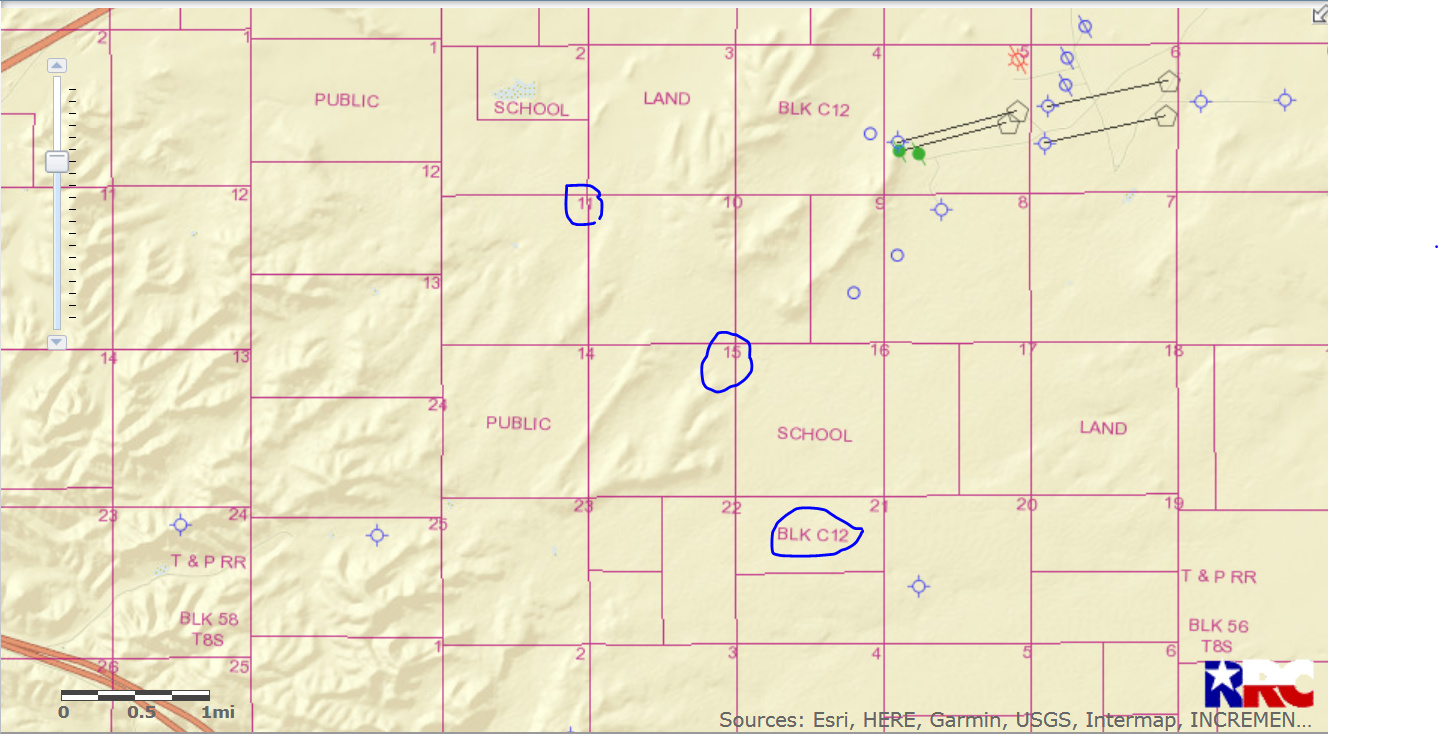
I don’t find a Block 12 but I do find a Block C12/Section 11 & 15. I see no activity anywhere near this acreage.
GIS Map of Reeves County Section 11 & 15 Block C12 and surrounding area:
CLICK ON MAP TO ENLARGE
I find an older approved permit for an Apache Alpine High well (API 389-35755) in Section 8 that was approved in March 2017 but I find no spud notification (begin to drill).
1 Like
Clint,
What are those highways in the upper left corner and the bottom left corner of the map? Looks like a divided highway like Interstate 10 or 20 in the lower left and a single highway in the upper left. Knowing the location of the land in relation to highways helps me find the property without going through multiple sources of information. Highway identification makes it much easier for those of us who live in Reeves, Loving, Winkler, Ward, Pecos, and Culberson counties.
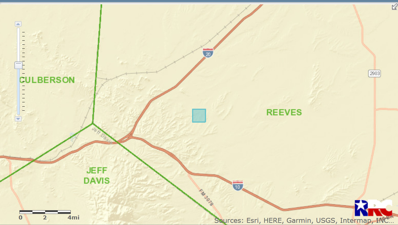
Yeah…that area is high volume gas and oil…high liquids in the gas…one of the richest production areas Apache has explored so far. That’s west of the Dakota unit…I think they call that the Navajo unit. I hear they are talking about putting in 6 more NGL cryogenic plants just east of the juncture of Interstates 10 and 20. At the juncture, it’s only about 12 miles to the abandoned town of Kent,Texas in Culberson county. Someone claimed there was no production in that area of Culberson, but that’s where the high liquids gas and high volume oil is trending. That’s also where Clayton Williams is concentrating his landmen to buy up all the leases they can. I TOLD the people on the Reeves and Culberson counties of the MRF that about a year ago. They may have to build an oilfield city there at the juncture of IH10 and IH20 to accommodate all the people, equipment, and businesses that will flock to that area soon.
, Reeves county, Tx ![]()
![]()
![]()
![]()
![]()
1 Like
I recently leased two tracts of land in Pecos County. One was to XTO and the other to Elk Land Resources (land men). The description on the lease was all of Section 11, Block 112 Survey A-3268. This was 5 net mineral acres leased for $2,000 per acre to Elk Land Resources.
The other was SE4, Block 112 Section 15 Survey A-3263, 2 net mineral acres leased to XTO. Price was also $2,000 per acre.
Can you find these tracts on your maps? My father obtained these leases in the 1950s. Is it possible that these lands have been reclassified during the intervening years?
I’m not sure what you mean by “reclassified,” but there is no current activity or production in all of Block 112. I know that XTO has been actively leasing the Block, however.
Might want to move this whole thread to Pecos County. Maybe I don’t follow.
FANG results in Block 142 are encouraging. Crickets in 112 thus far.
Thanks for the information. I was just a little confused when someone told me they couldn’t find Block 112 on the Pecos County maps.
I am so sorry. I realize that I meant to type Pecos County, not Reeves. Now I understand your reply.
On my original query I had the correct block and Section numbers but I typed in Reeves County instead of Pecos where they actually are. If you can, please move my query to Pecos County discussions.
I moved it to Pecos for you.
I agree with Clint, I see nothing near your tracts.
Constance, I see you are interested in Section 11 and 15, Block 12 in Pecos. I know all of the undivided royalty owners of Sections 2 through 11, Block 12 of H&GN survey but have never heard your name mentioned. Are you sure you have an interest in Section 11? I don’t know about Section 15, but we hold the sections on either side of that one (14 & 16). By the way, we do have a little action - interest in a couple of sections to the west of 11.