Pecos, Texas. Just curious if anyone knows if any drilling is being done in this area. Property owned by my mom and cousins.
Lots of activity in Pecos…suggest start with this map: http://www.gisp.rrc.texas.gov
Unfortunately, the link you attached does not work. I get a message that the “Site Cannot be Reached” and to go to http://www.texas.gov/ I did go on that website but I do not know where to go from there. I would be interested, also, in a map showing activity in Pecos County. Thank you.
First of all, C11 is in Reeves County. It is admittedly confusing that the town of Pecos is not in Pecos County.
There is not much going on currently near C11 Sec 19. I would guess you are leased by Apache and they are staring at 300,000 acres in SW Reeves trying to figure out what the heck they are going to do with 75 years of gas drilling inventory.
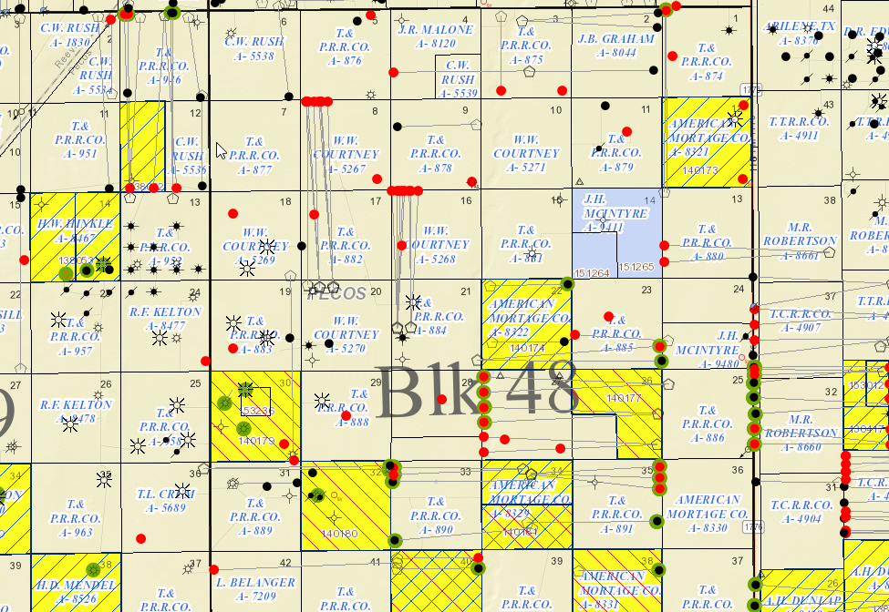
Pat, I would just google RRC GIS viewer or Texas GLO GIS viewer. You will need to zoom into the area of interest, which requires some frame of reference. Here is a sample map of the Pecos County Block 48 area if one perhaps wanted to see the new wells spud in Sec 21 of the Cross lease (A-884).
1 Like
Thank you so much. Would you be able to point me to Sec 21 and Sec 27 on this map? I have mineral rights in Sec 21 Blk 48 and Sec 27 Blk 48, Pecos County. I am still very new at all of this. Thanks in advance.
Look for Blk 48 written in the middle. Right above the “lk” is Sec 21. Sec 27 is under the 4 in 48.