I am still trying to picture the producing formation for Grady County or maybe even the entire Grady, Canadian, and Kingfisher counties. I am not sure I really comprehend the difference between Scoop and Stack, but being a mineral and surface owner in 2 & 11, 7N 7W Grady and in 14, 14N 5W Canadian counties I would like to learn as much as I can.
Is there a cross section of this area depicting the dip of the formation? It has been 40 years since my college geology courses and my specialty has been geotechnical engineering of the upper 300 ft of the state of Oklahoma.
There is a wealth of information here, and some of the nicest experts I have ever had the pleasure of reading their comments. Could you point me/us or provide a drawing that would explain all this? I can read contour maps, but the ones I have seen are somewhat confusing…
Yes, Cecil, there are. Another geologist here. Let me hunt it down and I will post it. Just saw it a few days ago.
In the meantime, go over to the Topic for Anadarko Basin Woodford and I posted a bunch of maps in there. It might be hiding in one of the articles.
Grady is difficult because of the way the formation folds into the uplift.
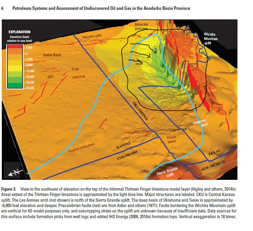
The following exhibit (Figure 4 from Chapter 7 of the USGS Anadarko Basin survey) provides a decent visual of the ‘plunge’ that I or Martha refers to in the southwestern portion of the basin.
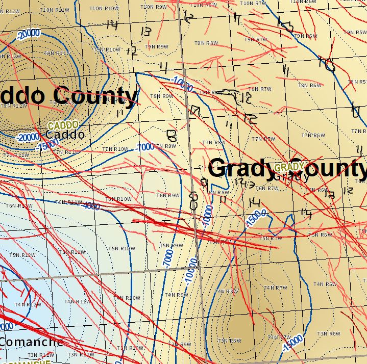
In your specific area (7N 7W), the depth of the Woodford dips to the South and Center of the Township - note in the following map it ranges from -12,000 in the north to -13,000 in the southern part of the Township.
Both East and West of 7N 7W the formation is more shallow. To the South the depth starts to drop significantly as you traverse 6N 7W into 5N 7W with some of the deepest portions of the basin at the intersection of 3N & 4N / 7W & 8W.
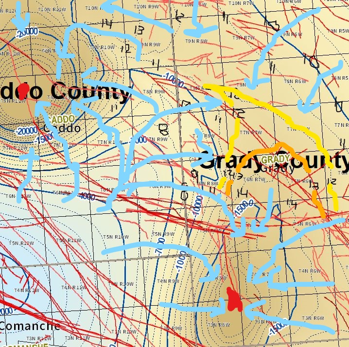
The basin also plunges into some of the deepest portions of the basin to the Northwest in 8N 12W.
Pardon the hand-drawn arrows in the following picture, I need to fire up a different program and adjust the contour shading to provide a clearer picture of how the formation dips and drops into the two deeper areas I mentioned.
1 Like
Thanks
I am guessing the thin red lines are known fractures?
Cecil
Yes, the red lines are known faults, the map is rather busy. Let me see if I can come up with something cleaner for you.
Does it help you get the lay of the land?
I am seeing a lot of fracture lines in 5 North 7 West where I have minerals. Is that a good thing?
Cross Section Anadarko Basin
Anadarko cross section (51.9 KB)
This is a very simplified cross section. I am hunting for a better one
1 Like
Here you go. Brand new thesis from OU.
The file is too big to share here Great update on Grady, maps, cross sections, etc.
Look up the OU Master’s thesis from Brian J. Castro Manrique 2018
Structural Geology of the Woodford Shale in the South-Eastern Anadarko Basin, Grady County, Oklahoma
I found it by doing a Google Search called "cross section Grady County Oklahoma. It pops up as Master’s These Template - ShareOK
1 Like
Thanks, Martha!! Very informative.