I had to go through all sorts of gyrations including printing both of them THE SAME SIZE and then holding them up to the light. By golly you are correct, sir. Admittedly my method(s) were not particularly the most exact or technically correct but it does look like an overlap.
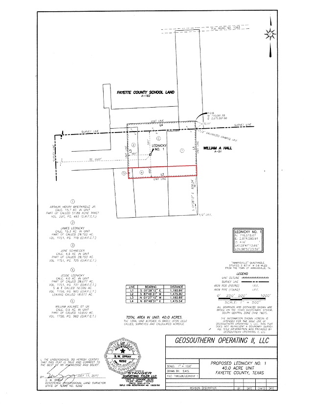
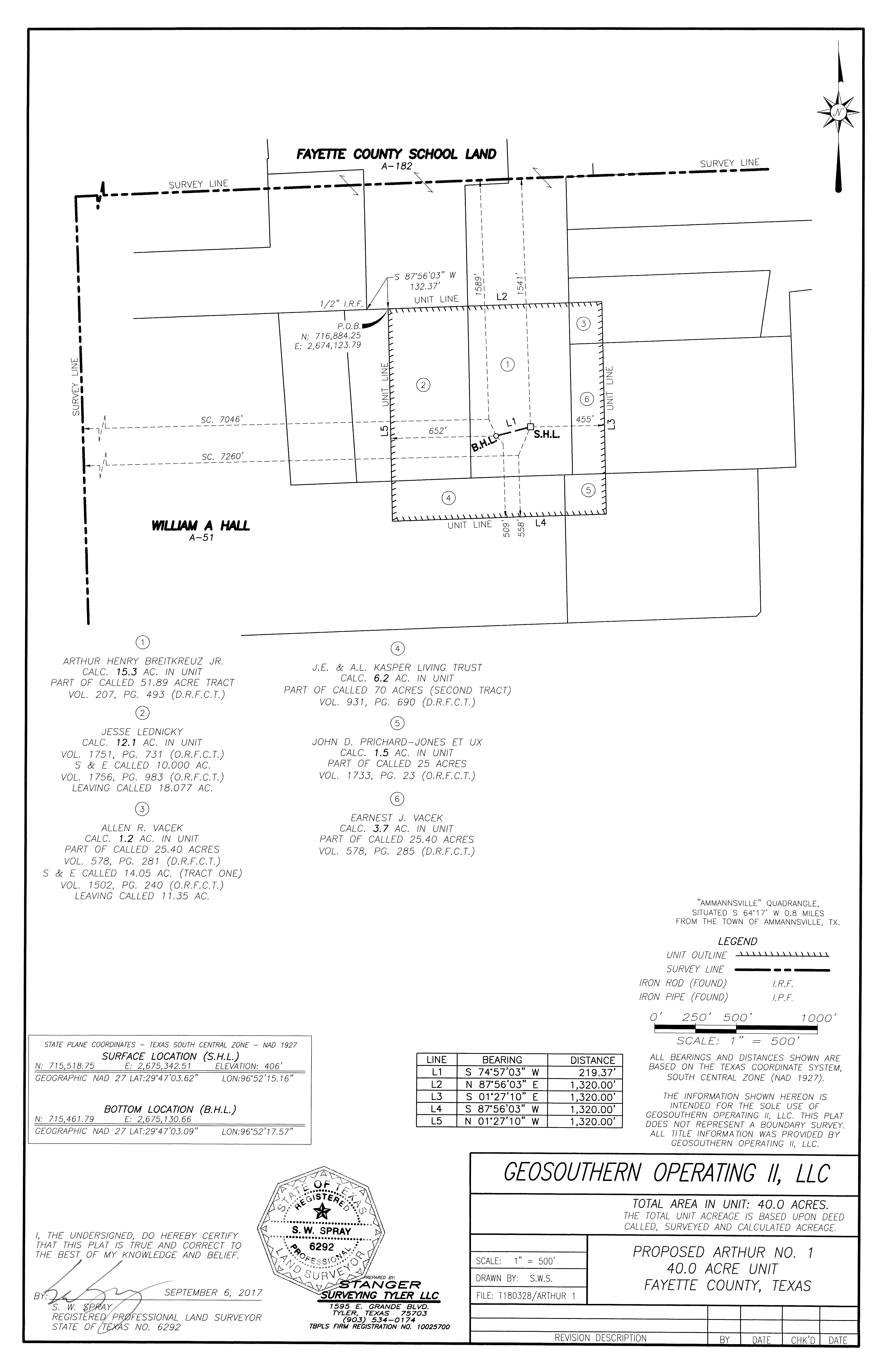
Thanks for checking it out. I extended the red lines a little too far and it looks like the overlap really covers about 11 acres. Interesting, at least to me, but probably meaningless. Particularly since the same family seems to own that whole area.
If we’re guessing right about these being research, or what EOG used to call science wells, think what a bummer it would be to find out two wells were going to be drilled in your back 40, your family’s got 100% of both units, and they end up producing nothing but data. May have to think about some new royalty provisions for that.
As closed mouth as Geosouthern is this may stay a mystery. Wonder if your source has an idea why they would only need to go to 9,600’ and what kind of data, cores etc. GS could be after that they didn’t already have access to in the vertical sections of all the wells they’ve already drilled in that area? Communication between the two holes seems logical but at 9,600’? Maybe the start of a big new, vertical, deep Wilcox field?
The plats for both Osina and Breitkreuz show 6,500’ laterals and their W-1s show 13,800 TD (total depth). So that makes the Vertical Depth 7,300’. So if they’re going to somehow test using Arthur and Lednicky 9,600’ will easily include any potential stacked laterals.
And even though I totally agree with their right to be this way, I also agree with you about their being close mouthed. It seems like the KGB is more likely to divulge info than GS.
The Osina and Breitkreuz are ~11,800 vertical depth, they are 19,300 and 18,400 measured depth, respectively. I have noticed that there is no real consistency on permitting with regard to putting vertical depth vs measured depth.
It seems that the new permits are targeting something shallower than the Chalk. My theory is that they aren’t going to drill the Lednicky well, they moved the surface to the Osina pad to save $$$ and are repermitting it as the Arthur.
Welp. I had heard that there’s an issue with reporting the various depths but please help me out here because I like to do my own CORRECT research (and avoid looking stupid) whenever possible. What document are you looking at to get your figures? All I could see was the W-1 figure of 13,800 and the lateral length of 6,500 on the plat. Thanks.
Dusty, this may or may not be relevant to the Ammensville / Dubina, but back in 2012 a company called SEV Texas drilled 4 wells near Moravia, at a depth of 9500 feet. There is supposed to be a Wilcox formation at that depth. Just food for thought! One of them, the Steffek, was a pretty good well for about 6 months, but the other three, the Rother, Spies, and Ridout, were dry holes.
Looks like those SEV wells were about 18 miles from that GS Arthur well but maybe it’s also Wilcox. The permit for the Arthur shows Geosouthern spudded it on 11/18 so should be finished drilling by now. They never report completions right away particularly if it’s a research well but maybe somebody in that area can tell us if it looks like it’s been completed.