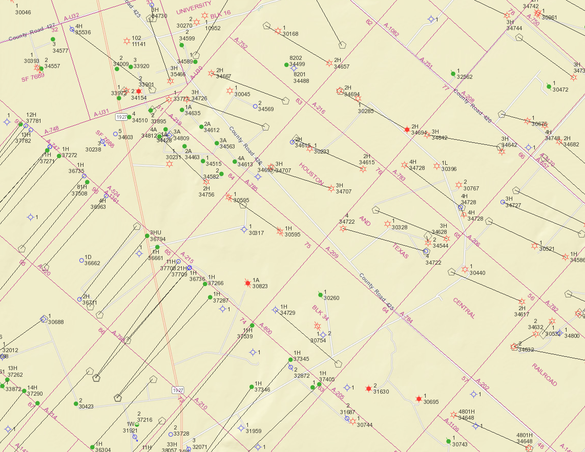
Not long ago, I posed the question here asking if anyone knows of anything being done in Section 75 (HT&C Block 34).
Several of you were good enough to respond, one stating, “When zooming out, you see Section 75 is on a very apparent line where horizontals fade to vertical gas wells that fade to extremely old vertical oil wells. In other words, this acreage is on the edge of the play (for now at least) and is all about speculation.”
Then, under another topic, it was said, “As to whether this is totally ‘fringe’ area, that may be open to interpretation. Your section is surrounded on three sides by acreage held by XTO/Exxon under 1970s deep gas wells. These wells do not produce much gas but they enable XTO to hold thousands of acres.”
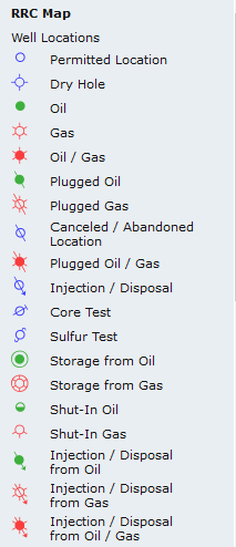
So today looking at the RRC Viewer I see that all three of the sections adjacent to us now have the small blue circle indicating locations of permitted wells. If I’m seeing this correctly, these sections long been held by XTO/Exxon are now being targeted, I’d guess for oil. Can I take from this that XTO considers this acreage as having good oil producing potential and not on the “fringe” of the play?