Comstock has now permitted two horizontal wells in Leon County. They are both located in the J McKelvey Survey A-543, and the laterals parallel each other, about one mile apart. Target will be Lower Bossier.
3 Likes
Are these located in any existing old units by chance?
Is the second well going in at the same site as the first? Any idea when they’re starting that second well?
The two wells are about one mile apart.
Thanks Alan. Sure appreciate the information. Do you know if they’ve started a road and pad for that second site yet?
I don’t know if they’ve started yet, BernardJ.
Comstock Oil and Gas/Leon County/Abstract 543///API 289-32180/JG Dinkins 1H & API 289-32181 CW Lanier 1H
CLICK ON MAP TO ENLARGE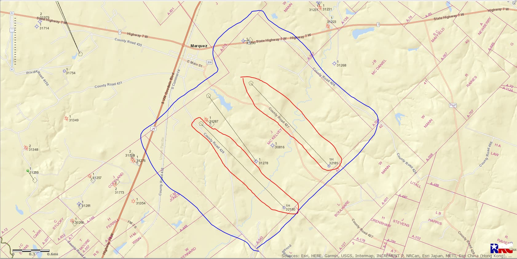
There has been a lot of leasing going on for the relatively small amount of drilling that has been done so far on the deep Bossier play.
What’s it looking like for those with mineral rights between A126 and A127? Less than a mile south of Dinkins JG 1H.
Surprise Valley has leased acreage in both 126 and 127. In addition, Comstock has acquired acreage in 126 through a deal with Ovintiv and a deal with Legacy Reserves.
Any word on how that Dinkins or the Lanier wells are coming along?
The Dinkins well was spud (begin drilling) on January 10, 2023 but I find no spud notice yet for the Lanier well.
Thanks Clint. Where would I go to find information like that? Do I need some type of subscription to access it?
Dinkins approved permit/API 289-32180 [Drilling Permit (W-1) Query)]
Lanier approved permit/API 289-32181 [Form W-1: Field List]
Bernard this is the link that I use: [Drilling Permit (W-1) Query]
Click on the link/type in the API number and then click SUBMIT CLICK ON DOCUMENT TO ENLARGE
This topic was automatically closed after 90 days. New replies are no longer allowed.