I’ve recently inherited some long-lost mineral rights and have been lurking through the forum and other sites to learn as much as I can, but I’ve hit a roadblock in trying to locate a property in the Carillo Survey in Karnes County Texas. The legal description from the 1930 deed starts from the “South corner of division No.2” but I can’t find any maps to show where that is/was. Can anyone point to a source that would show that location? Thanks!!!
Your best bet is probably- Go to the Texas RRC site. Then Public GIS Viewer. Then county list at top. Karnes County, then zoom in. You’ll have to do a lot of hunting around, it’s crowded.
Yep, I’ve been using that and the county plat maps a bunch, but I don’t see anything calling out division 2 from the 1930s era. Any other sources come to mind?
@Vicious, is it possible the description is referring to Tract No. 2? Any other description details you can share? Maybe the location can be deduced from the other landmarks in the description.
The property is 100 acres out of 500 acres which is located on or near the Cibolo river. Unfortunately the start and borders only reference the “division No.2” corners and edges. If this is instead Tract 2, where can I find a map with those divisions? Thanks!
It might be helpful to look at the legal description in earlier deeds in the title chain of your property. In counties that use metes and bounds description, I find prior deeds referenced quite a bit. Sometime their description have additional information that helps in mapping tract.
@Vicious, the Tract 2 idea was a dead end. Spotted that on the Karnes Appraisal District parcel map, but it was just 0.5 acre. @J_Walker post above to check earlier deeds would seem to be a reasonable approach.
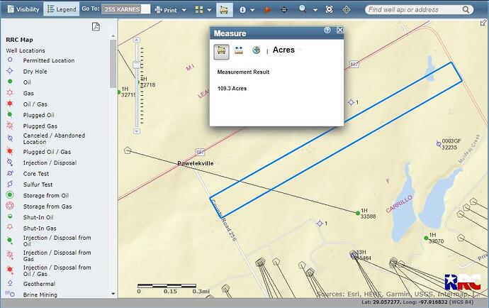
@Vicious, attached a sketch of a best guess at where the 100 acres is. The division No. 2, must be a similarly shaped area just to the north of the 100 acres. There was a deed reference that gave some metes and bounds to the NW corner of the F Corrillo survey. A guess is that the original 500 acres was split into five one hundred acre blocks, with division 2 being the second block, and the 100 acres would be the 3rd division.
Thanks! I’ll check it out and see if the boundaries work out.
This topic was automatically closed after 90 days. New replies are no longer allowed.
