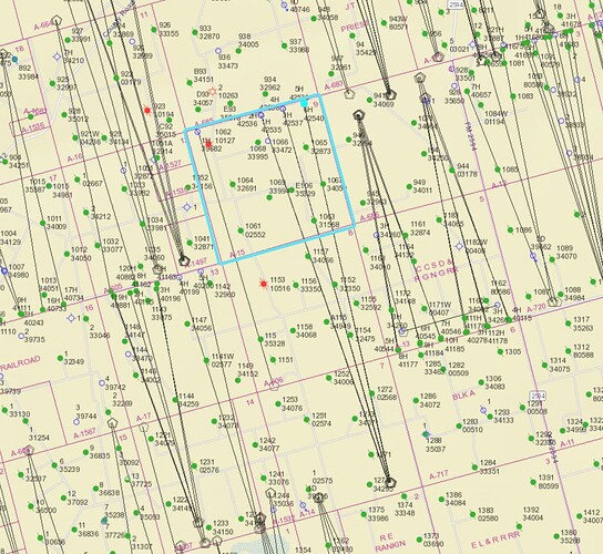
Pioneer has pulled permits on 6 new wells under a Brook A-E7 lease with a final take point in Section 9, A-15 in Upton County. I received a P-17 from Pioneer today saying they were requesting a commingling permit from the RRC to combine with other leases: Brook Y-6, Woodfin-Dollie and Brook-B. Does anyone have any additional insight into these new Brook A-E7 wells and what questions I might ask Pioneer, if any, as to how to track production?
Use the Texas GIS viewer and look for API numbers. 46142535 46142536 46142537 46142538 46142539 46142540. Currently they show nothing as they are not producing at this time. link to GIS viewer. RRC GIS
Yes, thank you. I don’t think I phrased my question correctly. I’m mainly wondering how I should track prod under a pooling order and if there are questions I should ask Pioneer now.
These are allocation horizontal wells, not pooled. Commingling is not pooling. It allows for a distribution point for the wells oil for transportation.
MK
1 Like
This topic was automatically closed after 90 days. New replies are no longer allowed.
