A couple of years ago I discovered I was an heir to mineral rights in Midland and Martin County, Texas. The larger interest, conveyed by royalty deed, covered 4,815 acres and I have focused my attention on getting on the pay list for that holding.
Now I am turning my attention to a holding for the NE 1/4 of the NE 1/4 of the above listed parcel. Looking at the Railroad Commission site, it appears there has been recent activity involving this parcel with more planned.
My question is: other than eyeballing the Railroad Commission map, is there a way to confirm the activity includes my 40-acre interest?
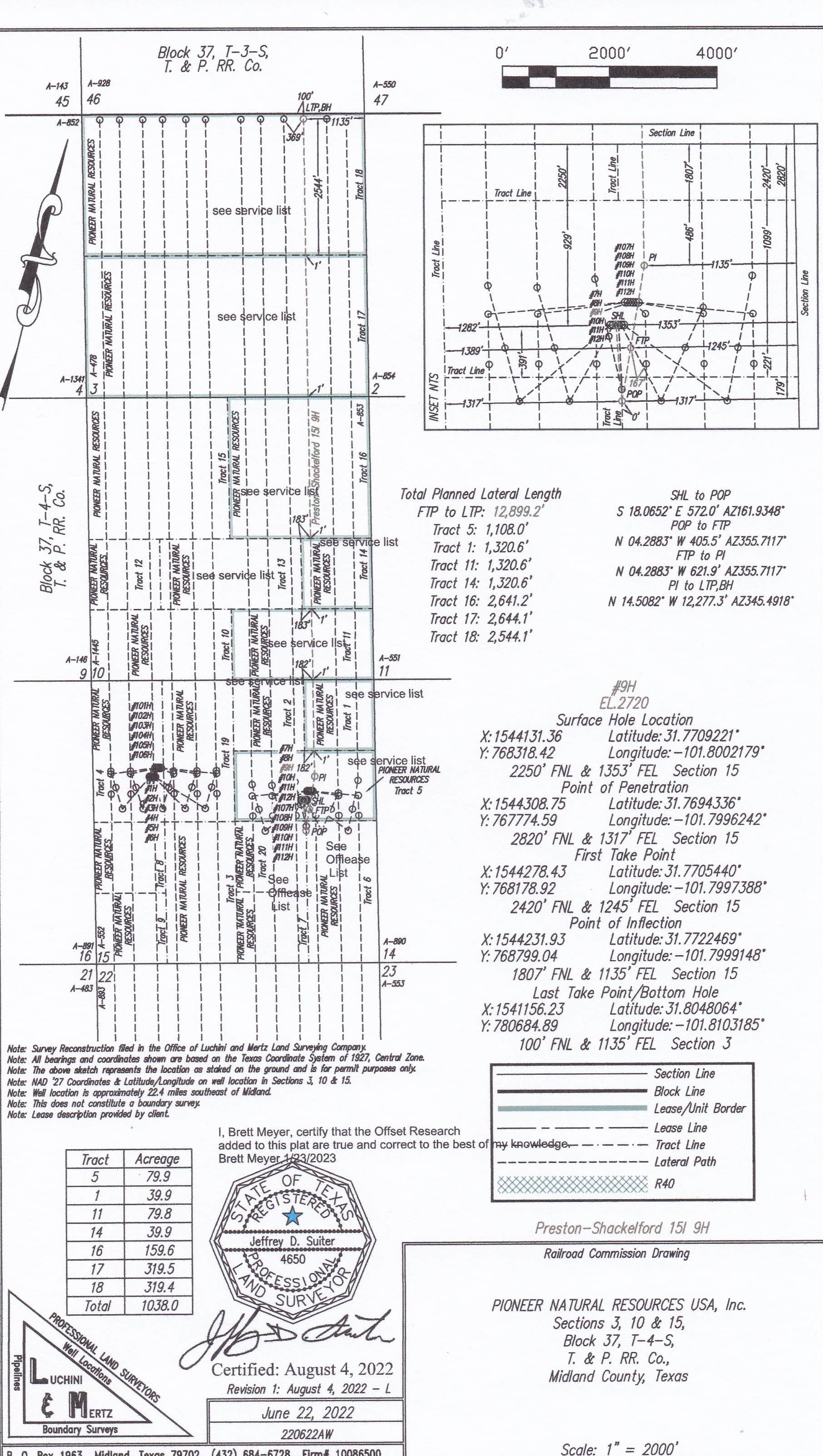
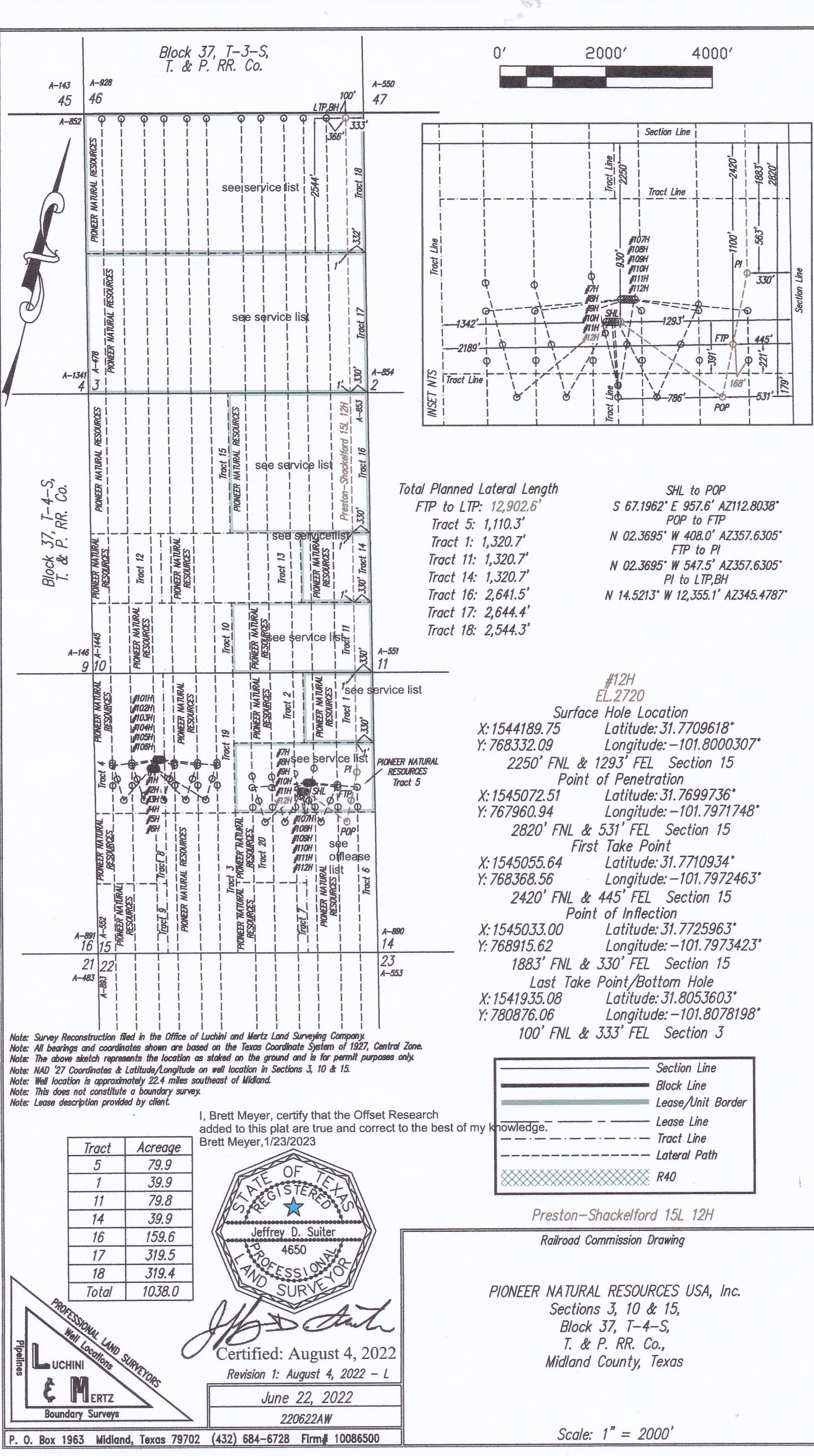
You mentioned checking the Railroad Commission’s map so you may already know, but it looks like the NE 1/4 of NE 1/4 of Section 15 should be included in three horizontal allocation wells Pioneer Natural Resources got permits to drill in March of this year. The permits don’t indicate if they have been drilled.
Below are the plats of what Pioneer designated as Wells 15 I 9H and 15 L 12H in their Preston-Shackelford Unit. I didn’t include the plat of the 15 K 11H well, but I think you can see from the plats that are attached where that third well path fits between the #9 and 12.
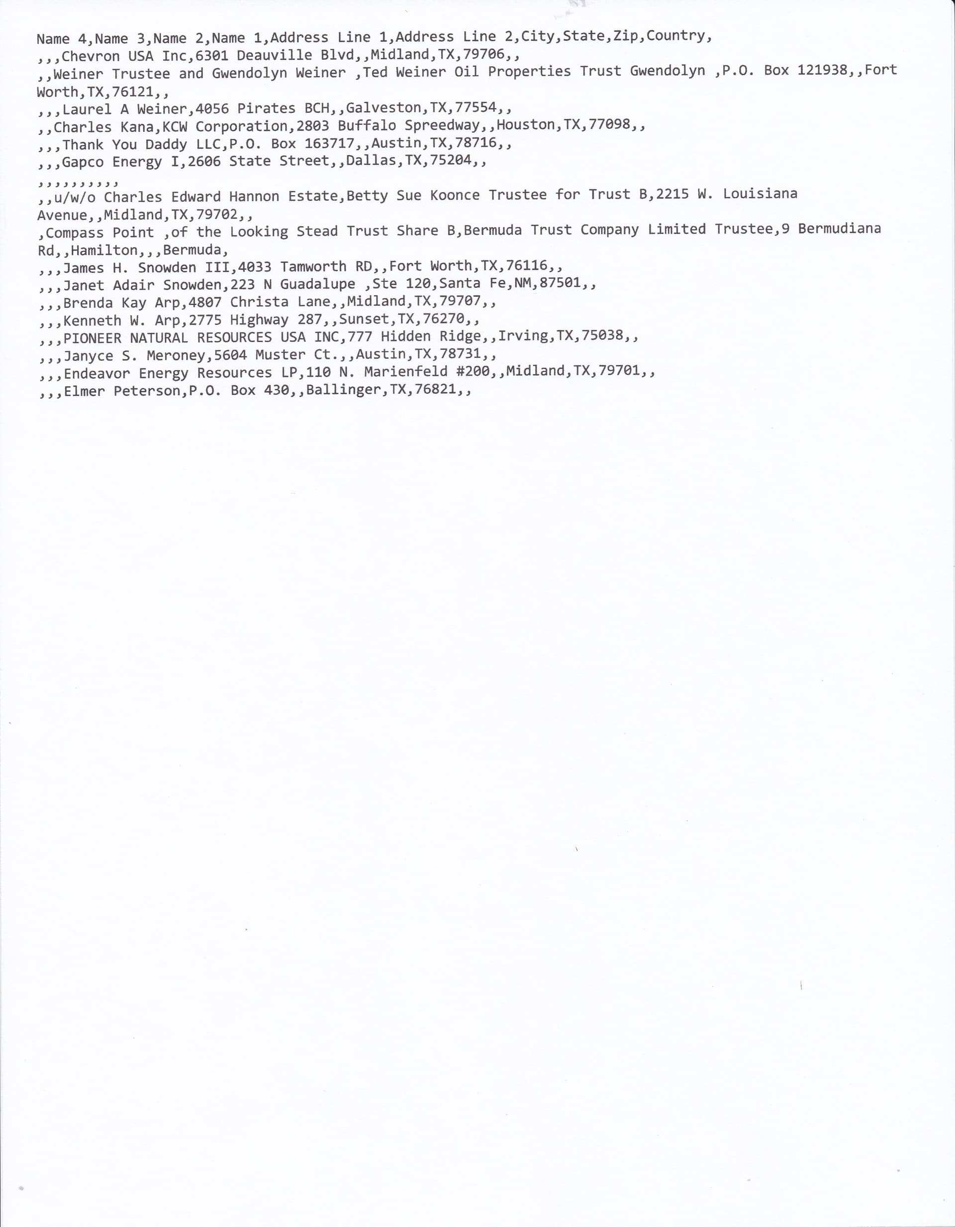
If you can enlarge the plats I think you will be able to see in the table at the lower left side the tract you described is identified as “Tract 1”, called 39.9 acres. There is a note on that area of the plats saying “see service list”, which normally means there is unleased acreage. That service list is also attached below. If your name is on it Pioneer should have already contacted you about the planned wells. If they haven’t you should probably try to contact them.