I received division orders from Antero today. I own several tracts. The decimal owned doesn’t match up to the net acreage on any of my leases nor does the property so I can’t determine which lease this covers or which tracts.
I’ve attached a photo. Can someone explain to me how to read the division order? Thank you! M
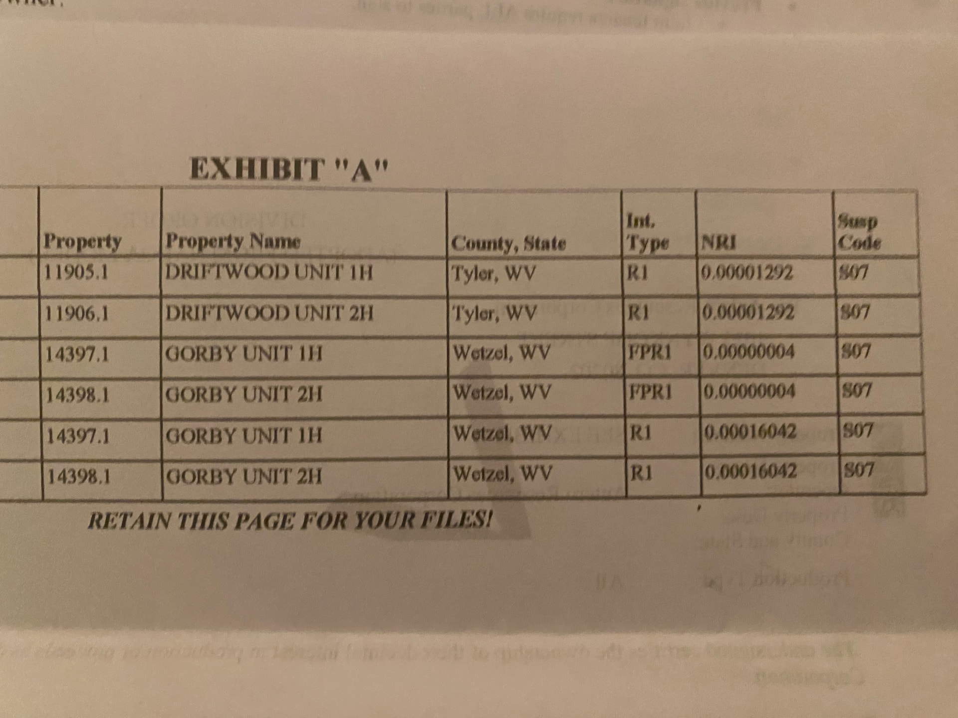
Each operator has a certain style, but they are similar. The Property ID is an internal code for the well. Then they list the name of the well, county and state, royalty type, net revenue interest and whether or not you are in pay or in suspense.
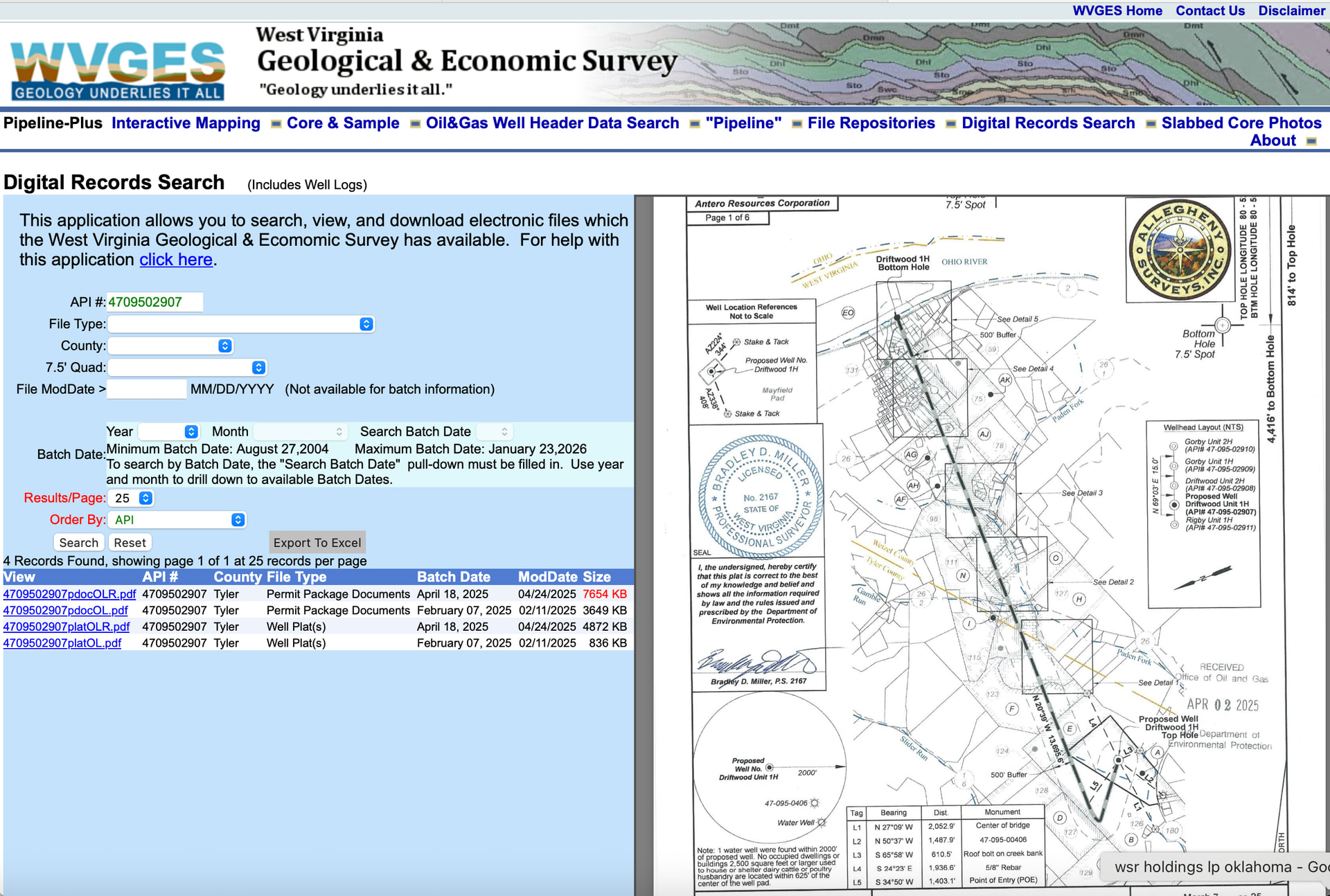
Driftwood Unit 1H has an API (American Petroleum Institute) unique ID of 4709502907. 2H is 4709502908. Save those numbers. They were drilled in Tyler Co WV. The NRI or Net revenue interest is made up of several components. Your net mineral acres, the actual spacing of the drilling unit and the royalty from your lease. You need your lease for the royalty percentage, the permit is listed on the state website and the final drilling spacing or pooling spacing will be on the as drilled paperwork.
The easiest thing to do is ask the Division Order analyst what net acres, spacing acres and royalty they are carrying for you.
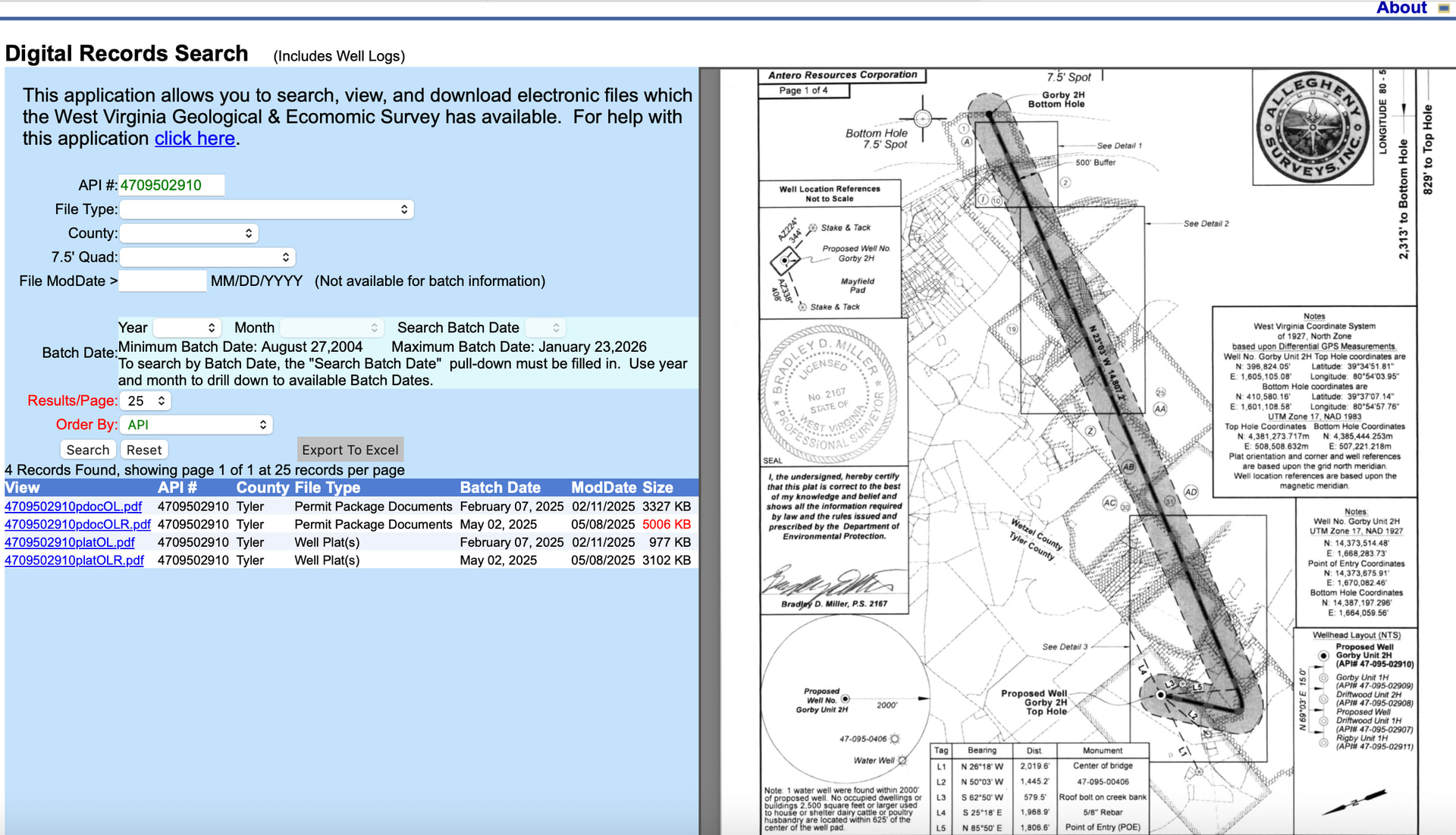
The Gorby Unit is in a different county according to their list, but I see the surface location in Tyler very close to the countyline, so not sure what the deal is there. Looks like a different code on the first two wells lines. Might be an override or something with force pooling. Ask the agent what it means or it might be listed on the statement, Force Pooled royalty Interest? Gorby 1H is API 4709502909. Gorby 2H is 4709502910. Save these.
Here are two of the plats. Your interest will be determined as how the well plat crosses your acreage and what percentage of the well is allocated to you.
WVDEP Oil&Gas Well Information. Here is the map, I zoomed into the surface location and then picked up a list of wells and then buried down until I found the wells.
A big THANK YOU for the wonderful explanation! I appreciate the time it took to pull this together for me. I feel like I have to learn more about this so I don’t get taken advantage of.
Yes, I do have one lease that was forced by a court order. There were hundreds of rights holders and Antero didn’t have the percent signed required to drill.
I will take your suggestion and reach out to Antero to confirm the leases and royalty rate.