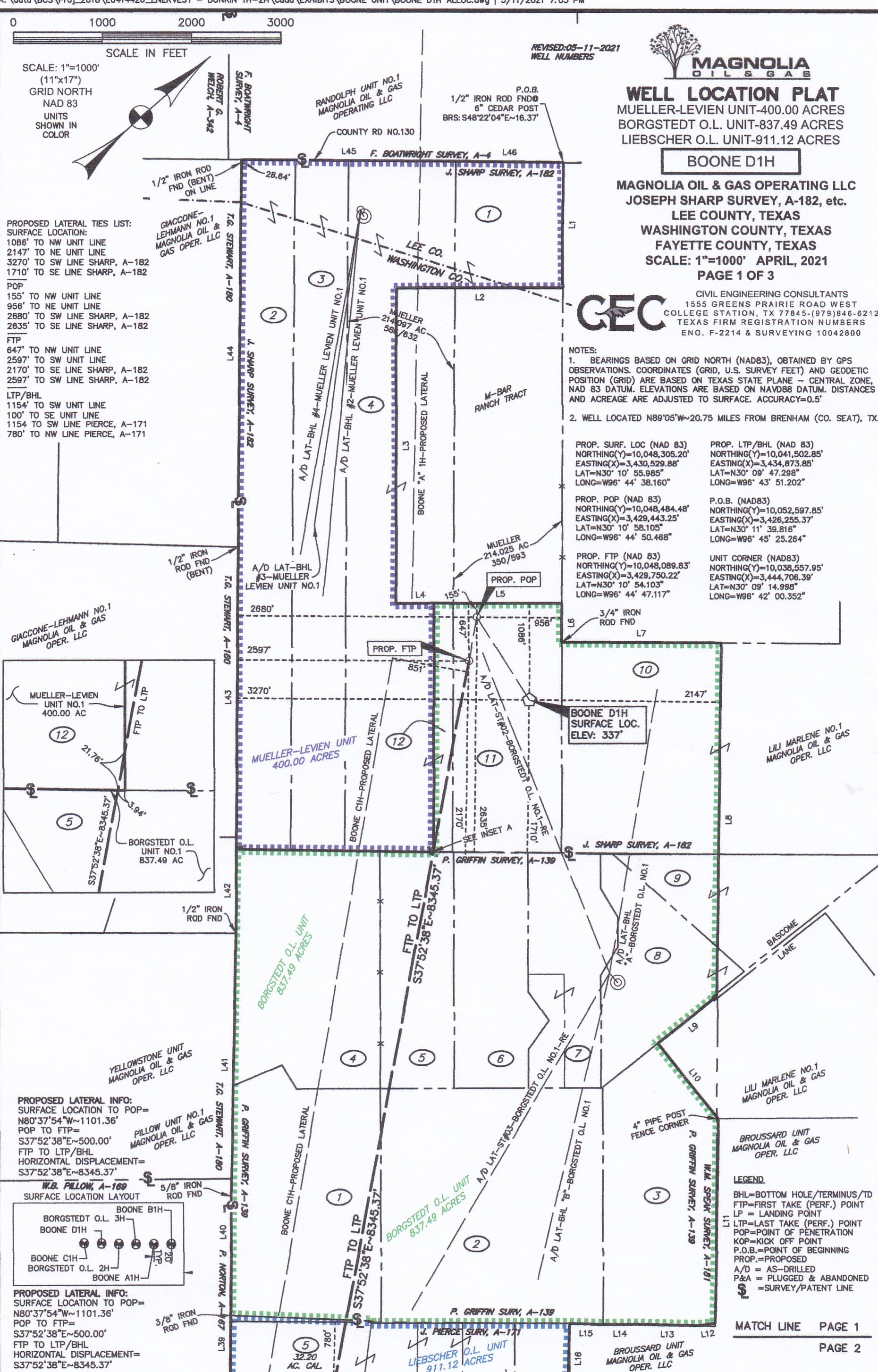
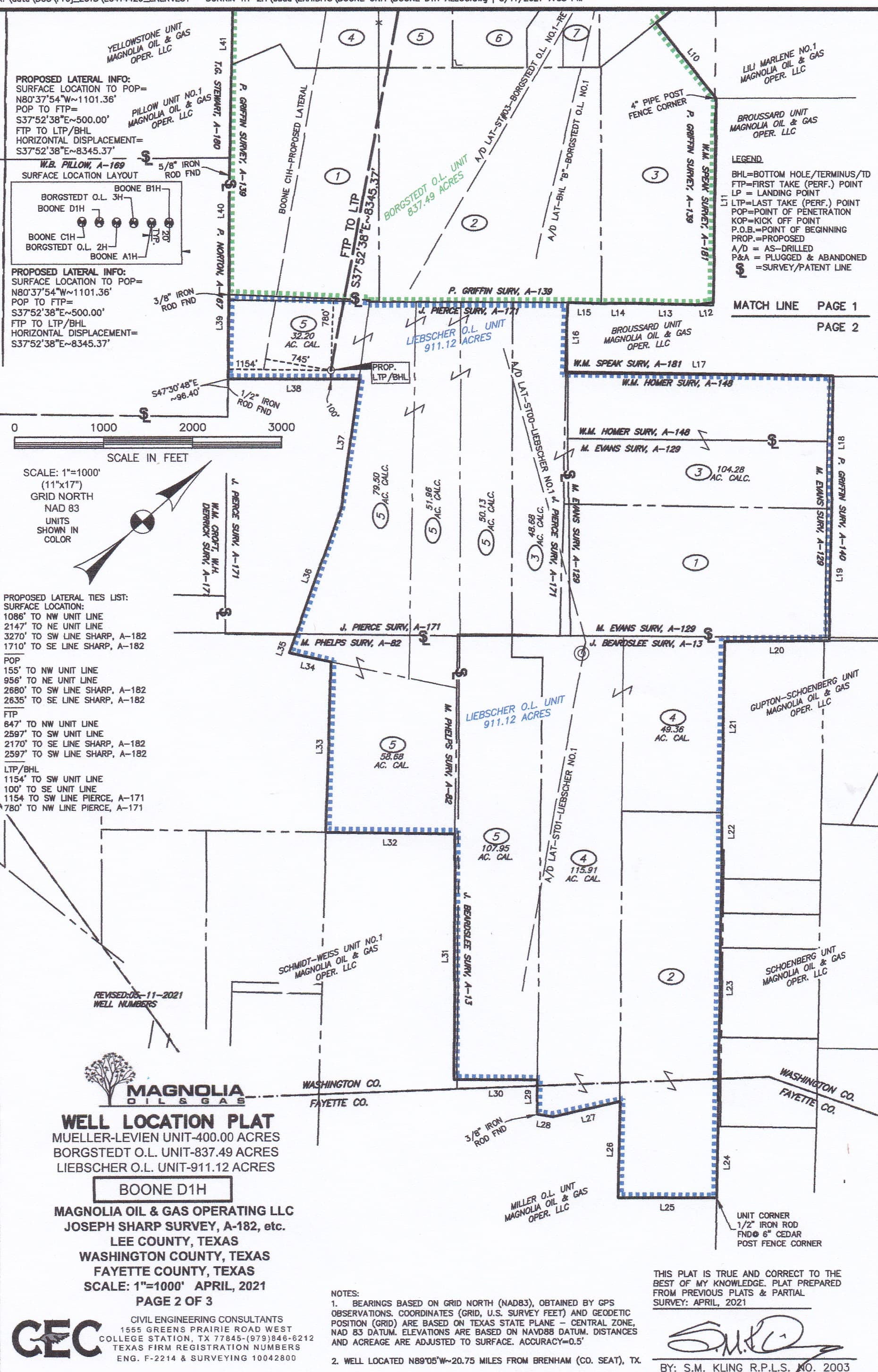
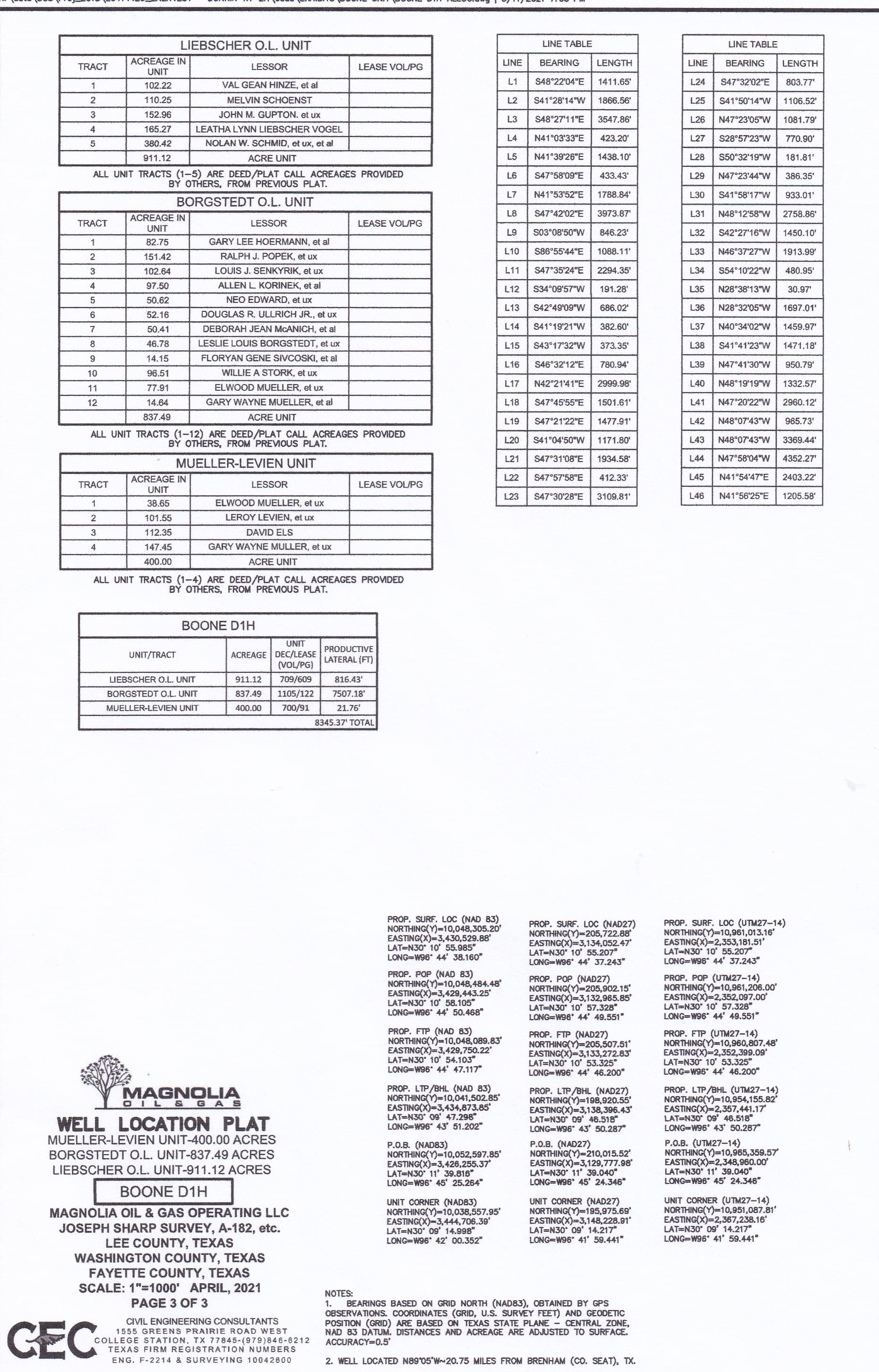
Although Magnolia hasn’t filed any drilling permits under a name like Thunder Creek, it looks like they may have formed a big allocation unit that combined the Borgstedt O.L. Unit with the Liebscher O.L Unit, the Mueller-Lievien Unit and the Boone Unit. Below is the unit plat they filed in 2021 before drilling one of the Boone wells.
In the past couple of years Magnolia has created a bunch of co-op units where they drilled new allocation wells. From what I’ve seen those unit agreements were circulated for signature until after most, if not all, of the wells they planned to drill in the co-op unit had been completed. Unless your acreage for some reason was missed during the initial signings I’m not sure why you wouldn’t have gotten this agreement earlier since it looks like the new wells may have already been completed.
If it is like others I’ve seen the co-op agreement Magnolia sent you should have included an exhibit that shows the boundaries of the new co-op unit they formed, and I think it should look similar the plats attached below. That combined unit is so large it had to be shown on two separate plats, so you will need to connect the first two pages together to get the full picture of the unit. The breakdown of the acreage that was combined to form the new unit is listed on the third page.
Magnolia seems to have some good land people. If you don’t understand the status of the agreement they sent you, the cover letter that came with it should have included a phone number or email address for a person you can contact about it. If it doesn’t post here again and I’ll give you a name you can try.