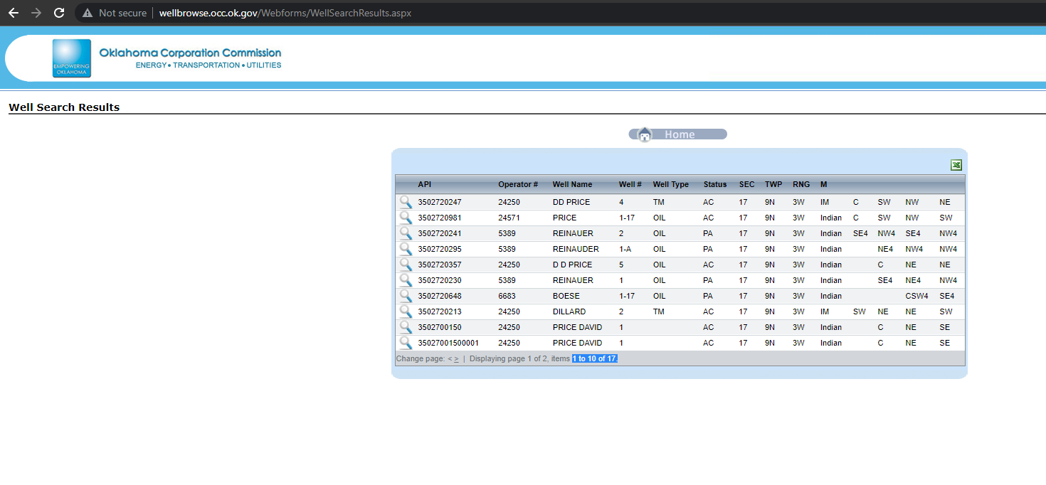
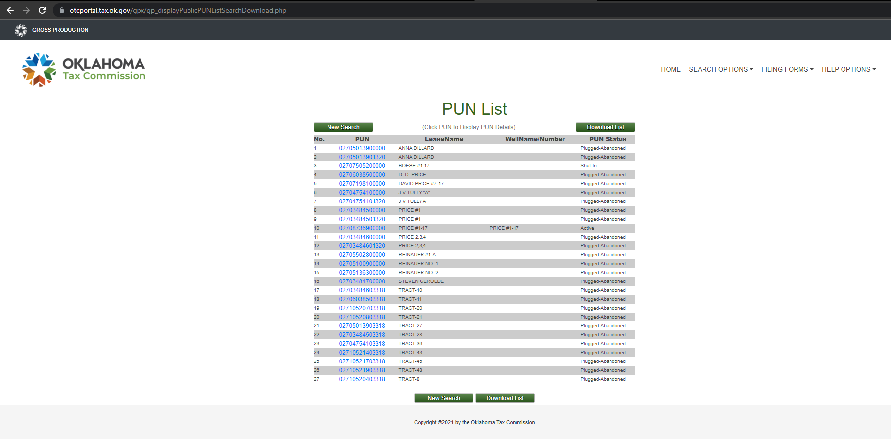
I have noticed that these two websites do not always have the same info though. For example, Cleveland County 17-09N-03W. The Well Browse OCC website returns 17 results and the Oklahoma Tax Commission websites returns 27 results.
I also noticed that the OTC website returns what are called “TRACTS”. Pardon my ignorance, but what is the definition of a TRACT in the oil & gas industry? Is that a certain amount of acreage?
Thank you in advance to all! I appreciate your time and feedback.
The OCC lists wells by the surface location. The OTC tax site lists wells by their bottom hole location (sometimes…) hence the difference. Also, sometimes wells change names over time, so you have to account for that as well.
I also check the OCC Unitization Documents. OGUnitization
“Tracts” is a term with several meanings. The print is small, but it looks like the OTC is listing a waterflood unit which has the parcels of acreage listed by the original spacing unit of the original well with a new tract # name. (It can get a bit confusing). If you are part of a waterflood, then you get revenue from all the wells according to the rules of the waterflood. If other wells are not in the waterflood, then the regular spacing rules apply.
Test This is a bit easier to read and lists all the wells and all of the documents that go with them.
Regular wells-You will only own the wells where the spacing unit includes your acreage. So look for the permit (Form 1000) and the Completion report (1002). For example, if you own 10 acres in the NE4 but a well is listed in the SW4 and only has an 80 acre spacing, then you will not have that well.
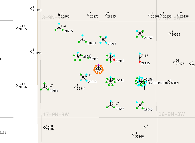
17-9N-3W- Here is a map with the last digits of the API unique identifier number. Use it with the OCC list.