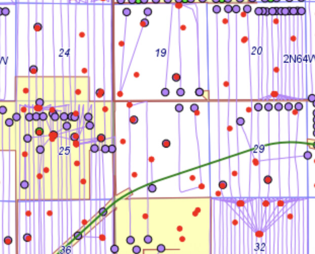
Hi I own mineral rights located at Township 2 North, Range 64 West section 30:SE. I am doing some research and need help Finding the map To see if there is drilling or Plans to drill in that area. Can someone point me in the right direction? Thanks in advance
Please give your state and county so that we can point you to the correct source.
Whoops Weld County Colorado
At least two wells in the SE which were spud in the NE4. SM Energy Grattan 4A 30-H and Grattan 4B 30-H. ECMC GISOnline. They are still online. There are other horizontals on the western side of the section.
Thank you so much for your assistance. Your knowledge is greatly appreciated
Hello there!
Would you show me that foe 11/11n/25w?
Thank you for all your guidance!
RSollers, Please give the state and county for 11-11N-25W.
Roger Mills
Myers Family
This thread is for Weld County, CO. Please submit your question in the Oklahoma Mineral Rights, Roger Mills County. (This keeps the logic for the forum clean by putting questions in topic areas where they belong.)
I will watch for it there and answer it.