December 20, 2018
Hi Clint I had to be out of pocket for some time. I’ve caught up on the permits you have there back through late Sept. Is there a way to look at older ones? Interested in knowing if anything is going on in Block G 310, 344 or 346. Looks like recent permits are all around those numbers. Thanks! Tammy Fowler
December 21, 2018
Hello Tammy. Try this link for older approved permits:
http://webapps2.rrc.state.tx.us/EWA/drillingPermitsQueryAction.do
Tammy, I don’t see much going on in Block G, Section 310, 344, and 346.
GIS Map of Gaines County Sections 310, 344 & 346.
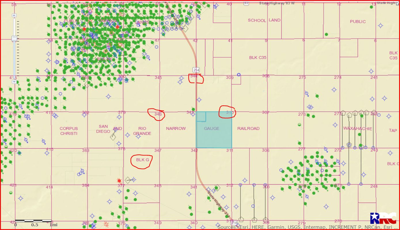
DOUBLE LEFT CLICK ON MAP TO ENLARGE
January 04, 2019
January 07, 2019
Clint, How can I find out who, if anyone, is drilling on our interest? We leased Section 277, Block G in Gaines County back in July of 2018.
Kim, I see where Ring Energy has 9 approved permits to the SW, NE, and East of your minerals. Those permits were approved April and May 2018. Only 2 of those horizontal wells have been spud (begun drilling), API 165-38708 and 38720. I see no activity in Section 277 at this time.
GIS map of Gaines County Section 277/Block G/A-193 and surrounding area:
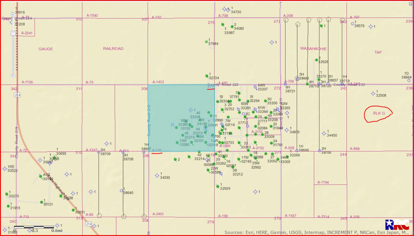
Double left click on map to enlarge.
January 08, 2019
January 10, 2019
January 11, 2019
January 14, 2019
Thank you Clint![]() I hope someone with deep pockets will drill on it soon. Is there any way I can find out who our interest got flipped to? Landman won’t tell us. Thx
I hope someone with deep pockets will drill on it soon. Is there any way I can find out who our interest got flipped to? Landman won’t tell us. Thx
Kim,
Google the name of the company you were leased to and you may find out.
January 15, 2019
January 17, 2019
January 18, 2019
We have a lease in Gaines County on our mineral rights in Gaines County, State of Texas, All of Section 7, Block A-9 P.S.L. The lease is with Adobe. We have not heard a thing from them since we signed the lease in August 2017. I called them but our contact no longer works with them. How should we proceed? We are new at this. Thank you.
This is a link to a RRC map which shows a well has been drilled into and under your section. Use the magnification bar on the left side of the map to zoom out a bit for a better view. There is also another permitted well in the section. Do you own all of the minerals in the section? If you own a fraction of the section, do you have an undivided interest in the entire section? I think you should contact Joint Resources.
Thank you, we own mineral interest in Gaines County, State of Texas All of Section 7, Block A-9 P.S.L. We own 7.999774 net mineral acres.