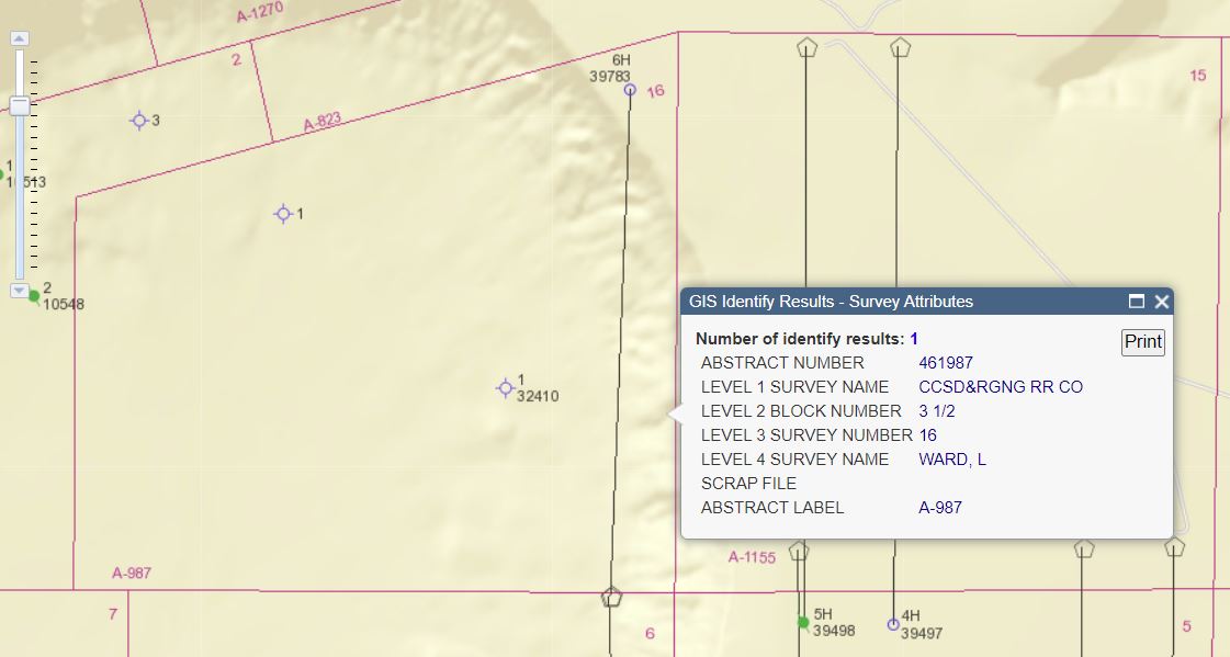
Below is the current Railroad Commission map of the area you described. What was called Survey 16 is actually Section 16. It is also known as the L. Ward Survey, Abstract 987.
According to RRC’s records, in September, 2014 Silver Creek got a permit approved to drill a horizontal well they designated as the Milkyway 16 #6H. The drilling unit was supposed to include all of Section 16. But the well was never drilled so the permit expired in 2017. The map is still showing the location they proposed running parallel to the east boundary of Section 16. At the same time Silver Creek permitted another well that was never drilled that would have extended south through Section 6.
The map shows a horizontal well to the east in Section 15 that Apache drilled in 2015 but that showed very little production. Apache cancelled the other wells they had permitted in that section, and it could have been the reason Silver Creek decided not to drill what they had permitted in Section 16 and 6.