# Wood Unit B #1 Sec 15 7N 4W, McClain County
**URL:** https://www.mineralrightsforum.com/t/wood-unit-b-1-sec-15-7n-4w-mcclain-county/64722
**Category:** McClain County, OK
**Created:** [February 1, 2022, 4:01pm UTC](https://www.mineralrightsforum.com/t/wood-unit-b-1-sec-15-7n-4w-mcclain-county/64722 "2022-02-01T16:01:42Z")
**Posts on this page:** 5
**Page:** 1
### Author:  [@PaulaOwner](https://www.mineralrightsforum.com/u/PaulaOwner)
#### Post date: [February 1, 2022, 4:01pm UTC](https://www.mineralrightsforum.com/t/wood-unit-b-1-sec-15-7n-4w-mcclain-county/64722/1 "2022-02-01T16:01:42Z")
Does anyone know if this unit is still producing? It was established about 1979. I can’t find any real information about it. Thank you.
---
### Author:  [@Lasxl111](https://www.mineralrightsforum.com/u/Lasxl111)
#### Post date: [February 1, 2022, 5:11pm UTC](https://www.mineralrightsforum.com/t/wood-unit-b-1-sec-15-7n-4w-mcclain-county/64722/2 "2022-02-01T17:11:17Z")
Still a gas producer at 700 to 800 mcf monthly through November 2021.
---
### Author:  [@PaulaOwner](https://www.mineralrightsforum.com/u/PaulaOwner)
#### Post date: [February 10, 2022, 2:21pm UTC](https://www.mineralrightsforum.com/t/wood-unit-b-1-sec-15-7n-4w-mcclain-county/64722/3 "2022-02-10T14:21:21Z")
Thank you. I appreciate the response.
---
### Author:  [@M\_Barnes](https://www.mineralrightsforum.com/u/M_Barnes)
#### Post date: [February 10, 2022, 2:40pm UTC](https://www.mineralrightsforum.com/t/wood-unit-b-1-sec-15-7n-4w-mcclain-county/64722/4 "2022-02-10T14:40:08Z")
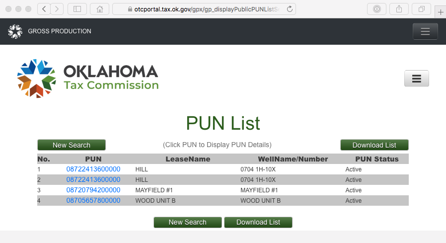
[https://otcportal.tax.ok.gov/gpx/gp\_displayPublicPUNListSearchDownload.php](https://otcportal.tax.ok.gov/gpx/gp_displayPublicPUNListSearchDownload.php) Type in 15 07N 04W in the location box.
You may also have a horizontal in that section. The surface location is in section 21.
---
### Author:  [@system](https://www.mineralrightsforum.com/u/system)
#### Post date: [May 2, 2022, 4:02pm UTC](https://www.mineralrightsforum.com/t/wood-unit-b-1-sec-15-7n-4w-mcclain-county/64722/5 "2022-05-02T16:02:04Z")
This topic was automatically closed after 90 days. New replies are no longer allowed.