# Well activity info: Caddo County
**URL:** https://www.mineralrightsforum.com/t/well-activity-info-caddo-county/76173
**Category:** Caddo County, OK
**Created:** [June 27, 2024, 7:22pm UTC](https://www.mineralrightsforum.com/t/well-activity-info-caddo-county/76173 "2024-06-27T19:22:21Z")
**Posts on this page:** 4
**Page:** 1
### Author:  [@KaraMc](https://www.mineralrightsforum.com/u/KaraMc)
#### Post date: [June 27, 2024, 7:22pm UTC](https://www.mineralrightsforum.com/t/well-activity-info-caddo-county/76173/1 "2024-06-27T19:22:21Z")
We own mineral rights 1-8N-9W-Caddo County. Mid 2023 (I think, not sure of exact date) Continental Resources filed for a multi-unit horizontal well in Sections 1-12-9N-9W. How do I know the progress of that well or any other activity in the area?
---
### Author:  [@M\_Barnes](https://www.mineralrightsforum.com/u/M_Barnes)
#### Post date: [June 27, 2024, 8:03pm UTC](https://www.mineralrightsforum.com/t/well-activity-info-caddo-county/76173/2 "2024-06-27T20:03:01Z")
Your acreage in 1-8N-9W would be six miles south of any well drilled in 1/12-9N-9W. (You might have a typo and be talking about 8N-9W for your question though)
Here is a map that will help you.
[Caddo County Map.pdf](https://www.mineralrightsforum.com/uploads/short-url/9MLyOrnlIdjzmTajB6J7PQuo044.pdf) (482.5 KB) You can follow wells from the Oklahoma Corporation Commission. The wells are listed by their surface location.
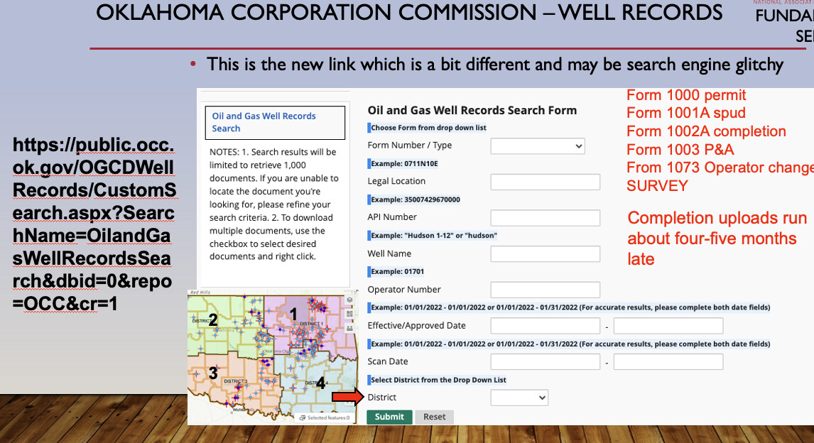
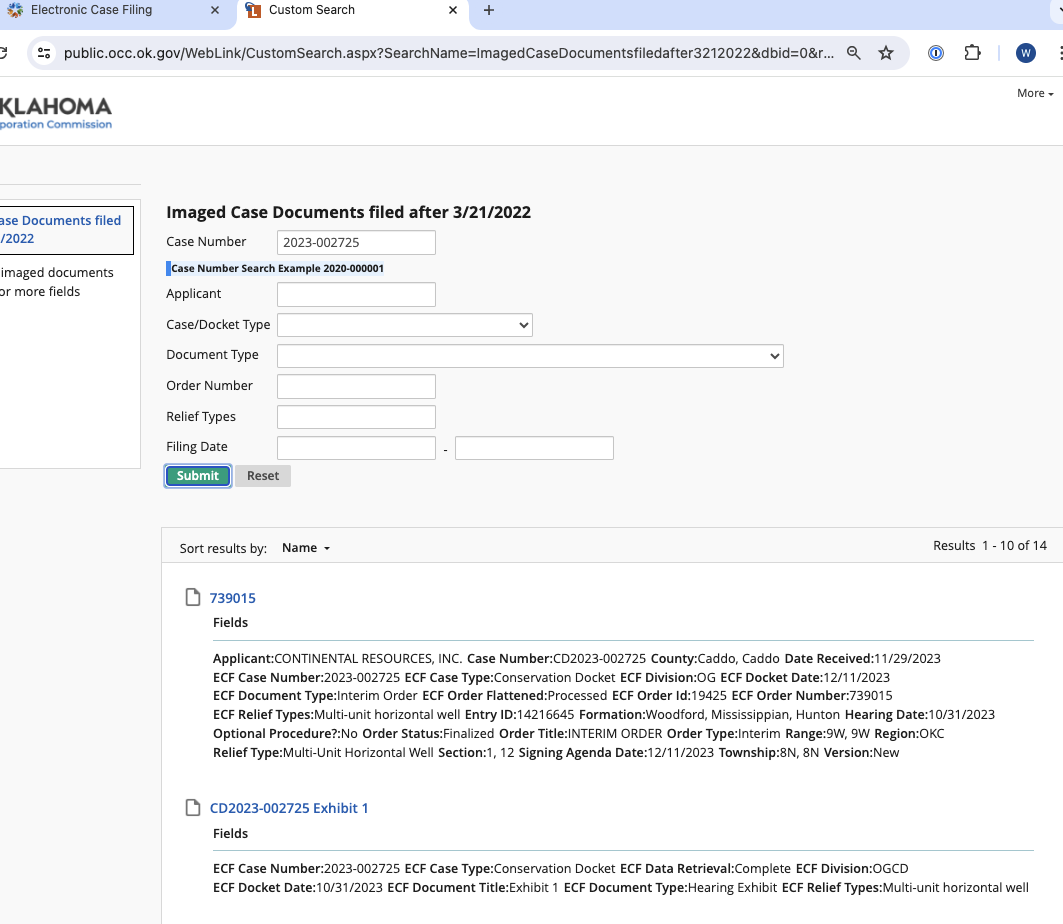
I could not find Continental in 9N-9W, but did find them in 8N-9W with cases. The cases are 2023-002723, 24, 25, 26 and 2023-003306-3307. Some of the cases were delayed to 6/18/24.
You can follow them on the OCC Electronic Case Filing site.
> **[Error](https://public.occ.ok.gov/WebLink/CustomSearch.aspx?SearchName=ImagedCaseDocumentsfiledafter3212022&dbid=0&repo=OCC&cr=1)**
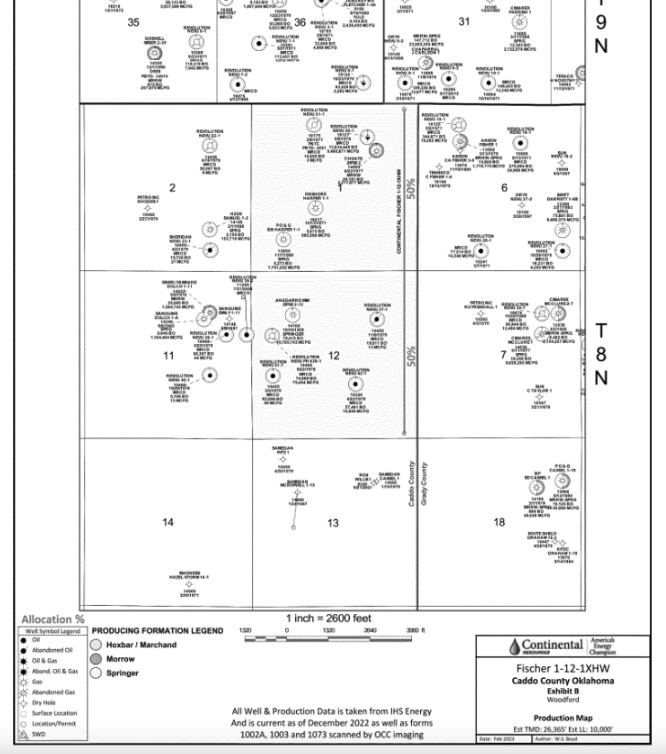
Here is a screen shot of the Multi-unit horizontal case . The well is approved. It will be called the Fischer 1-12-1XHW according to the exhibit. I do not see a permit yet. They need to finish the pooling cases first.
---
### Author:  [@KaraMc](https://www.mineralrightsforum.com/u/KaraMc)
#### Post date: [July 23, 2024, 4:22pm UTC](https://www.mineralrightsforum.com/t/well-activity-info-caddo-county/76173/3 "2024-07-23T16:22:57Z")
Thank you for the info. Can’t say I understand it all ;-), but thank you!
---
### Author:  [@system](https://www.mineralrightsforum.com/u/system)
#### Post date: [September 25, 2024, 7:22pm UTC](https://www.mineralrightsforum.com/t/well-activity-info-caddo-county/76173/4 "2024-09-25T19:22:32Z")
This topic was automatically closed after 90 days. New replies are no longer allowed.