# Validus Energy
**URL:** https://www.mineralrightsforum.com/t/validus-energy/82234
**Category:** Custer County, OK
**Created:** [July 2, 2025, 6:36pm UTC](https://www.mineralrightsforum.com/t/validus-energy/82234 "2025-07-02T18:36:22Z")
**Posts on this page:** 7
**Page:** 1
### Author:  [@Miller1981](https://www.mineralrightsforum.com/u/Miller1981)
#### Post date: [July 2, 2025, 6:36pm UTC](https://www.mineralrightsforum.com/t/validus-energy/82234/1 "2025-07-02T18:36:22Z")
Does anyone happen to have any current information on the well being drilled in Section 18 by Validus Energy?
---
### Author:  [@M\_Barnes](https://www.mineralrightsforum.com/u/M_Barnes)
#### Post date: [July 3, 2025, 12:48pm UTC](https://www.mineralrightsforum.com/t/validus-energy/82234/2 "2025-07-03T12:48:08Z")
There are many section 18’s in Custer. You need to give the complete section, township and range.
---
### Author:  [@Terrel\_Shields](https://www.mineralrightsforum.com/u/Terrel_Shields)
#### Post date: [July 3, 2025, 1:54pm UTC](https://www.mineralrightsforum.com/t/validus-energy/82234/3 "2025-07-03T13:54:56Z")
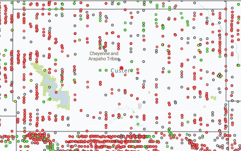
Lots and lots of wells in Custer County.
---
### Author:  [@DonH1](https://www.mineralrightsforum.com/u/DonH1)
#### Post date: [July 4, 2025, 10:52pm UTC](https://www.mineralrightsforum.com/t/validus-energy/82234/4 "2025-07-04T22:52:12Z")
Validus is drilling Sections 18 & 19 of Township 14N-Range 15W.
---
### Author:  [@Donna\_Shepherd](https://www.mineralrightsforum.com/u/Donna_Shepherd)
#### Post date: [July 8, 2025, 6:48pm UTC](https://www.mineralrightsforum.com/t/validus-energy/82234/5 "2025-07-08T18:48:58Z")
Where can I find this map online? Could you explain what the different colors mean - well drilled, permitted well, plugged well, inactive, etc? Thanks.
---
### Author:  [@M\_Barnes](https://www.mineralrightsforum.com/u/M_Barnes)
#### Post date: [July 16, 2025, 12:48pm UTC](https://www.mineralrightsforum.com/t/validus-energy/82234/6 "2025-07-16T12:48:17Z")
These are surface locations most likely. The red wells are the gas wells, green wells are oil. Gray wells are dry holes or plugged and abandoned. Yellow wells are probably permits.
---
### Author:  [@system](https://www.mineralrightsforum.com/u/system)
#### Post date: [September 30, 2025, 6:37pm UTC](https://www.mineralrightsforum.com/t/validus-energy/82234/7 "2025-09-30T18:37:14Z")
This topic was automatically closed after 90 days. New replies are no longer allowed.