My Mother-in-Law and a group of her family just inherited mineral rights in Campbell County, Wyoming in the following location:
Township 50 North, Range 75 West, 6th P.M.
Section 14: Lots 3, 4, 5, 11 and 12 (also described as N2NW4, SW4NW4, and W2SW4)
Section 15: Lots 8, 9, 16, and 17 (also described as SE4NE4, E2SE4)
Is there a way I can find out if there are currently wells on any of these? The lawyers for the estate are trying to get them to sell, but she wants to know if there are currently wells on there or possibly an interest in leasing them.
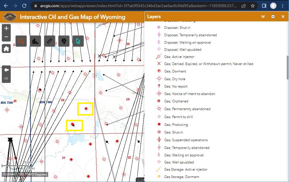
I’ve seen that map before but can’t decipher how to read it. My area of interest in 45N, 74W Section 30. Our family has interest in a few other sections nearby but I can’t seem to locate where active wells are. We do get a small royalty every few months from somewhere–how do I find which lands are considered leased (from leases years ago) and/or where current well operations are, and where companies may be getting ready to drill?
Yes, I agree it takes some time to set-up the layers so you can see what you want, but not too much. Attached a screen shot of 30-45N-74W. Looks like there are two producing gas wells operated by EOG. Catherine CS 1 api 49-005-47414 and Catherine CS 2 api 49-005-47415. It helps to have the layer info showing to act as a legend. The map won’t help much for leases, as you would probably have to consult the Campbell County deed records for that information. Several horizontal wells awaiting approval.
Thanks very much for responding. It is still hard to figure but what you wrote helped quite a bit. When the lines with arrows at their tips point to the edge of a section, does that mean drilling may go that far? Or maybe even beyond that section boundary?
The arrows indicate the planned end of the wells, but the actual paths will be different. Each well will initially start out in an east-west direction until turning north-south. The intended result is a series of parallel north-south wellbores evenly spaced across the pooled unit. They cannot go beyond the pooled unit boundary. In fact they cannot go closer than the designated setback for the unit, which is probably 200 feet.