I think this discussion should be in the general section of the Ward County group. I just started this discussion for people who knew where their land was and wanted a picture of where it is on a plat map!
Hey Linton,
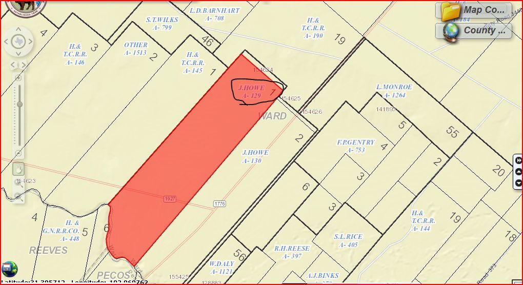
that the Abstract #---A-129...........
Clint Liles
Great. And what might the Block and Section number be that that abstract number covers? Hehehe… Thanks, Clint.
Eliza,
This is not the Plat map that Linton has but maybe it will help. I'm not certain how many acres this Section 1 consists of.................
GIS(Geographic Information Survey)map of Ward County A-129/Section 1/Block 33:
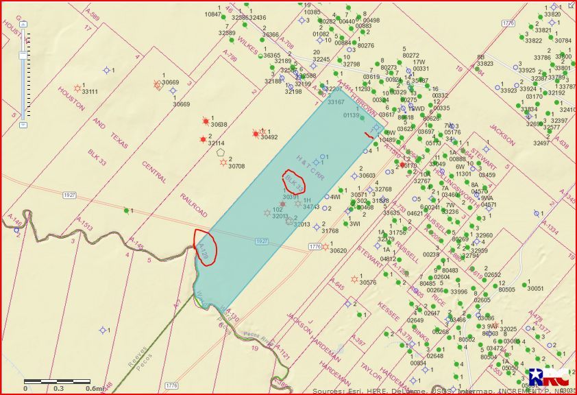
CLICK ON MAP TO ENLARGE
Clint Liles
Eliza, attached are a couple of pictures for you from my map. Your property is marked by the hot pink marker. Hope this helps. Linton 1962-IMG_20161121_111324.jpg (594 KB) 1963-IMG_20161121_111247.jpg (421 KB)
Thank you! I sure do appreciate your help and your quick reply! I may have a few more questions after I review the images.
You have been most helpful, thank you.
You bet. Linton
Thanks Clint I have block 1 section 28, lot 17 in ward county. I own surface only.
Hi, like others I'm an out of state owner with the inability to locate a map showing my property. The description is s/2 of s/2 sec 13 lot 22 blk 33 h&tc survey. I was recently contacted in regards to a seismic mapping of my property.
Here are a couple of pictures of my map where your property is, marked by the pink marker. 1959-IMG_20170313_105729.jpg (473 KB)
thank you !
We have land in Ward County, Texas, Blk 34, Sec: 135
Richard Milner
Blk 34, Sec: 135, Ward County, Texas
Richard, your section is marked with the hot pink marker northwest of the the “C”. Linton 1957-IMG_20170726_130706.jpg (520 KB) 1958-IMG_20170726_130645.jpg (526 KB)
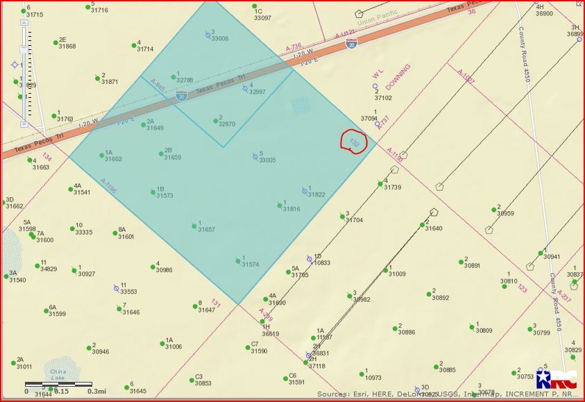
Can you check on this one: E/4, Section 132, Block 34, Ward County, Texas
I was told by a Landman that I have 1.944444 net mineral acres that I inherited from my parents and they are making an offer to Lease and/or Purchase.
Thanks!
David, I just have a map on the wall I take pictures of to show where someone’s property is. Not sure that is what you are wanting. Let me know. If you’re trying to find out what’s going on around your property, write to Clint Liles, a member of the forum, and he can supply you with that information and a picture of existing wells and/or permits. Linton
David Naumes:Ward County Section 132/Block 34:
GIS Map:
CLICK ON MAP TO ENLARGE
The 2 Horizontal wells in Section 123(36619 & 37118)/Cimarex Energy/Lease # 45999/Both of these wells are commingled to the same lease. Good wells. Oil and gas combination.
Link to Production Data on these 2 wells:
Manipulate the beginning date back to October 2014 to view all the production on this lease.
Clint Liles
Thanks so much for your quick reply, Clint. You rock!!!