Oh, no rush! Get yourself well. I hope this is all the correct info. I recently inherited all this and am still in the process of educating myself and learning the lingo!
Sec 20, Block F Hutchings Stock Assoc Field
Sec 6-40 Block F North Ward Estes Field
Sec 18-22 Block F North Ward Estes Field
Sec 14-16 Block F North Ward Estes Field
Sec 25-36 Block F North Ward Estes Field
Sec 23 Block 4 G&MMB&A Survey North Ward Estes Field
Sec 18 Block 4 G&MMB&A North Ward Estes Field
170 acres more or less out of the NW part of Sec 5 Block F G&MMB&A
160 acres more or less being the s/2 of the n/2 of Sec 1 Block 16 University Land Survey
Shawni, I marked the individual sections you listed in Block F in pink markers. I didn’t have enough markers to do 6-40, 18-22, 14-16, 25-36 individually, so I just took a closer picture of Block F so you could see where each section is. And I put pink markers in the other sections that were individually listed. Let me know if you need more, or closer up of anything. Hope this makes sense to you. Linton
1987-IMG_20160218_143011.jpg (471 KB)
1988-IMG_20160218_143121.jpg (510 KB)
1989-IMG_20160218_143141.jpg (453 KB)
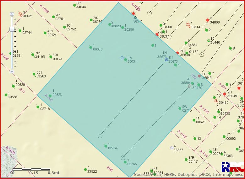
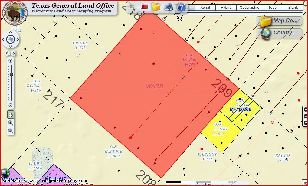
After checking your Abstract number and Section number they don't jive on the RR Commission GIS Mapping System. Abstract 280 is Section 209///Block 34 and Abstract 240 is Section 125///Block 34. Check your legal description again.
Hmmmm . . . I copied and pasted that directly from the "Surface Use Agreement And Subsurface Wellbore Easement Agreement" we recently received from a Shell Oil Co rep.
This is a "first look" map he also included. That dotted diagonal line across the northern tip of Soda Lake leads from TBD 34-208 to TBD 34-209, which he's referenced in his emails. I think the grouping of blue/green/black dots, a little over halfway between, is the area we're looking for. Specifically, the 'Creedon' name above the top black dot. The 2nd attachment is from the Ward County Appraisal District's site. Hope that helps!
Hi, P.J. Here are your pictures from my map on the wall. Clint is right about 99.9 percent of the time, so I’ll let him orient you as to exact location. My pictures will just kind of orient you as to where your property is in relation to other surrounding counties and in Ward County itself. I took for pictures instead of my usual three, so I’ll post the last one in the next response, can only post 3 at a time. Yours is the purple marker close to the H in HT&C Railroad …
1978-IMG_20160407_145128.jpg (642 KB)
1979-IMG_20160407_145026.jpg (563 KB)
1980-IMG_20160407_145053.jpg (687 KB)
The EASIEST way, in my opinion, is to friend Clint Liles, a member on the forum, and keep asking him if one has been filed yet until you get an affirmative answer! That’s what I do, hehehe… Linton
P.S. You pictures are forthcoming.
I see my good buddy, Clint Liles, has supplied the info concerning completion reports, etc. I was going to tell you to contact him for that info because he’s the best. As usual, he beat me to it. I have attached three photos of the map location from various distances. Yours is the hot pink marker in the center of the photos. Congratulations and good luck! Linton
1972-IMG_20160914_120246.jpg (472 KB)
1973-IMG_20160914_120414.jpg (249 KB)
1974-IMG_20160914_120349.jpg (364 KB)
Hi, Paul. I’m having trouble finding that location so I’m going to ask my friend, Clint Liles, who is another member on the forum to help me. I’ll get back to you. Linton