# Sec 17 blk 35 Ts 4s T&P Ry. Co. Survey
**URL:** https://www.mineralrightsforum.com/t/sec-17-blk-35-ts-4s-t-p-ry-co-survey/66701
**Category:** Glasscock County, TX
**Created:** [June 14, 2022, 4:13pm UTC](https://www.mineralrightsforum.com/t/sec-17-blk-35-ts-4s-t-p-ry-co-survey/66701 "2022-06-14T16:13:34Z")
**Posts on this page:** 5
**Page:** 1
### Author:  [@46290mjrii](https://www.mineralrightsforum.com/u/46290mjrii)
#### Post date: [June 14, 2022, 4:13pm UTC](https://www.mineralrightsforum.com/t/sec-17-blk-35-ts-4s-t-p-ry-co-survey/66701/1 "2022-06-14T16:13:34Z")
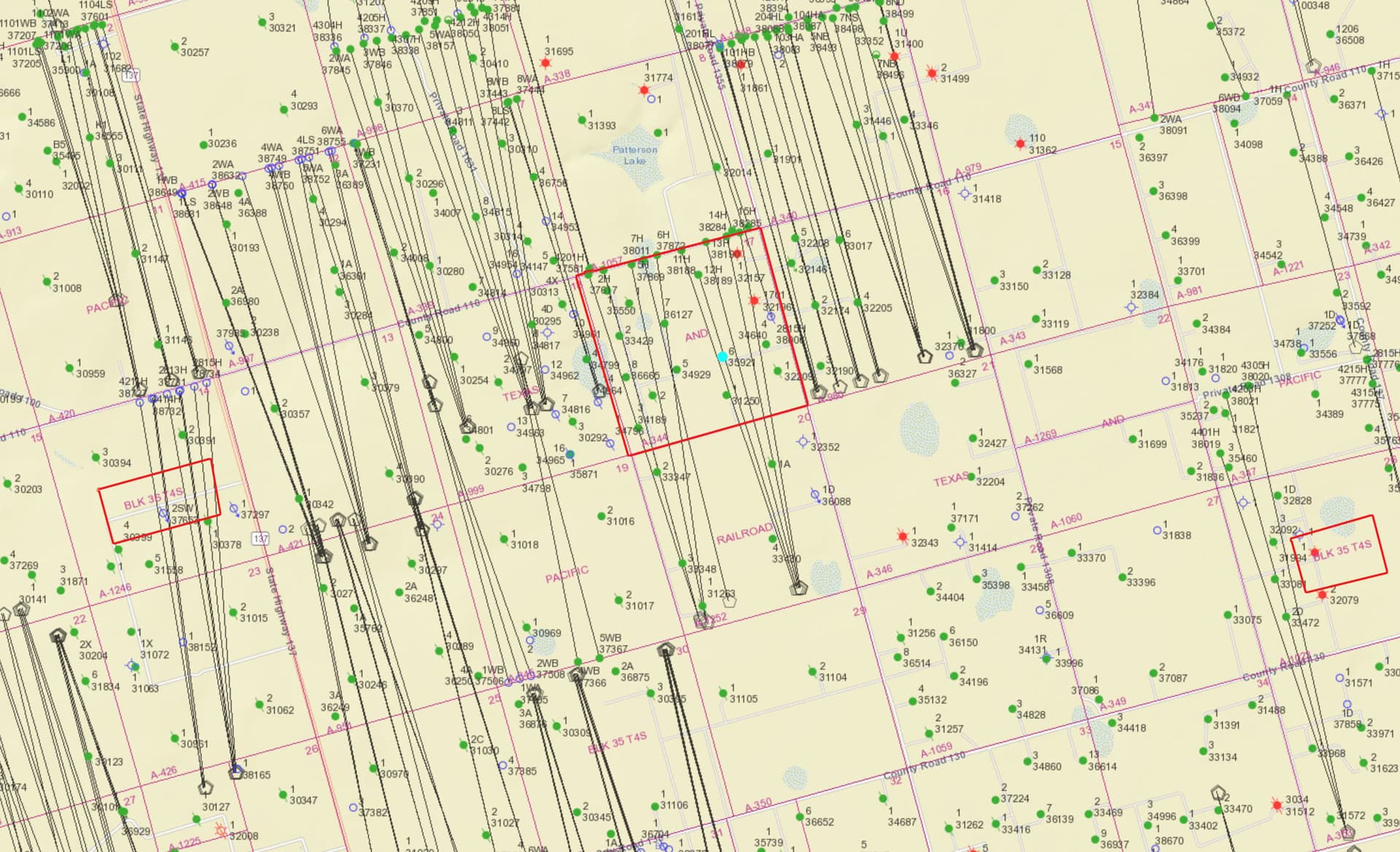
My family may have mineral interest on Section 17, Block 35, Township 4 South, T&P Ry. Co. Survey, Glasscock County, Texas. Can anyone help me to find out where this is located and what is happening in the area? Thank You.
---
### Author:  [@Mikro1TX](https://www.mineralrightsforum.com/u/Mikro1TX)
#### Post date: [June 14, 2022, 4:43pm UTC](https://www.mineralrightsforum.com/t/sec-17-blk-35-ts-4s-t-p-ry-co-survey/66701/2 "2022-06-14T16:43:57Z")
Here is Sec 17, Blk 35, T4S, T&P MK
---
### Author:  [@46290mjrii](https://www.mineralrightsforum.com/u/46290mjrii)
#### Post date: [June 14, 2022, 5:05pm UTC](https://www.mineralrightsforum.com/t/sec-17-blk-35-ts-4s-t-p-ry-co-survey/66701/3 "2022-06-14T17:05:04Z")
Thank you so much for the information.
---
### Author:  [@Mikro1TX](https://www.mineralrightsforum.com/u/Mikro1TX)
#### Post date: [June 14, 2022, 5:33pm UTC](https://www.mineralrightsforum.com/t/sec-17-blk-35-ts-4s-t-p-ry-co-survey/66701/4 "2022-06-14T17:33:39Z")
[Texas GIS viewer](https://gis.rrc.texas.gov/gisviewer/) If you go to this link and use 173xxxxx as the API # where the 5 digits of a well represent the x’s (example 35921 shows as a light blue dot in the image) That would be input in the search at the top right corner. Then once that one shows up you can left click on that to get more info for that well. Hope this helps. MK
---
### Author:  [@system](https://www.mineralrightsforum.com/u/system)
#### Post date: [September 12, 2022, 4:13pm UTC](https://www.mineralrightsforum.com/t/sec-17-blk-35-ts-4s-t-p-ry-co-survey/66701/5 "2022-09-12T16:13:41Z")
This topic was automatically closed after 90 days. New replies are no longer allowed.