# Permian News of General Interest
**URL:** https://www.mineralrightsforum.com/t/permian-news-of-general-interest/32692
**Category:** Permian Basin
**Created:** [August 29, 2018, 11:39pm UTC](https://www.mineralrightsforum.com/t/permian-news-of-general-interest/32692 "2018-08-29T23:39:22Z")
**Posts on this page:** 5
**Page:** 19
### Author:  [@Clint\_Liles](https://www.mineralrightsforum.com/u/Clint_Liles)
#### Post date: [July 4, 2023, 8:04pm UTC](https://www.mineralrightsforum.com/t/permian-news-of-general-interest/32692/370 "2023-07-04T20:04:54Z")
[https://gis.rrc.texas.gov/gisviewer/](https://gis.rrc.texas.gov/gisviewer/)
Click on the GIS viewer link that I gave you and at the top of the page you will see a small magnifying glass… click on that magnifying glass and then click on surveys.
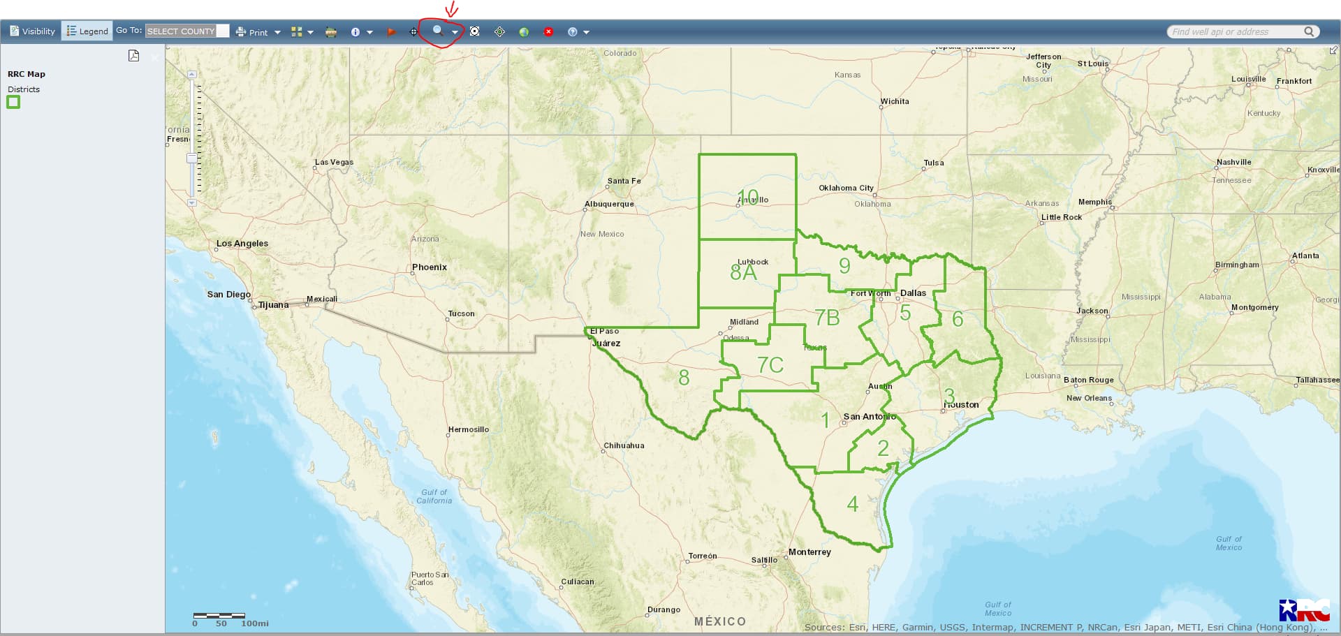
After you click on surveys you will have a pop-up screen and type in the section 30… then go to where it says select county and click on that little empty square box… scroll down and click on Winkler and then click on Query… then you have a popup screen and then select Block 27/A-1744… Click on that and then your map should be there.

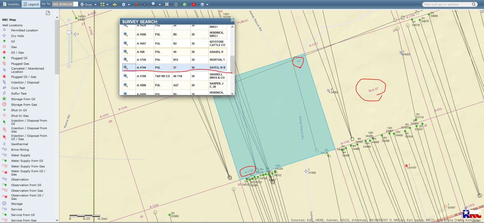
CLICK ON MAPS TO ENLARGE
---
### Author:  [@Roy](https://www.mineralrightsforum.com/u/Roy)
#### Post date: [July 4, 2023, 8:09pm UTC](https://www.mineralrightsforum.com/t/permian-news-of-general-interest/32692/371 "2023-07-04T20:09:01Z")
I’m not Clint Liles. You open the RRC online map at [https://gis.rrc.texas.gov/GISViewer/](https://gis.rrc.texas.gov/GISViewer/).
Search wells in upper right corner, enter 49533930, 495 is Winkler County prefix. Map zooms to a well drilled in Section 30, runs across two sections (two mile lateral). To access drop down menus for wells, you must click “Identify Wells” in toolbar across top.
To view pipelines, click “Visibility” upper left, check the box for pipelines.
---
### Author:  [@Ceilingguy](https://www.mineralrightsforum.com/u/Ceilingguy)
#### Post date: [July 4, 2023, 8:44pm UTC](https://www.mineralrightsforum.com/t/permian-news-of-general-interest/32692/372 "2023-07-04T20:44:45Z")
Thank you for the help.
---
### Author:  [@Ceilingguy](https://www.mineralrightsforum.com/u/Ceilingguy)
#### Post date: [July 4, 2023, 8:45pm UTC](https://www.mineralrightsforum.com/t/permian-news-of-general-interest/32692/373 "2023-07-04T20:45:30Z")
Thanks, it worked great.
---
### Author:  [@MRFAdmin\_SV](https://www.mineralrightsforum.com/u/MRFAdmin_SV)
#### Post date: [January 11, 2025, 5:15pm UTC](https://www.mineralrightsforum.com/t/permian-news-of-general-interest/32692/374 "2025-01-11T17:15:17Z")
[Previous page](https://www.mineralrightsforum.com/t/permian-news-of-general-interest/32692.md?page=18)