# Newbie question Mineral Rights Panola County Texas
**URL:** https://www.mineralrightsforum.com/t/newbie-question-mineral-rights-panola-county-texas/72934
**Category:** Panola County, TX
**Created:** [November 3, 2023, 1:53pm UTC](https://www.mineralrightsforum.com/t/newbie-question-mineral-rights-panola-county-texas/72934 "2023-11-03T13:53:09Z")
**Posts on this page:** 4
**Page:** 1
### Author:  [@BillWilliams](https://www.mineralrightsforum.com/u/BillWilliams)
#### Post date: [November 3, 2023, 1:53pm UTC](https://www.mineralrightsforum.com/t/newbie-question-mineral-rights-panola-county-texas/72934/1 "2023-11-03T13:53:09Z")
Hello All, I am just starting to learn about mineral rights because I find myself in the same situation as many here, trying to value rights that have been passed to me. If you don’t mind I would like to avail myself of your expertise.
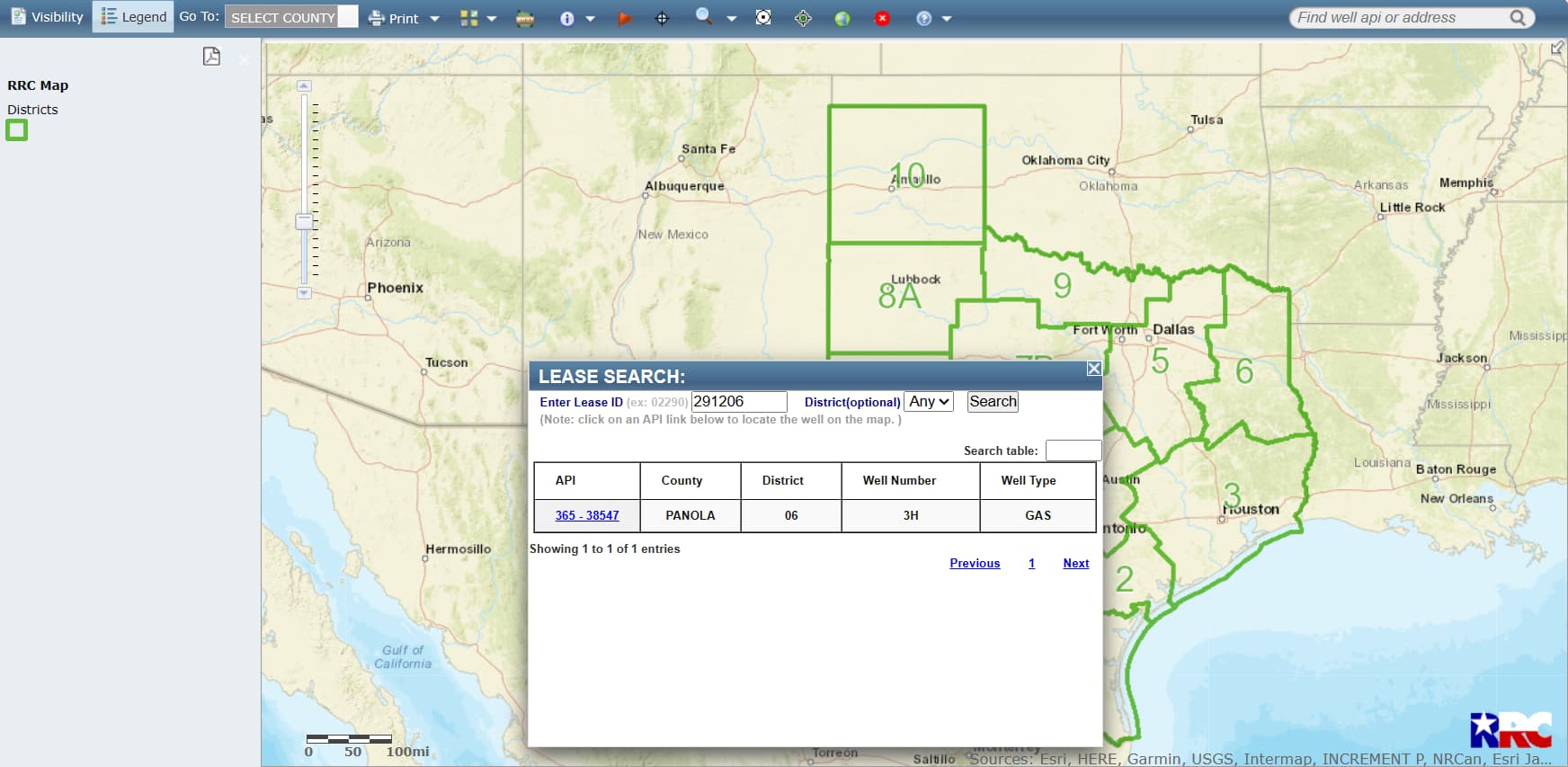
My question revolves around how things are identified in letters that we often receive with offers to purchase. If I may give you an example: One of the properties is identified as “Guill-Furrh HV Unit C #3H” and it has a Raw RRC #:291206 and offers come with this type of reference. On some offers the letters refer to the properties as survey such as William English Survey A-194.
Am I correct in assuming that the Unit description is just a subdivision of the larger survey? What is a Raw RRC#?
Thanks so much for any help and your patience. I’m sure you get asked similarly a lot although in my searches I could not find what I was looking for.
Best,
Bill
---
### Author:  [@nop\_llc](https://www.mineralrightsforum.com/u/nop_llc)
#### Post date: [November 3, 2023, 2:18pm UTC](https://www.mineralrightsforum.com/t/newbie-question-mineral-rights-panola-county-texas/72934/2 "2023-11-03T14:18:24Z")
Units can be part of a larger survey, include multiple whole surveys or parts of multiple surveys.
That is a lease ID #, go to RRC viewer ([RRC Public GIS Viewer (texas.gov)](https://gis.rrc.texas.gov/GISViewer/)) and hit the magnifying glass at the top. You can do the same thing with your abstract (A-194) if you click surveys in the dropdown.
---
### Author:  [@BillWilliams](https://www.mineralrightsforum.com/u/BillWilliams)
#### Post date: [November 3, 2023, 2:34pm UTC](https://www.mineralrightsforum.com/t/newbie-question-mineral-rights-panola-county-texas/72934/3 "2023-11-03T14:34:02Z")
Thank you so much!!!
---
### Author:  [@system](https://www.mineralrightsforum.com/u/system)
#### Post date: [February 1, 2024, 1:53pm UTC](https://www.mineralrightsforum.com/t/newbie-question-mineral-rights-panola-county-texas/72934/4 "2024-02-01T13:53:40Z")
This topic was automatically closed after 90 days. New replies are no longer allowed.