# New Oil-Gas Leasing In Anderson County
**URL:** https://www.mineralrightsforum.com/t/new-oil-gas-leasing-in-anderson-county/76570
**Category:** Anderson County, TX
**Created:** [July 20, 2024, 1:50am UTC](https://www.mineralrightsforum.com/t/new-oil-gas-leasing-in-anderson-county/76570 "2024-07-20T01:50:34Z")
**Posts on this page:** 4
**Page:** 1
### Author:  [@Alan\_Herrington](https://www.mineralrightsforum.com/u/Alan_Herrington)
#### Post date: [July 20, 2024, 1:50am UTC](https://www.mineralrightsforum.com/t/new-oil-gas-leasing-in-anderson-county/76570/1 "2024-07-20T01:50:34Z")
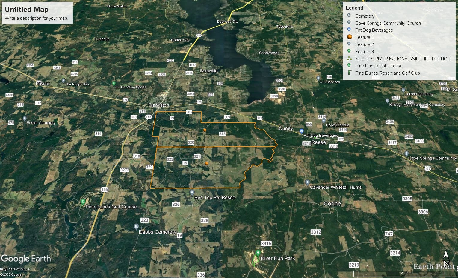
On July 18, Texline Energy recorded six new leases covering about 1,400 gross acres in the T Goss A-27 and WF Pool A-57 Surveys:
Texline is the primary leasing agent for Jamex, Inc. Back in 2013, Jamex drilled the only Goodland Lime horizontal well to be completed in Anderson County. Unfortunately, the well was not economic.
If the 1,400 acres is located in the eastern part of the surveys, then the site may be in a rim syncline feature of the Brooks Salt Dome, which could be prospective for Goodland. If the location is in the west, then the target is likely to be something else.
We will see what happens…
---
### Author:  [@Dusty1](https://www.mineralrightsforum.com/u/Dusty1)
#### Post date: [July 22, 2024, 11:23am UTC](https://www.mineralrightsforum.com/t/new-oil-gas-leasing-in-anderson-county/76570/2 "2024-07-22T11:23:35Z")
Thanks for highlighting those leases. I try to track Anderson County but missed them.
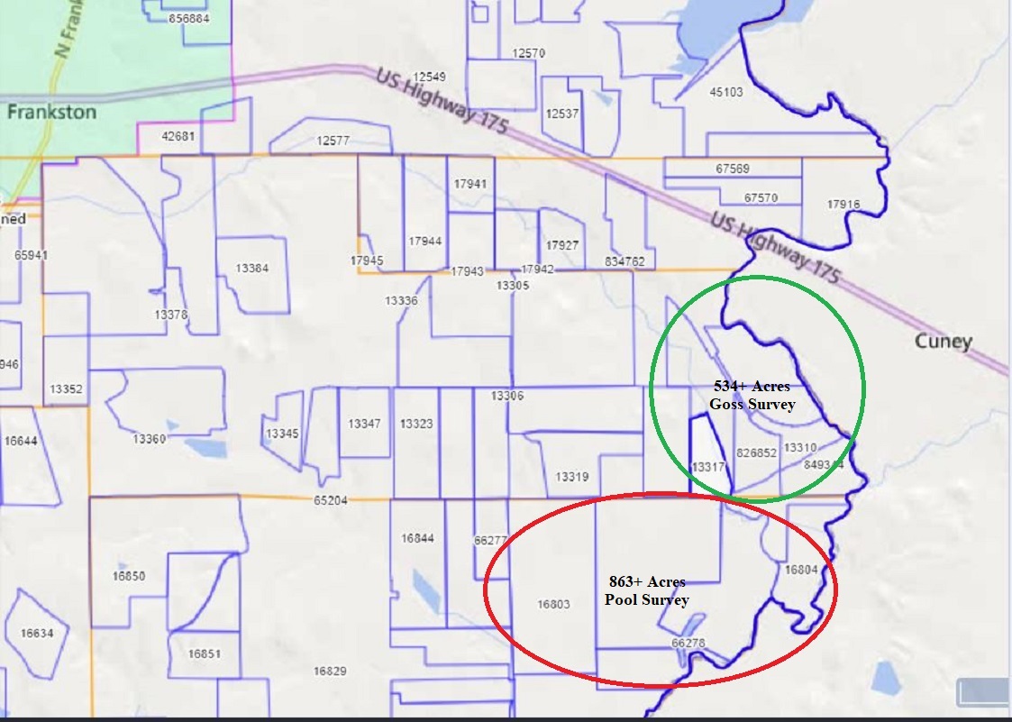
Those lease locations are at the far east side of the two surveys in the general areas marked below. I’m guessing Texline has more leases to file, possibly extending across the Neches. With the area where Geosouthern applied to drill their Goodland well less than two miles further north makes having the same target seem logical.
Your comment about Jamex being the first to complete a horizontal Goodland Lime well in Anderson County also surprised me. I know EOG didn’t complete theirs, but although I get a once-a-year royalty check from your namesake well, in my mind it was a Rodessa. When I looked back at their completion report the formation record is short on detail but the log and directional survey are Goodland depth.
Good having something to talk about on that side of the county again.
---
### Author:  [@JHardman](https://www.mineralrightsforum.com/u/JHardman)
#### Post date: [September 3, 2024, 12:33pm UTC](https://www.mineralrightsforum.com/t/new-oil-gas-leasing-in-anderson-county/76570/3 "2024-09-03T12:33:35Z")
I’m pretty sure my dad has minerals in Pool Survey. I’m trying to find out.
---
### Author:  [@system](https://www.mineralrightsforum.com/u/system)
#### Post date: [October 18, 2024, 1:51am UTC](https://www.mineralrightsforum.com/t/new-oil-gas-leasing-in-anderson-county/76570/4 "2024-10-18T01:51:06Z")
This topic was automatically closed after 90 days. New replies are no longer allowed.