# New Comstock Drilling Permit - 1/14/2026
**URL:** https://www.mineralrightsforum.com/t/new-comstock-drilling-permit-1-14-2026/85475
**Category:** Freestone County, TX
**Created:** [January 14, 2026, 9:59pm UTC](https://www.mineralrightsforum.com/t/new-comstock-drilling-permit-1-14-2026/85475 "2026-01-14T21:59:32Z")
**Posts on this page:** 9
**Page:** 1
### Author:  [@Alan\_Herrington](https://www.mineralrightsforum.com/u/Alan_Herrington)
#### Post date: [January 14, 2026, 9:59pm UTC](https://www.mineralrightsforum.com/t/new-comstock-drilling-permit-1-14-2026/85475/1 "2026-01-14T21:59:32Z")
> **[Form W-1: Field List](https://webapps.rrc.state.tx.us/DP/drillDownQueryAction.do?name=DOLLIE%2BJONES%2BRP&fromPublicQuery=Y&univDocNo=498917130)**
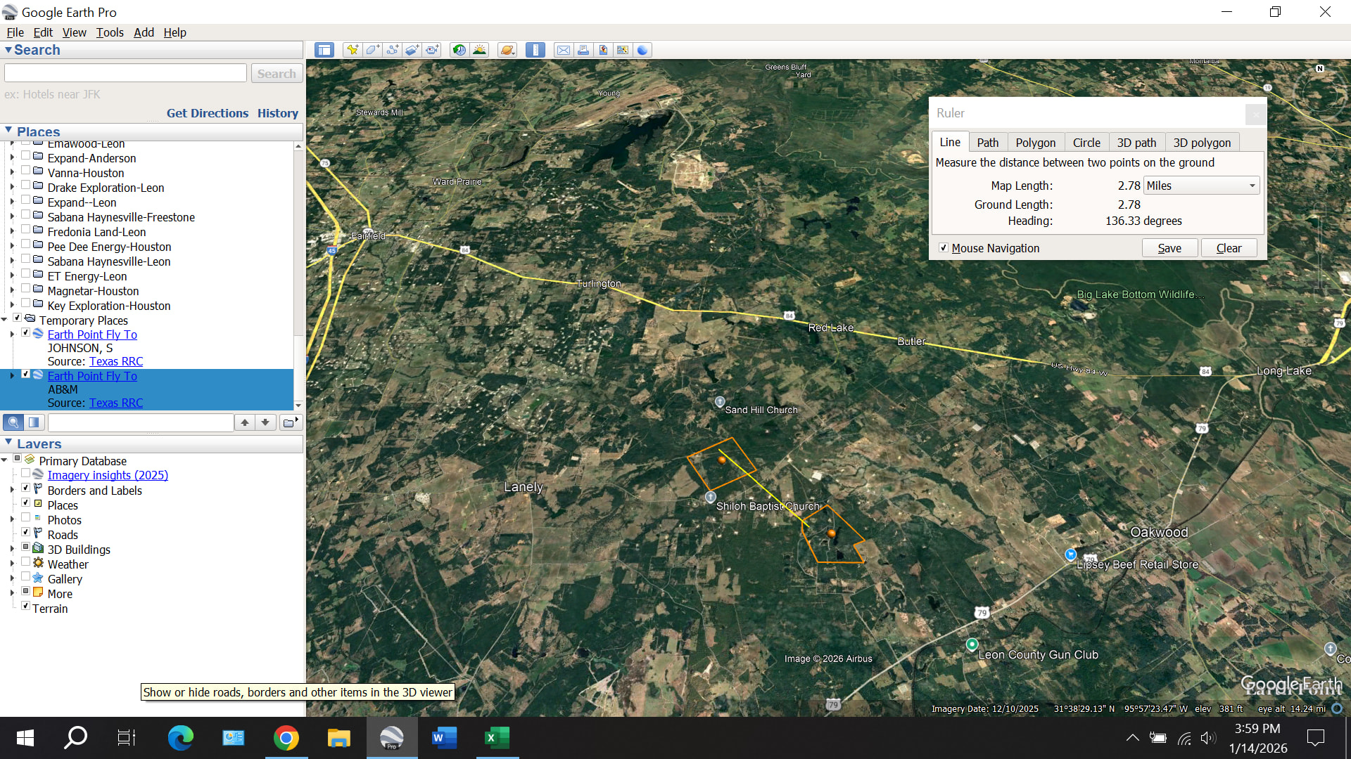
Here’s the approximate location of the lateral… pad is at the north end:
---
### Author:  [@Alan\_Herrington](https://www.mineralrightsforum.com/u/Alan_Herrington)
#### Post date: [January 14, 2026, 10:53pm UTC](https://www.mineralrightsforum.com/t/new-comstock-drilling-permit-1-14-2026/85475/2 "2026-01-14T22:53:33Z")
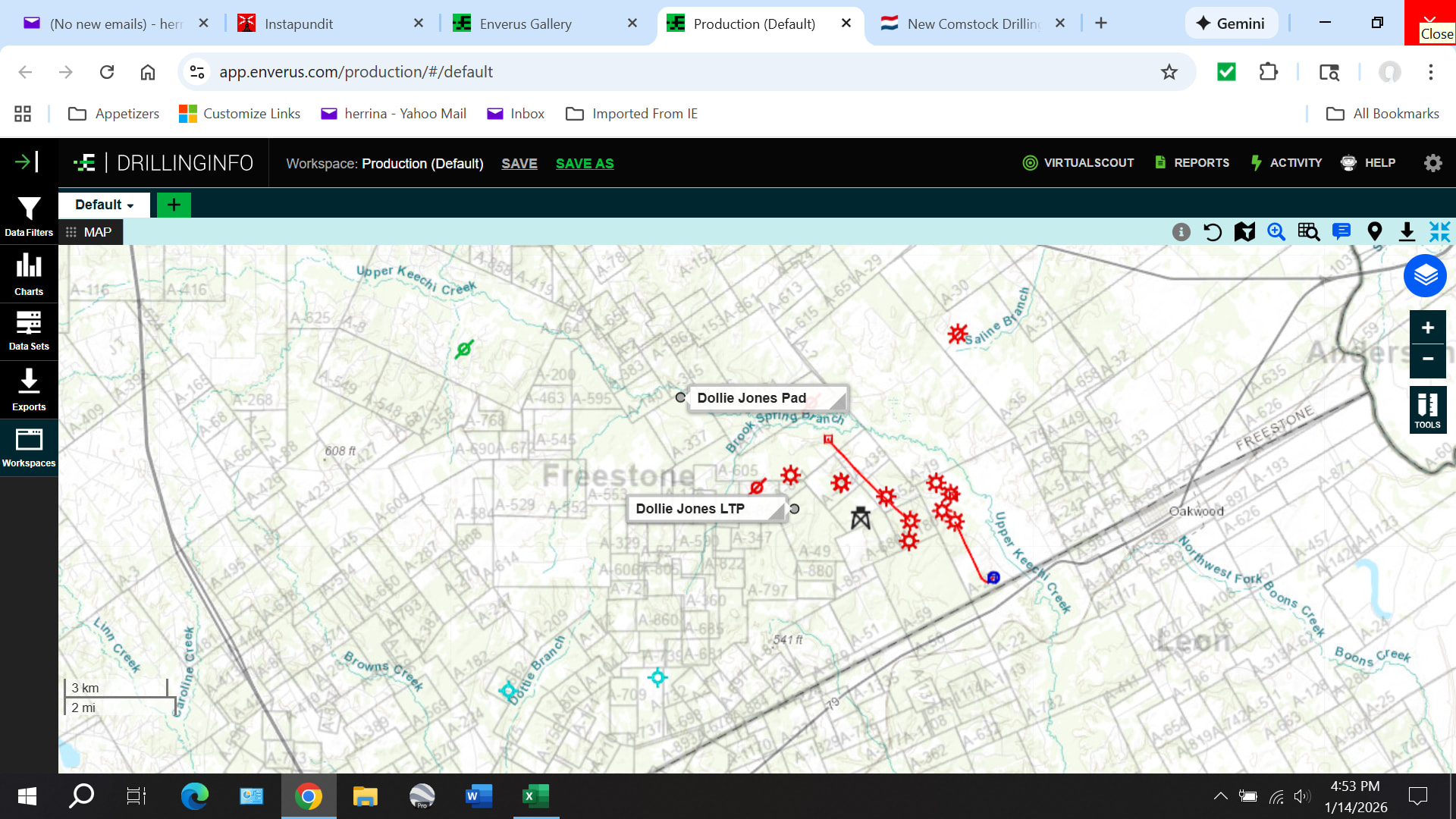
Here’s the location of the Dollie Jones well compared to existing vertical and horizontal wells with TVDs of 17,000 feet or deeper:
---
### Author:  [@Alan\_Herrington](https://www.mineralrightsforum.com/u/Alan_Herrington)
#### Post date: [January 17, 2026, 8:36pm UTC](https://www.mineralrightsforum.com/t/new-comstock-drilling-permit-1-14-2026/85475/3 "2026-01-17T20:36:22Z")
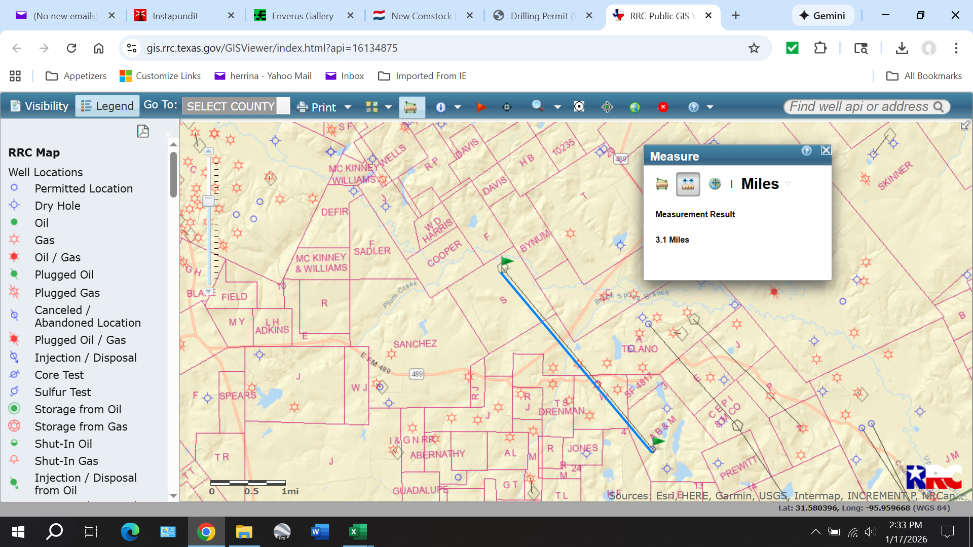
Comstock is planning a really long lateral!
---
### Author:  [@PantherGulch](https://www.mineralrightsforum.com/u/PantherGulch)
#### Post date: [January 18, 2026, 12:08pm UTC](https://www.mineralrightsforum.com/t/new-comstock-drilling-permit-1-14-2026/85475/4 "2026-01-18T12:08:16Z")
Is that south of 84?
---
### Author:  [@Alan\_Herrington](https://www.mineralrightsforum.com/u/Alan_Herrington)
#### Post date: [January 18, 2026, 2:03pm UTC](https://www.mineralrightsforum.com/t/new-comstock-drilling-permit-1-14-2026/85475/5 "2026-01-18T14:03:44Z")
Yes, it is. And north of 79.
---
### Author:  [@nielloeb](https://www.mineralrightsforum.com/u/nielloeb)
#### Post date: [January 20, 2026, 12:00am UTC](https://www.mineralrightsforum.com/t/new-comstock-drilling-permit-1-14-2026/85475/6 "2026-01-20T00:00:45Z")
I own rights here. They are part of a pooled unit. The unit declaration says leases here cover rights from the surface down to the deepest depth of the first well they drill. My lease for that well says they will drill down to between 12,196 feet and 13,700 feet. So I get no benefit from Comstock drilling underneath that at 30,000 feet. The more you know . . .
---
### Author:  [@Alan\_Herrington](https://www.mineralrightsforum.com/u/Alan_Herrington)
#### Post date: [January 20, 2026, 12:08am UTC](https://www.mineralrightsforum.com/t/new-comstock-drilling-permit-1-14-2026/85475/7 "2026-01-20T00:08:56Z")
30,000 feet is the estimated maximum total length of the wellbore, not the true vertical depth. I don’t know why the Texas RRC doesn’t require a standard definition of permitted depth.
---
### Author:  [@AnthonyCalifornia](https://www.mineralrightsforum.com/u/AnthonyCalifornia)
#### Post date: [January 20, 2026, 1:32am UTC](https://www.mineralrightsforum.com/t/new-comstock-drilling-permit-1-14-2026/85475/8 "2026-01-20T01:32:33Z")
Good to know! Looking forward to learning more.
---
### Author:  [@system](https://www.mineralrightsforum.com/u/system)
#### Post date: [April 14, 2026, 10:00pm UTC](https://www.mineralrightsforum.com/t/new-comstock-drilling-permit-1-14-2026/85475/9 "2026-04-14T22:00:20Z")
This topic was automatically closed after 90 days. New replies are no longer allowed.