# Ned well W-2
**URL:** https://www.mineralrightsforum.com/t/ned-well-w-2/6054
**Category:** Henderson County, TX
**Created:** [October 27, 2015, 12:56am UTC](https://www.mineralrightsforum.com/t/ned-well-w-2/6054 "2015-10-27T00:56:04Z")
**Posts on this page:** 20
**Page:** 2
### Author:  [@Alan\_Herrington](https://www.mineralrightsforum.com/u/Alan_Herrington)
#### Post date: [October 31, 2016, 10:04pm UTC](https://www.mineralrightsforum.com/t/ned-well-w-2/6054/21 "2016-10-31T22:04:01Z")
Yes, light towers are in place.
---
### Author:  [@J.H](https://www.mineralrightsforum.com/u/J.H)
#### Post date: [November 2, 2016, 3:04pm UTC](https://www.mineralrightsforum.com/t/ned-well-w-2/6054/22 "2016-11-02T15:04:09Z")
Thank you for the field update.
---
### Author:  [@Paul\_Bennett](https://www.mineralrightsforum.com/u/Paul_Bennett)
#### Post date: [January 4, 2017, 8:53pm UTC](https://www.mineralrightsforum.com/t/ned-well-w-2/6054/23 "2017-01-04T20:53:08Z")
Curious if there has been any other activity with respect to this well? Thanks.
---
### Author:  [@Rock\_Man](https://www.mineralrightsforum.com/u/Rock_Man)
#### Post date: [January 4, 2017, 9:51pm UTC](https://www.mineralrightsforum.com/t/ned-well-w-2/6054/24 "2017-01-04T21:51:09Z")
No official completion reports filed yet for this well. But the well was fraced about two months ago and has been flowing back. Some rumors on rates but just rumors.
---
### Author:  [@Paul\_Bennett](https://www.mineralrightsforum.com/u/Paul_Bennett)
#### Post date: [January 16, 2017, 10:31pm UTC](https://www.mineralrightsforum.com/t/ned-well-w-2/6054/25 "2017-01-16T22:31:29Z")
Thank you Rock Man. Flowing back meaning it was not a dry hole?
---
### Author:  [@Rock\_Man](https://www.mineralrightsforum.com/u/Rock_Man)
#### Post date: [January 16, 2017, 11:02pm UTC](https://www.mineralrightsforum.com/t/ned-well-w-2/6054/26 "2017-01-16T23:02:02Z")
Technically, yes - not a dry hole.
But the question “Is this economic at today’s oil prices and drilling costs” still needs to be answered
---
### Author:  [@Clint\_Liles](https://www.mineralrightsforum.com/u/Clint_Liles)
#### Post date: [February 27, 2017, 7:44pm UTC](https://www.mineralrightsforum.com/t/ned-well-w-2/6054/27 "2017-02-27T19:44:31Z")
Completion Report—Ned #1H
[http://webapps.rrc.texas.gov/CMPL/viewPdfReportFormAction.do?method=cmplW2FormPdf&packetSummaryId=169570](http://webapps.rrc.texas.gov/CMPL/viewPdfReportFormAction.do?method=cmplW2FormPdf&packetSummaryId=169570)
Henderson County (East of Brownsboro on Hwy 31) Ned #1H February 27, 2017
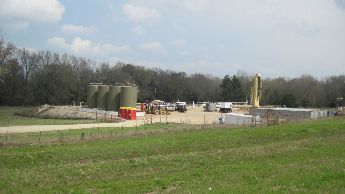CLICK ON PICTURE TO ENLARGE
---
### Author:  [@J.H](https://www.mineralrightsforum.com/u/J.H)
#### Post date: [February 27, 2017, 8:01pm UTC](https://www.mineralrightsforum.com/t/ned-well-w-2/6054/28 "2017-02-27T20:01:30Z")
Thanks Clint for the pic and completion report. How does that 24 hour test interpret to you? I wonder how choked down they ran it at?
---
### Author:  [@Rock\_Man](https://www.mineralrightsforum.com/u/Rock_Man)
#### Post date: [February 27, 2017, 8:32pm UTC](https://www.mineralrightsforum.com/t/ned-well-w-2/6054/29 "2017-02-27T20:32:25Z")
Very early in flow back period. Also on gas lift.
the low oil gravity concerns me a lot - very thick and viscous oil at 32 API
---
### Author:  [@J.H](https://www.mineralrightsforum.com/u/J.H)
#### Post date: [February 28, 2017, 2:00am UTC](https://www.mineralrightsforum.com/t/ned-well-w-2/6054/30 "2017-02-28T02:00:07Z")
How does this 32 API compare to the Cowan unit also in Goodland Lime on the east side of Lake Palestine? I couldn’t locate a completion well to compare.
---
### Author:  [@Clint\_Liles](https://www.mineralrightsforum.com/u/Clint_Liles)
#### Post date: [February 28, 2017, 2:10am UTC](https://www.mineralrightsforum.com/t/ned-well-w-2/6054/31 "2017-02-28T02:10:31Z")
Completion Report on Cowan #1H drilled by EOG:
[http://webapps.rrc.texas.gov/CMPL/viewPdfReportFormAction.do?method=cmplW2FormPdf&packetSummaryId=97018](http://webapps.rrc.texas.gov/CMPL/viewPdfReportFormAction.do?method=cmplW2FormPdf&packetSummaryId=97018)
---
### Author:  [@Clint\_Liles](https://www.mineralrightsforum.com/u/Clint_Liles)
#### Post date: [February 28, 2017, 2:19am UTC](https://www.mineralrightsforum.com/t/ned-well-w-2/6054/32 "2017-02-28T02:19:38Z")
Production Data on Cowan #1H drilled and completed by EOG but now owned and operated by Valence Operating Company:
[http://webapps2.rrc.state.tx.us/EWA/specificLeaseQueryAction.do?tab=init&viewType=prodAndTotalDisp&methodToCall=fromGisViewer&pdqSearchArgs.paramValue=](http://webapps2.rrc.state.tx.us/EWA/specificLeaseQueryAction.do?tab=init&viewType=prodAndTotalDisp&methodToCall=fromGisViewer&pdqSearchArgs.paramValue=%7C2=01%7C3=2016%7C4=12%7C5=2016%7C103=15266%7C6=O%7C102=06%7C8=specificLease%7C204=district%7C9=dispDetails%7C10=0)
---
### Author:  [@Rock\_Man](https://www.mineralrightsforum.com/u/Rock_Man)
#### Post date: [February 28, 2017, 3:42am UTC](https://www.mineralrightsforum.com/t/ned-well-w-2/6054/33 "2017-02-28T03:42:39Z")
Based on DrillingInfo pricing section for this well, API gravity of oil sold every month has ranged from 35.8 API to 41 API.
---
### Author:  [@J.H](https://www.mineralrightsforum.com/u/J.H)
#### Post date: [February 28, 2017, 3:28pm UTC](https://www.mineralrightsforum.com/t/ned-well-w-2/6054/34 "2017-02-28T15:28:10Z")
sweet…(pun intended)
---
### Author:  [@cooper\_goodson\_jr](https://www.mineralrightsforum.com/u/cooper_goodson_jr)
#### Post date: [March 5, 2017, 11:20pm UTC](https://www.mineralrightsforum.com/t/ned-well-w-2/6054/35 "2017-03-05T23:20:07Z")
The oil and gas report in Tyler paper March 5
shows a completion report of 275 Bbls/218 Mcf but no choke information supplied
---
### Author:  [@Rock\_Man](https://www.mineralrightsforum.com/u/Rock_Man)
#### Post date: [March 5, 2017, 11:26pm UTC](https://www.mineralrightsforum.com/t/ned-well-w-2/6054/36 "2017-03-05T23:26:56Z")
Being that this is on gas lift, one should probably assume 1" choke
W2 attached
Note that this IP test was taken in late December - there is a different pumping unit on location now as per visual observations that can move a lot more fluid on a per day rate
[994-TXCompletions37a18e9dae0347d0b5e62d0bf9fb77b4CHKNed.pdf](https://www.mineralrightsforum.com/uploads/db5755/original/2X/4/4e23e21d9e7b2ec77259b54ed53e5355cbcb2217.pdf) (19.5 KB)
---
### Author:  [@cooper\_goodson\_jr](https://www.mineralrightsforum.com/u/cooper_goodson_jr)
#### Post date: [March 6, 2017, 4:32am UTC](https://www.mineralrightsforum.com/t/ned-well-w-2/6054/37 "2017-03-06T04:32:20Z")
Is there any way to know how they may pool the mineral rights on this well or how far from the well you can be? We have mineral rights in the Burford Survey about 1.5 miles away.
---
### Author:  [@Rock\_Man](https://www.mineralrightsforum.com/u/Rock_Man)
#### Post date: [March 6, 2017, 4:41am UTC](https://www.mineralrightsforum.com/t/ned-well-w-2/6054/38 "2017-03-06T04:41:30Z")
Here is the unit that CHK has filed for this well. About 1000’ wide and 8200’ long. Survey info included on this plat.
All this info is in public and open files on the Tx RRC site
[993-Nedpermitandplat.pdf](https://www.mineralrightsforum.com/uploads/db5755/original/2X/a/ad2a04053a640d00c3d8ae75ead157e03e17ac3f.pdf) (84.8 KB)
---
### Author:  [@Paul\_Bennett](https://www.mineralrightsforum.com/u/Paul_Bennett)
#### Post date: [August 31, 2017, 5:04pm UTC](https://www.mineralrightsforum.com/t/ned-well-w-2/6054/39 "2017-08-31T17:04:39Z")
Since the Ned W-2 is apparently a producing well, does anyone know if Chesapeake (or someone else) has any new activity in this area?
Thanks
---
### Author:  [@Clint\_Liles](https://www.mineralrightsforum.com/u/Clint_Liles)
#### Post date: [August 31, 2017, 5:32pm UTC](https://www.mineralrightsforum.com/t/ned-well-w-2/6054/40 "2017-08-31T17:32:39Z")
Paul at this time I know of no more activity in the area of the Ned 1H, but I do know that Chesapeake has leased land North of the Ned well to the Van Zandt County line and to the South and southeast.
[Previous page](https://www.mineralrightsforum.com/t/ned-well-w-2/6054.md?page=1)
[Next page](https://www.mineralrightsforum.com/t/ned-well-w-2/6054.md?page=3)