# Lease ID help
**URL:** https://www.mineralrightsforum.com/t/lease-id-help/65627
**Category:** Oil and Gas Leasing Help
**Created:** [March 26, 2022, 11:26pm UTC](https://www.mineralrightsforum.com/t/lease-id-help/65627 "2022-03-26T23:26:05Z")
**Posts on this page:** 12
**Page:** 1
### Author:  [@jstall0](https://www.mineralrightsforum.com/u/jstall0)
#### Post date: [March 26, 2022, 11:26pm UTC](https://www.mineralrightsforum.com/t/lease-id-help/65627/1 "2022-03-26T23:26:05Z")
Below is a well I am told is currently being drilled. How can I obtain the lease ID and other information regarding progress of the well?
Section 35, Block 32, Township 3 North, Howard County, Texas
**API:** 22741544 **GIS WELL NUMBER:** 3AH
---
### Author:  [@Mikro1TX](https://www.mineralrightsforum.com/u/Mikro1TX)
#### Post date: [March 26, 2022, 11:39pm UTC](https://www.mineralrightsforum.com/t/lease-id-help/65627/2 "2022-03-26T23:39:15Z")
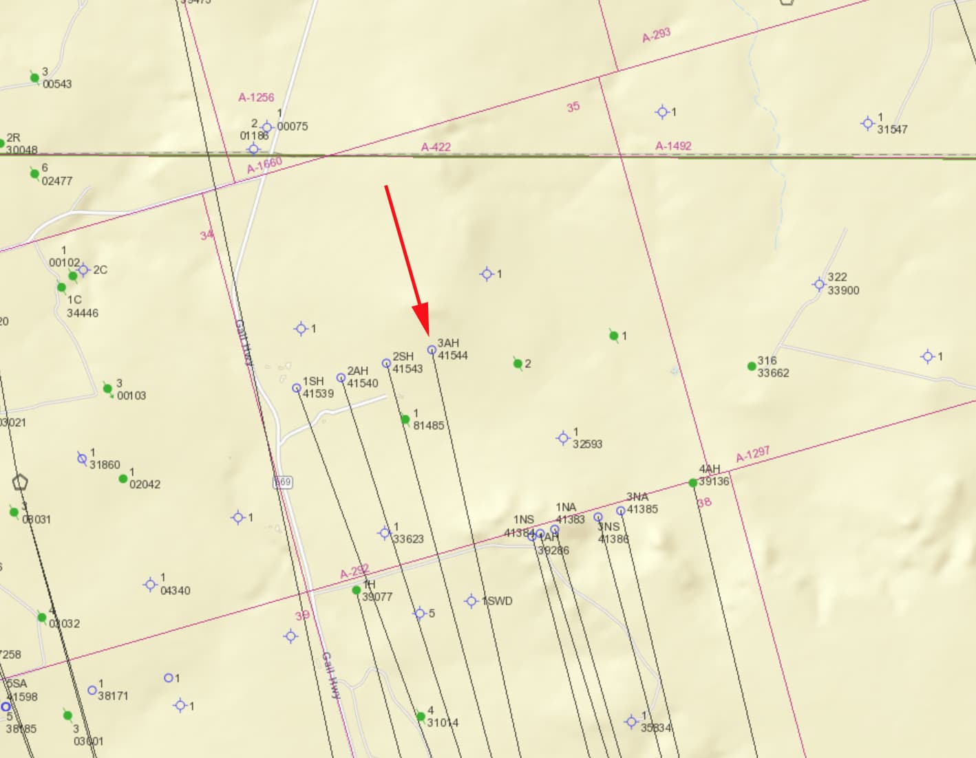
Start with the RRC website and use the query section. There are three other wells alongside the one you are asking about. MK
---
### Author:  [@Clint\_Liles](https://www.mineralrightsforum.com/u/Clint_Liles)
#### Post date: [March 27, 2022, 2:24am UTC](https://www.mineralrightsforum.com/t/lease-id-help/65627/3 "2022-03-27T02:24:04Z")
I don’t think a lease number is allotted until just before the well starts producing.
---
### Author:  [@Dusty1](https://www.mineralrightsforum.com/u/Dusty1)
#### Post date: [March 27, 2022, 2:51am UTC](https://www.mineralrightsforum.com/t/lease-id-help/65627/4 "2022-03-27T02:51:18Z")
In case you haven’t seen it, the link below will take you to the unit plat and acreage designation Surge filed with the permit for the well you inquired about.
It looks like Surge expanded the original 640-acre unit they called the Hyden 47-38 by adding another 186.66 acres to the north in Section 35. The permits for the four wells MK told you about were just approved by RRC in January of this year. The “Lease ID” you asked about isn’t designated until a well is completed and the completion report filed with RRC. Since these wells seem to be part of a proration unit, all those new wells, if completed, may end up being carried under the same Lease ID 49100 that applied to the first well Surge completed in that unit in 2017.
[Howard County = Surge Hyden 47-35 3AH.pdf](https://www.mineralrightsforum.com/uploads/short-url/cPHm2ykACZTYhgIaeAFPp4SZBmm.pdf) (1.3 MB)
---
### Author:  [@jstall0](https://www.mineralrightsforum.com/u/jstall0)
#### Post date: [March 27, 2022, 7:52pm UTC](https://www.mineralrightsforum.com/t/lease-id-help/65627/5 "2022-03-27T19:52:27Z")
Thank you. I am trying to follow the progress and I am receiving some information from a potential buyer of my mineral interest. I don’t know how the pooling will play out. Is there a source for information, free or otherwise that would provide all information regarding the progress of the wells mentioned? I have contacted Surge with no satisfaction.
---
### Author:  [@Dusty1](https://www.mineralrightsforum.com/u/Dusty1)
#### Post date: [March 27, 2022, 11:19pm UTC](https://www.mineralrightsforum.com/t/lease-id-help/65627/6 "2022-03-27T23:19:24Z")
RRC’s site is the only free source and it’s only as timely on spud dates and completion reports as the operator is on reporting them. Enverus has pay service [https://www.enverus.com/drillinginfo-and-rigdata/](https://www.enverus.com/drillinginfo-and-rigdata/) that would be pricey if you are only trying to track a couple of wells, and wouldn’t help on questions about the makeup of the unit. That might require the advice of an O&G attorney but may be premature to get into until Surge records the unit designation for the new wells.
---
### Author:  [@jstall0](https://www.mineralrightsforum.com/u/jstall0)
#### Post date: [March 28, 2022, 10:19pm UTC](https://www.mineralrightsforum.com/t/lease-id-help/65627/8 "2022-03-28T22:19:11Z")
Thank you. The “Form W-1” that you have displayed shows the “Completion Information”
I can’t find the same document.
---
### Author:  [@Mikro1TX](https://www.mineralrightsforum.com/u/Mikro1TX)
#### Post date: [March 28, 2022, 10:58pm UTC](https://www.mineralrightsforum.com/t/lease-id-help/65627/9 "2022-03-28T22:58:32Z")
Here is the link to the W1 review for the API you have at the top. mk
```auto
https://webapps.rrc.texas.gov/DP/drillDownQueryAction.do?name=HYDEN%2BUNIT%2B47-35&fromPublicQuery=Y&univDocNo=494870002
```
---
### Author:  [@Clint\_Liles](https://www.mineralrightsforum.com/u/Clint_Liles)
#### Post date: [March 29, 2022, 2:09am UTC](https://www.mineralrightsforum.com/t/lease-id-help/65627/10 "2022-03-29T02:09:12Z")
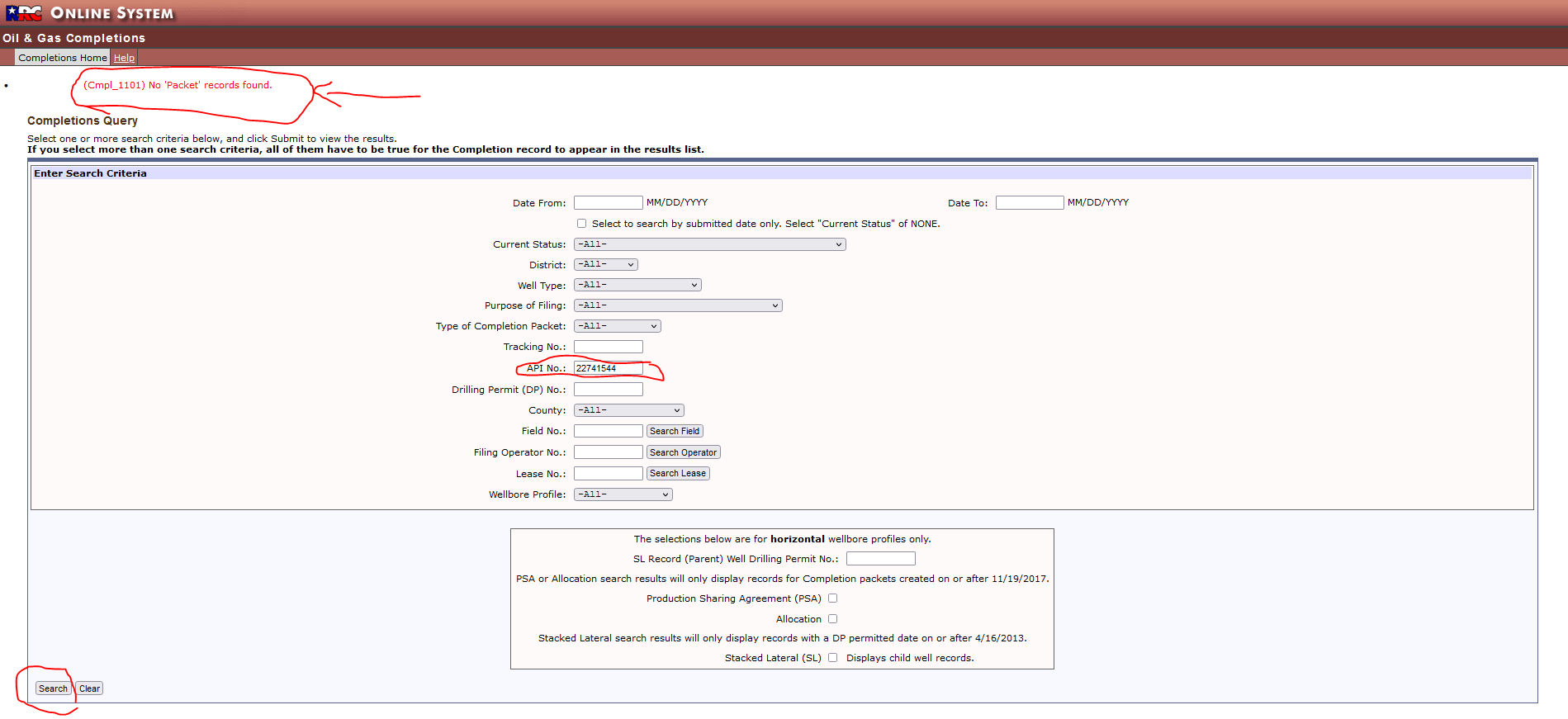
[http://webapps2.rrc.texas.gov/EWA/drillingPermitDetailAction.do?methodToCall=searchByUniversalDocNo&universalDocNo=494870002](http://webapps2.rrc.texas.gov/EWA/drillingPermitDetailAction.do?methodToCall=searchByUniversalDocNo&universalDocNo=494870002)
NO COMPLETION REPORT AVAILABLE UNTIL AFTER DRILLING ENDS AND TEST IS RUN ON WELL
---
### Author:  [@jstall0](https://www.mineralrightsforum.com/u/jstall0)
#### Post date: [March 29, 2022, 2:28am UTC](https://www.mineralrightsforum.com/t/lease-id-help/65627/11 "2022-03-29T02:28:46Z")
Thank you, I appreciate the additional help.
---
### Author:  [@TxGermanGirl](https://www.mineralrightsforum.com/u/TxGermanGirl)
#### Post date: [March 30, 2022, 2:01am UTC](https://www.mineralrightsforum.com/t/lease-id-help/65627/12 "2022-03-30T02:01:04Z")
22741544
When you hover over the well you can see this info:
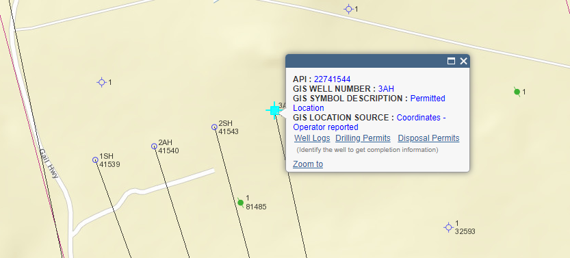
Looks as though the well was approved for drilling but it may not have been completed, maybe even not yet started. The TxRRC staff and website is outstanding.
Certainly whatever offer you are getting now to purchase your minerals is all speculative without any production.
---
### Author:  [@system](https://www.mineralrightsforum.com/u/system)
#### Post date: [June 24, 2022, 11:26pm UTC](https://www.mineralrightsforum.com/t/lease-id-help/65627/13 "2022-06-24T23:26:29Z")
This topic was automatically closed after 90 days. New replies are no longer allowed.