# Land and mineral rights
**URL:** https://www.mineralrightsforum.com/t/land-and-mineral-rights/57286
**Category:** Cass County, TX
**Created:** [April 30, 2020, 6:55pm UTC](https://www.mineralrightsforum.com/t/land-and-mineral-rights/57286 "2020-04-30T18:55:48Z")
**Posts on this page:** 7
**Page:** 1
### Author:  [@Ree-Ree](https://www.mineralrightsforum.com/u/Ree-Ree)
#### Post date: [April 30, 2020, 6:55pm UTC](https://www.mineralrightsforum.com/t/land-and-mineral-rights/57286/1 "2020-04-30T18:55:49Z")
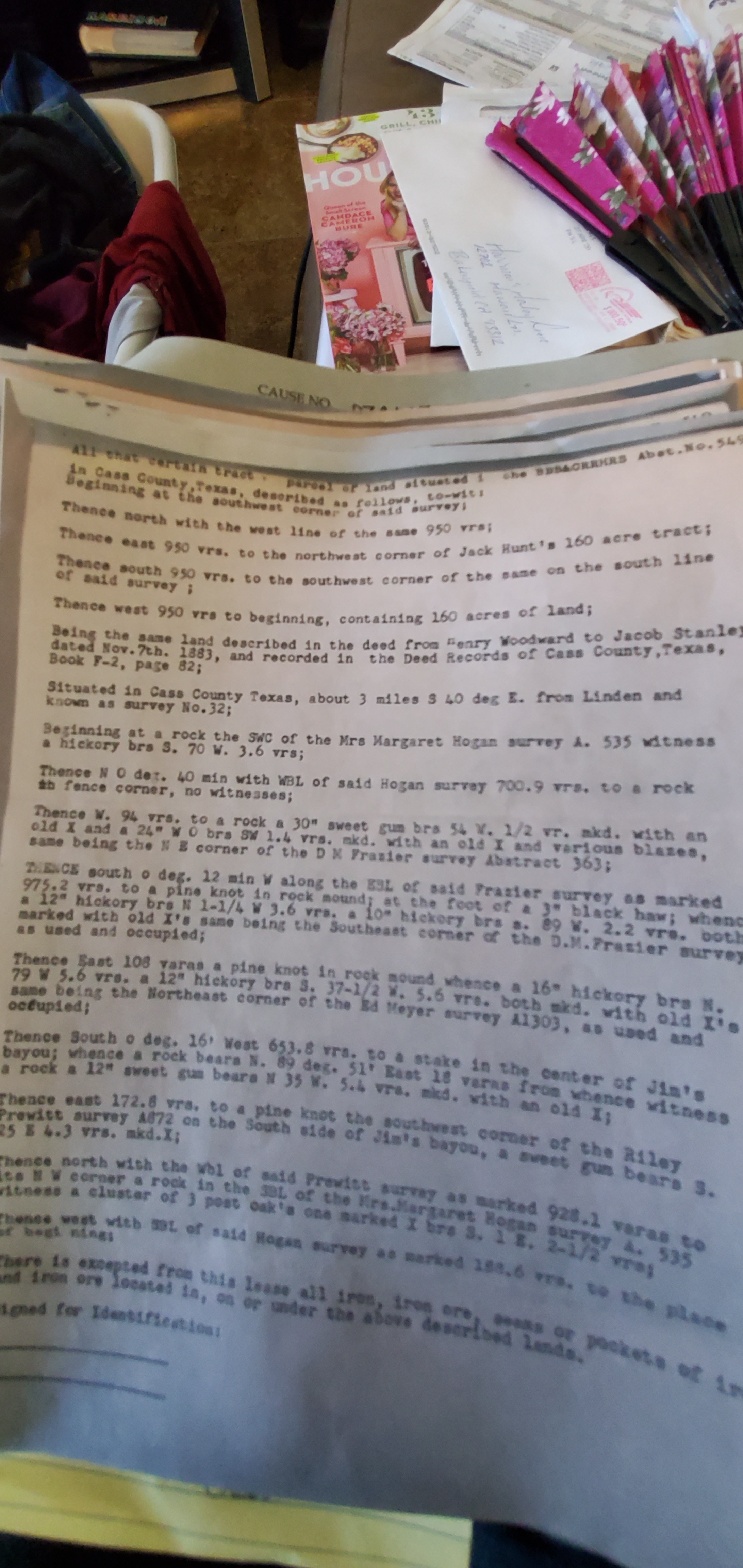 What am I looking at?
---
### Author:  [@Kenny\_DuBose](https://www.mineralrightsforum.com/u/Kenny_DuBose)
#### Post date: [April 30, 2020, 7:26pm UTC](https://www.mineralrightsforum.com/t/land-and-mineral-rights/57286/2 "2020-04-30T19:26:51Z")
---
### Author:  [@Kenny\_DuBose](https://www.mineralrightsforum.com/u/Kenny_DuBose)
#### Post date: [April 30, 2020, 7:27pm UTC](https://www.mineralrightsforum.com/t/land-and-mineral-rights/57286/3 "2020-04-30T19:27:25Z")
---
### Author:  [@M\_Barnes](https://www.mineralrightsforum.com/u/M_Barnes)
#### Post date: [April 30, 2020, 8:07pm UTC](https://www.mineralrightsforum.com/t/land-and-mineral-rights/57286/4 "2020-04-30T20:07:24Z")
It is a bit fuzzy, but it looks like the meets and bounds description of the front page of a lease for that described mineral tract.
---
### Author:  [@Ree-Ree](https://www.mineralrightsforum.com/u/Ree-Ree)
#### Post date: [May 1, 2020, 12:17am UTC](https://www.mineralrightsforum.com/t/land-and-mineral-rights/57286/5 "2020-05-01T00:17:42Z")
Property IDs: 22126 map id-42.49, 22157 map id-J11-42, 22124 map id-42- & 1985 map J11-42. Where do I start looking to get information on the above or a map of the above?
---
### Author:  [@M\_Barnes](https://www.mineralrightsforum.com/u/M_Barnes)
#### Post date: [May 1, 2020, 1:08pm UTC](https://www.mineralrightsforum.com/t/land-and-mineral-rights/57286/6 "2020-05-01T13:08:21Z")
If it is a lease and you know who it came from, one place to look is [https://www.texasfile.com](https://www.texasfile.com) for the lease if you don’t have the whole thing. A memorandum of lease may only be there.
[http://wwwgisp.rrc.texas.gov/GISViewer2/](http://wwwgisp.rrc.texas.gov/GISViewer2/) Is the place to start for a map of the location.
Also go to the county assessor’s link and see if you can find it there.
---
### Author:  [@system](https://www.mineralrightsforum.com/u/system)
#### Post date: [July 29, 2020, 6:55pm UTC](https://www.mineralrightsforum.com/t/land-and-mineral-rights/57286/7 "2020-07-29T18:55:49Z")
This topic was automatically closed after 90 days. New replies are no longer allowed.