# Keller 3625-1HX
**URL:** https://www.mineralrightsforum.com/t/keller-3625-1hx/65170
**Category:** Hughes County, OK
**Created:** [February 26, 2022, 9:51pm UTC](https://www.mineralrightsforum.com/t/keller-3625-1hx/65170 "2022-02-26T21:51:50Z")
**Posts on this page:** 3
**Page:** 1
### Author:  [@ed\_elmore](https://www.mineralrightsforum.com/u/ed_elmore)
#### Post date: [February 26, 2022, 9:51pm UTC](https://www.mineralrightsforum.com/t/keller-3625-1hx/65170/1 "2022-02-26T21:51:50Z")
How do I find the production history on this well - Section 36-08N-10E - Hughes County, Oklahoma?
---
### Author:  [@M\_Barnes](https://www.mineralrightsforum.com/u/M_Barnes)
#### Post date: [February 26, 2022, 10:23pm UTC](https://www.mineralrightsforum.com/t/keller-3625-1hx/65170/2 "2022-02-26T22:23:40Z")
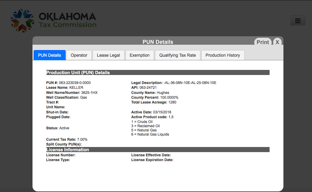
You can find the last ~12 months on the OK Tax site. “[https://otcportal.tax.ok.gov/gpx/gp\_displayPublicPUNListSearchDownload.php](https://otcportal.tax.ok.gov/gpx/gp_displayPublicPUNListSearchDownload.php)” Type 36 08N 10E in the location box. You will see the Keller well with a blue PUN number. Touch the PUN and the info will pop up.
---
### Author:  [@system](https://www.mineralrightsforum.com/u/system)
#### Post date: [May 27, 2022, 9:52pm UTC](https://www.mineralrightsforum.com/t/keller-3625-1hx/65170/3 "2022-05-27T21:52:26Z")
This topic was automatically closed after 90 days. New replies are no longer allowed.