# Just rec'd proposed oil/gas lease
**URL:** https://www.mineralrightsforum.com/t/just-recd-proposed-oil-gas-lease/6554
**Category:** Wood County, TX
**Created:** [July 29, 2015, 8:28pm UTC](https://www.mineralrightsforum.com/t/just-recd-proposed-oil-gas-lease/6554 "2015-07-29T20:28:04Z")
**Posts on this page:** 4
**Page:** 1
### Author:  [@L\_K](https://www.mineralrightsforum.com/u/L_K)
#### Post date: [July 29, 2015, 8:28pm UTC](https://www.mineralrightsforum.com/t/just-recd-proposed-oil-gas-lease/6554/1 "2015-07-29T20:28:04Z")
Hi–new to this venue.
My family and I just received an oil/gas lease.
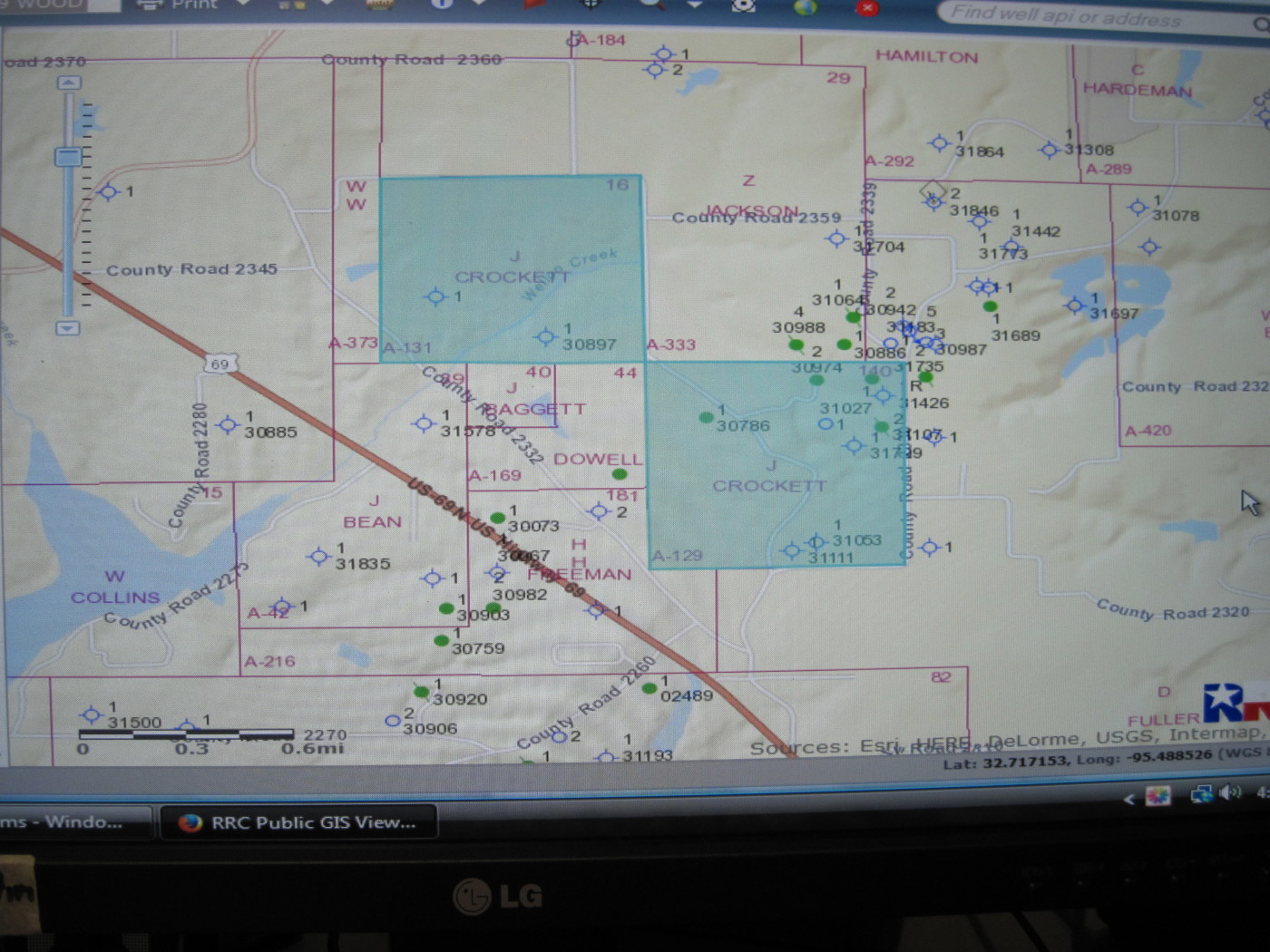
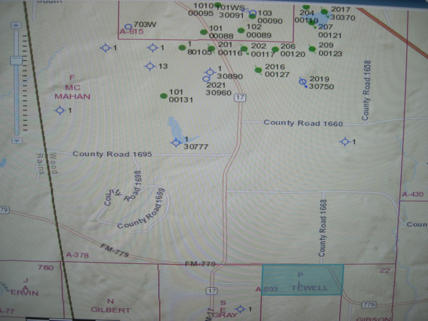
Our interests are in the J Crockett Survey and the S. L. Tewell Survey.
Any information about recent activity in the County would be appreciated.
Also, I would appreciate a referral for professional lease consultant–someone in the Dallas area.
Thanks,
Linda
---
### Author:  [@Clint\_Liles](https://www.mineralrightsforum.com/u/Clint_Liles)
#### Post date: [July 29, 2015, 9:42pm UTC](https://www.mineralrightsforum.com/t/just-recd-proposed-oil-gas-lease/6554/2 "2015-07-29T21:42:58Z")
Hello L K,
Click on this link and go to page 6 for approved permits for Wood County from May 8, 2015 through July 22, 2015.
[http://www.mineralrightsforum.com/group/wood-county-tx-oil-gas/forum/topic/show?id=4401368:Topic:359416](http://www.mineralrightsforum.com/group/wood-county-tx-oil-gas/forum/topic/show?id=4401368:Topic:359416)
After you click on the permit on the left side of the permit you will see a small ‘Map of the State of Texas’. Click on this little map and a GIS map will pop up of the area where the well will be drilled and the surrounding area.
GIS Map of J Crockett Survey…Don’t know which one of these is yours. Do you know what your Abstract # is for your minerals acreage in J Crockett Survey?
GIS Map of P L Tewell Survey:
Clint Liles
---
### Author:  [@L\_K](https://www.mineralrightsforum.com/u/L_K)
#### Post date: [July 29, 2015, 10:09pm UTC](https://www.mineralrightsforum.com/t/just-recd-proposed-oil-gas-lease/6554/3 "2015-07-29T22:09:46Z")
Thank you so much for this link. I’ll investigate it.
J Crockett is A-125
S\>L\> Tewell is A-593
---
### Author:  [@system](https://www.mineralrightsforum.com/u/system)
#### Post date: [August 14, 2018, 11:36pm UTC](https://www.mineralrightsforum.com/t/just-recd-proposed-oil-gas-lease/6554/4 "2018-08-14T23:36:13Z")