# How can i research units?
**URL:** https://www.mineralrightsforum.com/t/how-can-i-research-units/54526
**Category:** Oil and Gas Leasing Help
**Created:** [January 4, 2020, 9:05pm UTC](https://www.mineralrightsforum.com/t/how-can-i-research-units/54526 "2020-01-04T21:05:05Z")
**Posts on this page:** 5
**Page:** 1
### Author:  [@ChrisM](https://www.mineralrightsforum.com/u/ChrisM)
#### Post date: [January 4, 2020, 9:05pm UTC](https://www.mineralrightsforum.com/t/how-can-i-research-units/54526/1 "2020-01-04T21:05:05Z")
How can I find out what drilling/spacing unit I am in? Just signed a lease last March. Angelina County W Anderson Survey.
---
### Author:  [@Dusty1](https://www.mineralrightsforum.com/u/Dusty1)
#### Post date: [January 6, 2020, 2:37pm UTC](https://www.mineralrightsforum.com/t/how-can-i-research-units/54526/2 "2020-01-06T14:37:31Z")
Chris
Signing a lease doesn’t mean you are included in a unit unless a well gets permitted there.
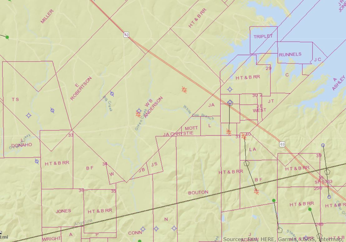
If you are talking about the WB Anderson Survey that’s near Hwy 63 a little east of Zavalla it doesn’t look like any new wells have been permitted in that area. The current Railroad Commission map of that area is below and it’s only showing a couple of plugged wells and one cancelled permit from long ago.
Also posting a couple of links to RRC’s online section where you can pull up maps or check for new permits.
[http://gis.rrc.texas.gov/GISViewer/](http://gis.rrc.texas.gov/GISViewer/)
> **[Drilling Permit (W-1) Query](https://webapps2.rrc.texas.gov//EWA/drillingPermitsQueryAction.do)**
---
### Author:  [@ChrisM](https://www.mineralrightsforum.com/u/ChrisM)
#### Post date: [February 11, 2020, 10:58pm UTC](https://www.mineralrightsforum.com/t/how-can-i-research-units/54526/3 "2020-02-11T22:58:01Z")
I may be mistaken. It looks to be the Ephriam Finley Survey. Sorry. I am so new to this.
---
### Author:  [@Dusty1](https://www.mineralrightsforum.com/u/Dusty1)
#### Post date: [February 12, 2020, 3:05am UTC](https://www.mineralrightsforum.com/t/how-can-i-research-units/54526/4 "2020-02-12T03:05:41Z")
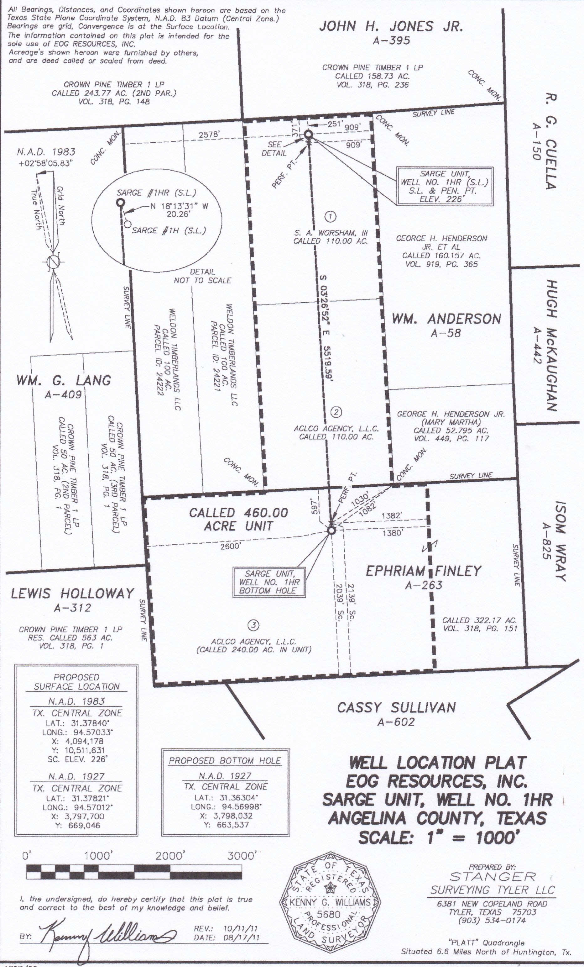
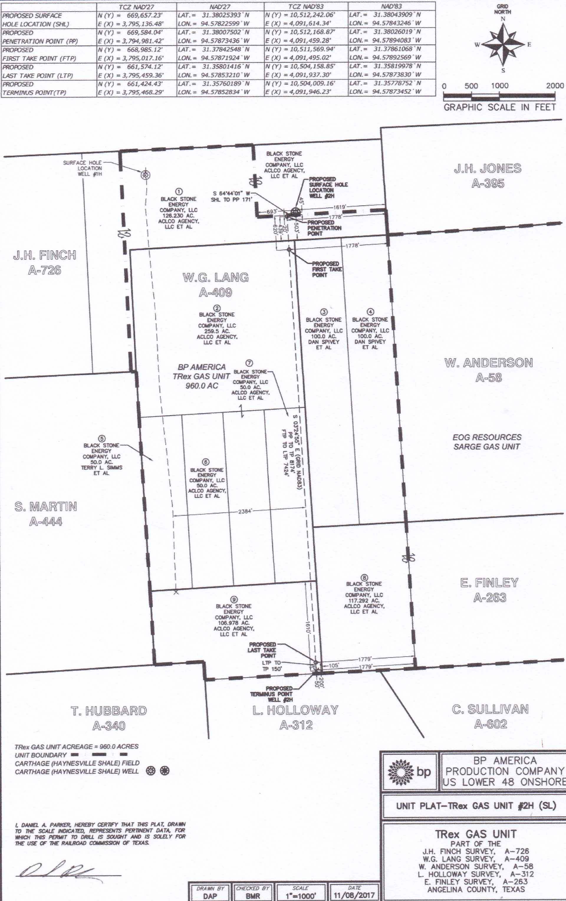
There are two Ephriam Finley Surveys in Angelina County but I think the one you are talking about is Abstract Number 263. If that’s right the two plats below show the boundaries of existing units covering parts of that survey. You said you signed a lease last March so I don’t think your mineral interest are in either of those units since the EOG unit was formed in 2012 and the BP unit in 2017.
I’m guessing your acreage may be part of the 80 acres at the east side of the survey that isn’t in a unit. According to the Railroad Commission no new wells have been permitted in that area.
---
### Author:  [@system](https://www.mineralrightsforum.com/u/system)
#### Post date: [March 4, 2020, 9:05pm UTC](https://www.mineralrightsforum.com/t/how-can-i-research-units/54526/5 "2020-03-04T21:05:05Z")
This topic was automatically closed after 60 days. New replies are no longer allowed.