# Help reading this please and opinion
**URL:** https://www.mineralrightsforum.com/t/help-reading-this-please-and-opinion/82114
**Category:** Martin County, TX
**Created:** [June 25, 2025, 7:45pm UTC](https://www.mineralrightsforum.com/t/help-reading-this-please-and-opinion/82114 "2025-06-25T19:45:54Z")
**Posts on this page:** 4
**Page:** 1
### Author:  [@creatureman](https://www.mineralrightsforum.com/u/creatureman)
#### Post date: [June 25, 2025, 7:45pm UTC](https://www.mineralrightsforum.com/t/help-reading-this-please-and-opinion/82114/1 "2025-06-25T19:45:54Z")
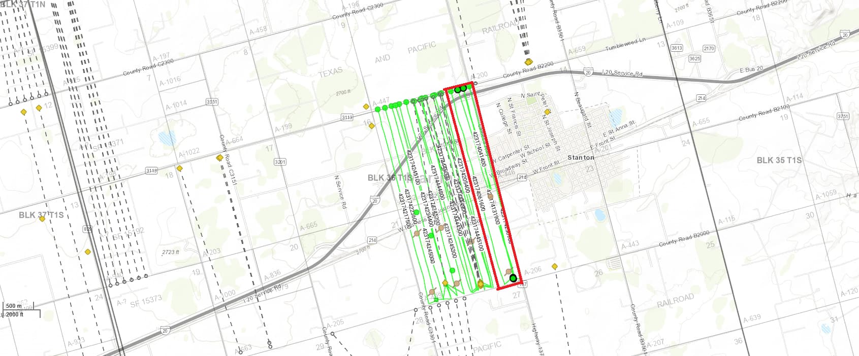
So everyone I did some research with the RIS viewer following you guys advice and believe this is the parcel I inherited. So I kinda looked at the legend and don’t think there are any wells in the area maybe horizontally there are some real close. Still learning about this parcel. If it’s not drilled or has wells on the parcel yet maybe it will soon? Oh I did get an offer to buy from Patch. Thanks
---
### Author:  [@Sotexnrg](https://www.mineralrightsforum.com/u/Sotexnrg)
#### Post date: [June 26, 2025, 2:22am UTC](https://www.mineralrightsforum.com/t/help-reading-this-please-and-opinion/82114/2 "2025-06-26T02:22:01Z")
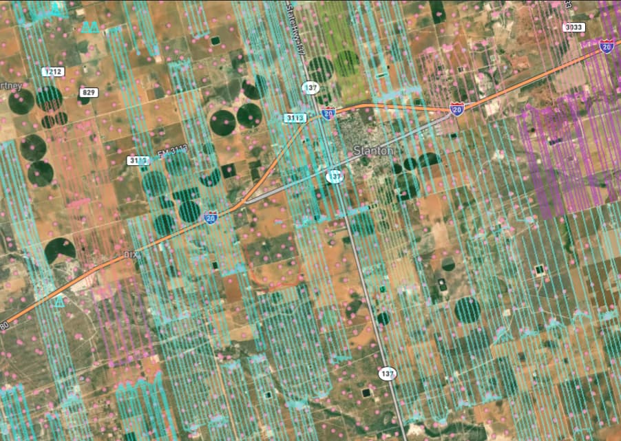Your map came from DI not TXRRC GIS. Appears your parcel is showing completed horizontal wells if it is in red box? This is Tier 1-1B Midland Basin. 5 - 10 benches if Barnett can be proved up here. All of the straight lines on my map are producing horizontal wells. The dots are producing vertical wells. Endeavor had a lot of HBP leasehold that has yet to be developed horizontally. Diamondback bought them last year and will certainly drill a ton of wells in the future. Pretty much Parkplace and Broadway.
---
### Author:  [@creatureman](https://www.mineralrightsforum.com/u/creatureman)
#### Post date: [June 26, 2025, 2:50am UTC](https://www.mineralrightsforum.com/t/help-reading-this-please-and-opinion/82114/3 "2025-06-26T02:50:41Z")
Thank you sir, that’s great info. A lady of one of the mineral right brokers sent me that map, my mistake. I did find it on the GIS viewer also. But I believe the red area is correct though I believe the legal address is NE/4NE/4 Section 22 Block 36, Township 1 South Abstract 499? Was the address on the sale offer from Patch/Diamondback? I just found out about this inherited property last week. My Dad passed away in 1999 so probate missed the parcels back then. So if there is drilling there at present, should I call Diamondback and ask about how to get the parcels in my name or any back royalties perhaps? Thanks for any advice.
---
### Author:  [@system](https://www.mineralrightsforum.com/u/system)
#### Post date: [September 23, 2025, 7:46pm UTC](https://www.mineralrightsforum.com/t/help-reading-this-please-and-opinion/82114/4 "2025-09-23T19:46:48Z")
This topic was automatically closed after 90 days. New replies are no longer allowed.